SUMMARY
This is AI generated summarization, which may have errors. For context, always refer to the full article.
What’s the weather like in your area? Report the situation through Rappler’s Agos or tweet us at @rapplerdotcom.
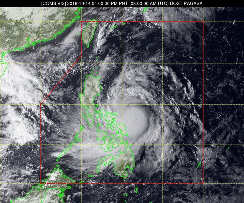
MANILA, Philippines – More areas were placed under warning signals on Friday afternoon, October 14, as Tropical Storm Karen (Sarika) intensified into a severe tropical storm.
In its bulletin issued 5 pm on Friday, state weather bureau PAGASA said Karen now has maximum winds of up to 100 kilometers per hour (km/h) and gustiness of up to 140 km/h.
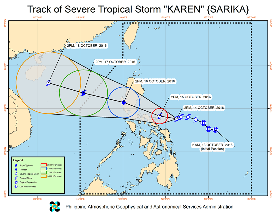
It is already 205 kilometers east of Virac, Catanduanes, moving west northwest at 9 km/h.
Signal number 2 is raised in the following provinces:
- Catanduanes
- Camarines Sur
- Camarines Norte
Those under signal number 2 will begin to feel the effects of stormy weather on Friday night, according to PAGASA.
The following areas, meanwhile, are under signal number 1:
- Albay
- Sorsogon
- Quezon including Polillo Island
- Aurora
- Isabela
- Quirino
- Laguna
- Rizal
- Marinduque
- Burias Island
- Masbate including Ticao Island
- Nueva Ecija
- Bulacan
- Pampanga
- Cavite
- Batangas
- Metro Manila
- Northern Samar
The Bicol Region, in general, will experience moderate to occasionally heavy rains beginning Friday night until Saturday, October 15.
Overall, moderate to heavy rain is expected within the 500-km diameter of the severe tropical storm. The rain could trigger possible floods and landslides in areas with tropical cyclone warning signals, so residents are advised to be on alert.

Karen could strengthen further into a typhoon before making landfall in the Quezon-Aurora area by Sunday morning, October 16. After that, it will then cross Central Luzon.
PAGASA also warned that sea travel in the eastern seaboards of Luzon and Samar is risky.
Karen is expected to leave the Philippine Area of Responsibility (PAR) on Monday, October 17.
Tropical depression, too
After Karen leaves on Monday, however, another tropical cyclone is expected to enter PAR on Tuesday, October 18.
It’s a tropical depression that was 1,980 kilometers east of Mindanao as of 4 pm on Friday, moving west northwest at 13 km/h.
The tropical depression has maximum winds of up to 45 km/h and gustiness of up to 55 km/h.
It could still intensify further, said PAGASA. – Rappler.com
Add a comment
How does this make you feel?
There are no comments yet. Add your comment to start the conversation.