SUMMARY
This is AI generated summarization, which may have errors. For context, always refer to the full article.
What’s the weather like in your area? Report the situation through Rappler’s Agos or tweet us at @rapplerdotcom.
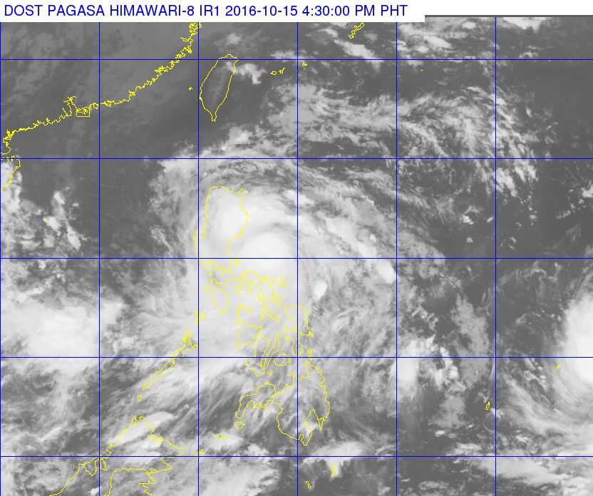
MANILA, Philippines – Typhoon Karen (Sarika) poses a serious threat to Aurora province, where it will make landfall on Sunday, October 16, between midnight and 2 am.
In its bulletin issued 5 pm on Saturday, state weather bureau PAGASA said Karen is 205 kilometers east of Infanta, Quezon, moving west northwest at a faster 22 kilometers per hour (km/h) from the previous 20 km/h.
It maintained its strength, with maximum winds of up to 130 km/h and gustiness of up to 180 km/h.
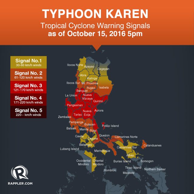
Signal number 3 is raised in the following areas:
- Pangasinan
- northern Zambales
- Tarlac
- Nueva Ecija
- Aurora
- northern Quezon including Polillo Island
- La Union
- Benguet
- Nueva Vizcaya
- Quirino
Signal number 2 is up in these areas:
- Ilocos Sur
- southern Isabela
- Mt Province
- Ifugao
- rest of Zambales
- Pampanga
- Bulacan
- Bataan
- Rizal
- Metro Manila
- rest of Quezon
- Camarines Norte
- Catanduanes
PAGASA warned that storm surges up to 2.6 meters high are possible in coastal areas of provinces under signal numbers 2 and 3.
The following areas, meanwhile, are under signal number 1:
- Ilocos Norte
- Abra
- Kalinga
- rest of Isabela
- southern Apayao
- southern Cagayan
- Oriental Mindoro
- Cavite
- Batangas
- Laguna
- Marinduque
- Camarines Sur
- Albay
- Burias Island
Moderate to heavy rain is expected within the 500-km diameter of the typhoon.
Just on Friday, October 14, Karen had dumped more than a month’s worth of rains in Catanduanes. PAGASA’s Virac Radar showed 406.55 millimeters (mm) of rain on Friday alone. The monthly average is just 393.5 mm.
PAGASA said residents of areas under warning signals should watch out for possible floods and landslides, especially those in Aurora and northern Quezon, in the eastern side of the Sierra Madre.
Metro Manila, in particular, will experience “rains with some gusty winds” starting Saturday night.
PAGASA also warned that sea travel in the northern seaboard of Northern Luzon and in the northern and eastern seaboards of Samar is risky.
After hitting land in Aurora early Sunday, Karen will cross Central Luzon the rest of the morning and then exit landmass via Pangasinan in the afternoon.
The typhoon is expected to leave the Philippine Area of Responsibility (PAR) on Monday, October 17, between 1 am and 3 am.
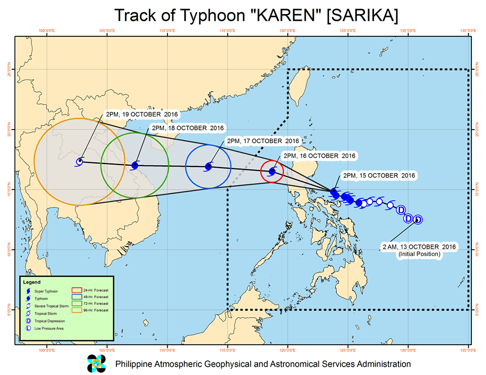
After Karen leaves, however, Tropical Storm Haima – currently located 1,850 km east of Mindanao – will enter PAR on Monday. It will be given the local name Lawin.
Since Haima is still over sea, it can still intensify further, according to PAGASA. – Rappler.com
Add a comment
How does this make you feel?
There are no comments yet. Add your comment to start the conversation.