SUMMARY
This is AI generated summarization, which may have errors. For context, always refer to the full article.
What’s the weather like in your area? Report the situation through Rappler’s Agos or tweet us at @rapplerdotcom.
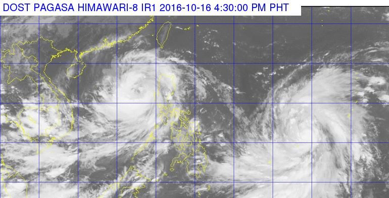
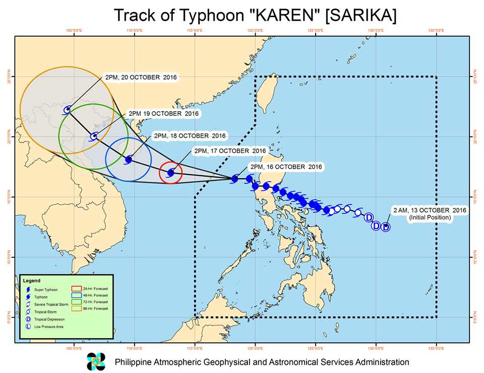
MANILA, Philippines – Typhoon Karen (Sarika) slightly intensified late Sunday afternoon, October 16, but it is already moving away from the country.
In its bulletin issued 5 pm on Saturday, state weather bureau PAGASA said Karen was already 260 kilometers west northwest of Iba, Zambales. It is still moving west northwest at 24 kilometers per hour (km/h).
Karen now has maximum winds of up to 130 km/h and gustiness of up to 200 km/h.
It earlier made landfall in Baler, Aurora at 2:30 am on Sunday. (WATCH: VIDEO: Aftermath of Typhoon Karen in Baler, Aurora)
There are no more areas under tropical cyclone warning signals.
Karen had brought heavy rain and strong winds to parts of Luzon. On Saturday, October 15, 199.5 millimeters (mm) of rain were recorded in Daet, Camarines Norte, the highest for the day.
Last Friday, October 14, Karen had dumped more than a month’s worth of rains in Catanduanes. PAGASA’s Virac Radar showed 406.55 mm of rain on Friday alone. The monthly average is just 393.5 mm.
While the typhoon is on it way out, it is still risky to travel in the seaboards of Northern Luzon and the western seaboard of Central Luzon.
Karen had also caused the cancellation of domestic and international flights on Saturday and Sunday.
The typhoon is expected to leave the Philippine Area of Responsibility (PAR) on Sunday night. (Read our live blog here.)
Typhoon Haima
After Karen leaves, however, another tropical cyclone will enter PAR on Monday afternoon.
Haima, which is currently located 1,535 km east of the Visayas, intensified into a typhoon on Sunday afternoon. It will be given the local name Lawin when it enters PAR.
PAGASA forecaster Benison Estareja earlier said that if Haima’s path stays the same, it will likely target Luzon. The exact areas, however, cannot be pinpointed yet as Haima is still too far from the country. – Rappler.com
Add a comment
How does this make you feel?
There are no comments yet. Add your comment to start the conversation.