SUMMARY
This is AI generated summarization, which may have errors. For context, always refer to the full article.
What’s the weather like in your area? Report the situation through Rappler’s Agos or tweet us at @rapplerdotcom.
For the latest updates on Typhoon Lawin (Haima), go to our live blog
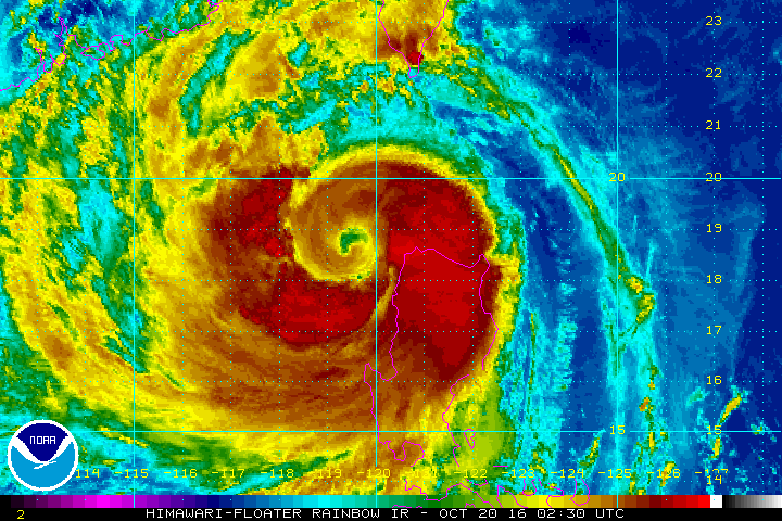
MANILA, Philippines – Typhoon Lawin (Haima) weakened further late Thursday morning, October 20, as it began to move away from the country.
In its bulletin issued 11 am on Thursday, PAGASA said Lawin now has maximum winds of up to 150 kilometers per hour (km/h) and gustiness of up to 185 km/h.
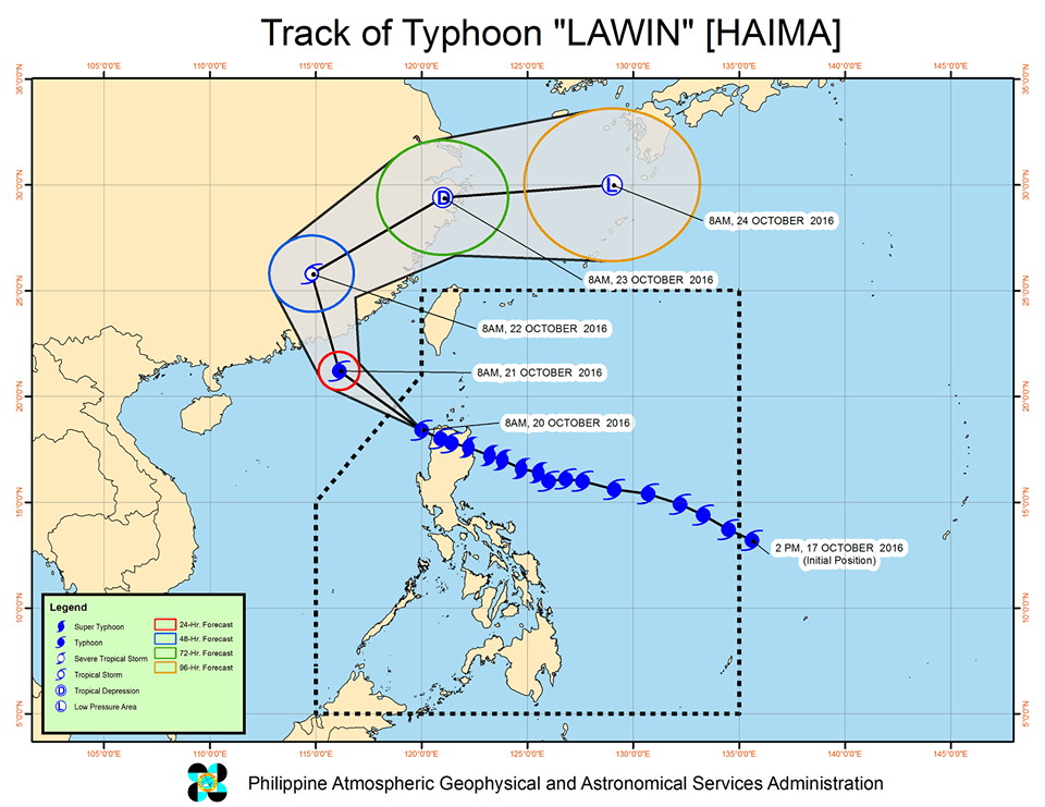
The typhoon is already off the coast of Ilocos Norte, at 130 kilometers northwest of Sinait, Ilocos Sur. It is moving west northwest at a slightly slower 21 km/h from the previous 22 km/h.
It had made landfall in Peñablanca, Cagayan at 11 pm on Wednesday, October 19, bringing intense rain and powerful winds.
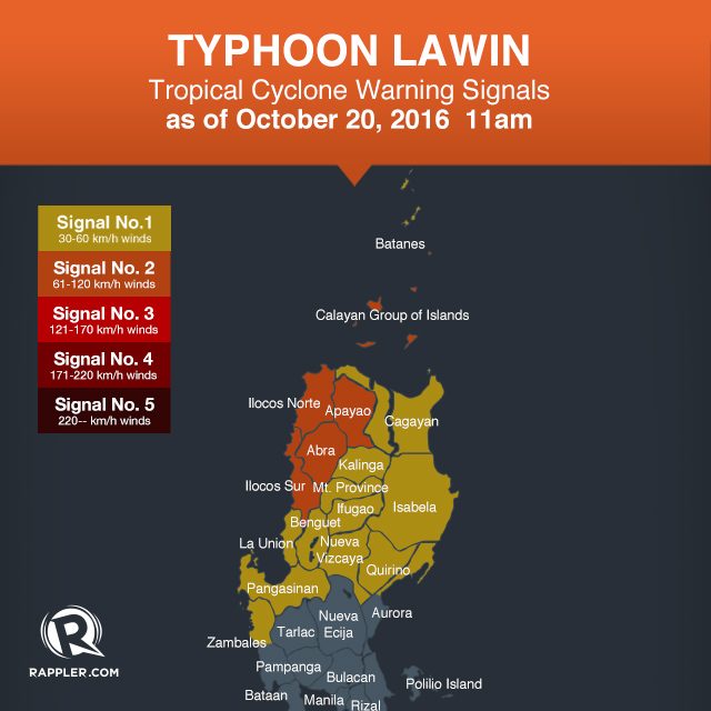
Below is the latest list of areas under warning signals.
Signal number 2:
- Ilocos Norte
- Apayao
- Abra
- Ilocos Sur
- Calayan Group of Islands
Signal number 1:
- Batanes
- Cagayan
- Kalinga
- Isabela
- Quirino
- northern Aurora
- Mt Province
- Ifugao
- Nueva Vizcaya
- Benguet
- La Union
- Pangasinan
- northern Zambales
Even though Lawin has weakened, moderate to heavy rain is still expected within its 700-km diameter.
Sea travel also remains risky in the seaboard of Southern Luzon and the northern and eastern seaboards of Samar.
Lawin is expected to leave the Philippine Area of Responsibility (PAR) on Thursday night.
– Rappler.com
Add a comment
How does this make you feel?
There are no comments yet. Add your comment to start the conversation.