SUMMARY
This is AI generated summarization, which may have errors. For context, always refer to the full article.
What’s the weather like in your area? Report the situation through Rappler’s Agos or tweet us at @rapplerdotcom.
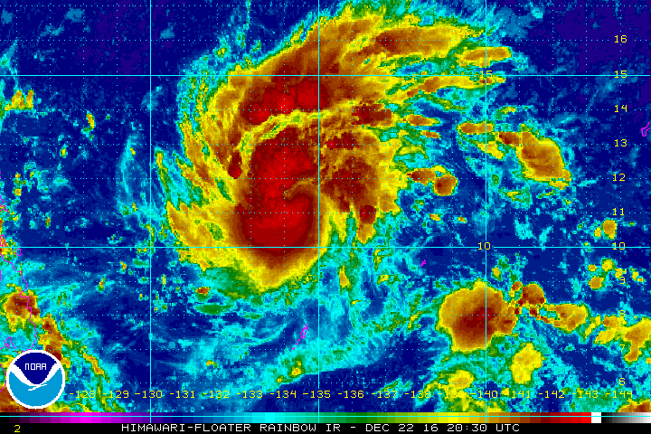
MANILA, Philippines (UPDATED) – Severe Tropical Storm Nock-ten entered the Philippine Area of Responsibility (PAR) at 3 am on Friday, December 23, and was given the local name Nina.
In a bulletin issued 5 am on Friday, state weather bureau PAGASA said Nina is now 960 kilometers east of Guiuan, Eastern Samar. It is moving west northwest toward the direction of Luzon at 25 kilometers per hour (km/h).
The severe tropical storm now has maximum winds of up to 95 km/h and gustiness of up to 120 km/h.
Moderate to heavy rain is expected within Nina’s 350-km diameter. There are no areas under tropical cyclone warning signals yet.
More detailed forecasts are expected as Nina comes closer.
PAGASA, meanwhile, said light to moderate rain and thunderstorms are expected in the regions of Eastern Visayas, Caraga, and Davao on Friday.
There will also be light rain in the regions of Ilocos, Cordillera, and Cagayan Valley, still due to the northeast monsoon.
The rest of the country will have just isolated rainshowers. – Rappler.com
Add a comment
How does this make you feel?
There are no comments yet. Add your comment to start the conversation.