SUMMARY
This is AI generated summarization, which may have errors. For context, always refer to the full article.
What’s the weather like in your area? Report the situation through Rappler’s Agos or tweet us at @rapplerdotcom.
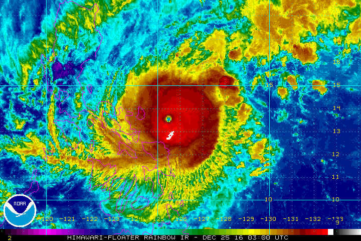
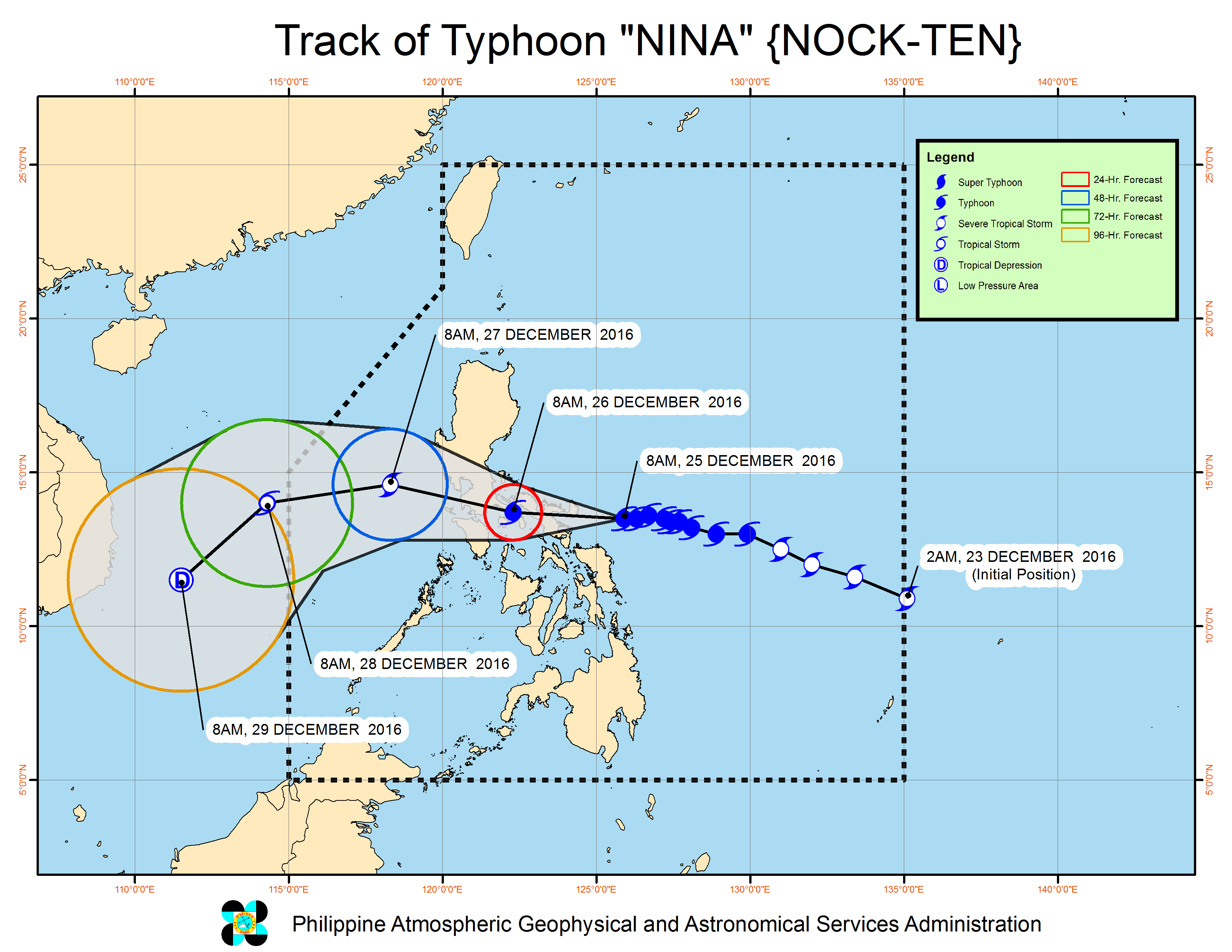
MANILA, Philippines – Catanduanes was placed under signal number 4 late Sunday morning, December 25, hours ahead of the expected landfall of the powerful Typhoon Nina (Nock-ten) in the province.
In a bulletin issued 11 am on Sunday, state weather bureau PAGASA said Nina is already 150 kilometers east of Virac, Catanduanes. It is still moving west at 15 kilometers per hour (km/h).
The typhoon intensified further and now has maximum winds of up to 185 km/h and gustiness of up to 255 km/h.
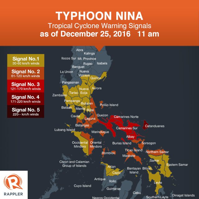
Below is the full list of areas under warning signals.
Signal number 4:
- Catanduanes
Signal number 3:
- Burias Island
- Albay
- Camarines Norte
- Camarines Sur
- southern Quezon
Signal number 2:
- Masbate including Ticao Island
- Sorsogon
- Oriental Mindoro
- Batangas
- Laguna
- rest of Quezon including Polillo Island
- Marinduque
- Romblon
- Northern Samar
Signal number 1:
- Metro Manila
- Rizal
- Bataan
- Occidental Mindoro including Lubang Island
- Nueva Ecija
- Aurora
- southern Quirino
- southern Nueva Vizcaya
- Zambales
- Pampanga
- Bulacan
- Tarlac
- Cavite
- Aklan
- Capiz
- Samar
- Eastern Samar
- Biliran
- Leyte
- Bantayan Island
Nina is expected to make landfall in Catanduanes on Sunday evening, causing a rainy Christmas for Filipinos.
Moderate to heavy rain is expected within Nina’s 500-km diameter, which could bring floods and landslides. Strong winds may damage medium- to high-risk structures, uproot trees, and destroy crops, added PAGASA.
In particular, PAGASA said Catanduanes, Camarines Sur, Camarines Norte, southern Quezon, Laguna, Batangas, Cavite, and Metro Manila should be on alert for the effects of the typhoon.
Metro Manila is expected to begin feeling Nina’s impact on Sunday night.
The state weather bureau also warned that storm surges up to 2.5 meters high are possible in coastal areas in Camarines Sur, Camarines Norte, Albay, Sorsogon, and Catanduanes. Sea travel is risky in the seaboards of Luzon.
Nina is expected to leave the Philippine Area of Responsibility (PAR) on Wednesday, December 28.
– Rappler.com
Add a comment
How does this make you feel?
There are no comments yet. Add your comment to start the conversation.