SUMMARY
This is AI generated summarization, which may have errors. For context, always refer to the full article.
What’s the weather like in your area? Report the situation through Rappler’s Agos or tweet us at @rapplerdotcom.
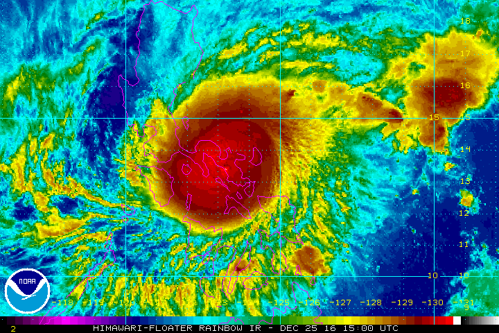
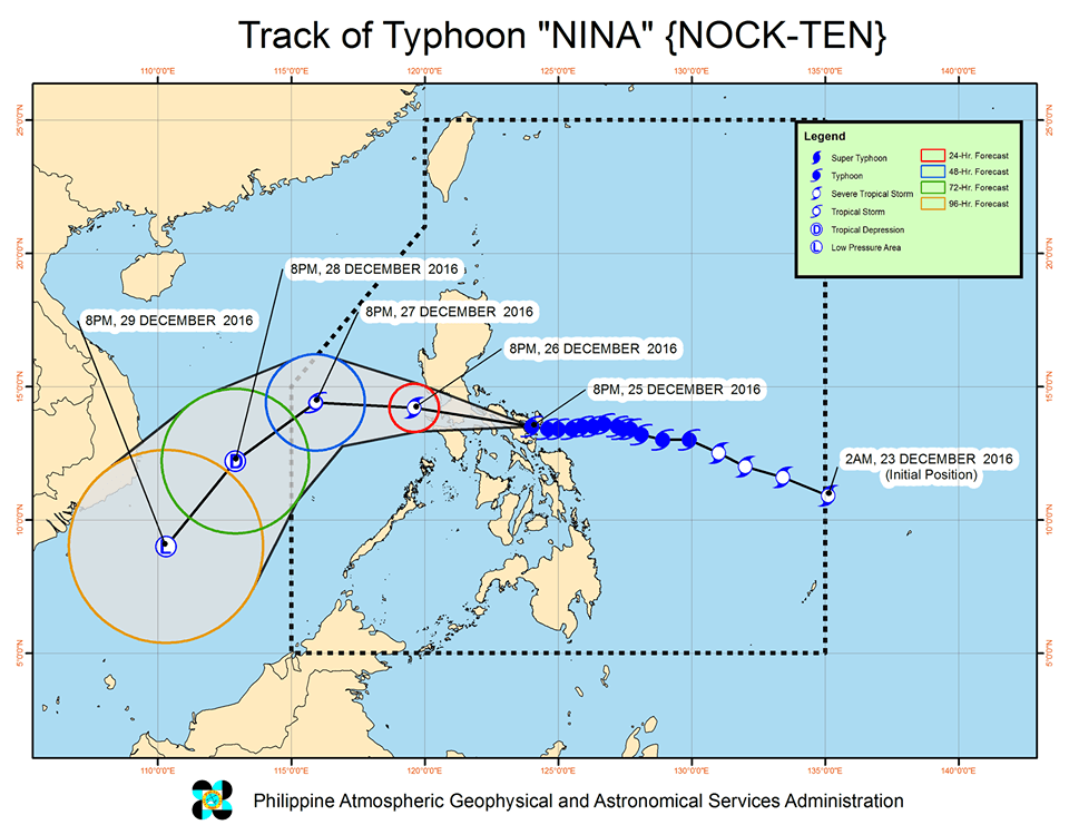
MANILA, Philippines – Typhoon Nina (Nock-ten) made its 2nd landfall in Sagñay, Camarines Sur around 9:30 pm on Sunday, December 25, after making landfall in Bato, Catanduanes at 6:30 pm.
In a bulletin issued 11 pm on Sunday, state weather bureau PAGASA said Nina is already at the border of Sagñay-Buhi, Camarines Sur. It accelerated as it began crossing Bicol, now moving west at 20 kilometers per hour (km/h) from the previous 15 km/h. The faster Nina moves, the better, so it can exit land earlier.
The typhoon remains powerful, with maximum winds of up to 175 km/h and gustiness of up to 290 km/h.
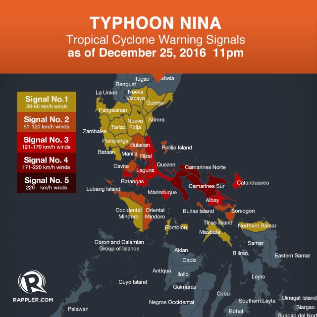
Below is the full list of areas under warning signals.
Signal number 4:
- Camarines Norte
- Camarines Sur
- southern Quezon
Signal number 3:
- Catanduanes
- Albay
- Laguna
- Batangas
- Marinduque
- rest of Quezon
Signal number 2:
- Metro Manila
- Bulacan
- Rizal
- Cavite
- Oriental Mindoro
- Polillo Island
- Sorsogon
- Lubang Island
- Burias Island
Signal number 1:
- Pangasinan
- Nueva Ecija
- Aurora
- Quirino
- Nueva Vizcaya
- Zambales
- Pampanga
- Tarlac
- Bataan
- Occidental Mindoro
- Romblon
- Masbate including Ticao Island
- Northern Samar
Moderate to heavy rain is being experienced within Nina’s 400-km diameter, which could bring floods and landslides. Strong winds may damage medium- to high-risk structures, uproot trees, and destroy crops, added PAGASA.
Catanduanes Governor Joseph Cua has said that his entire province lost electricity after Nina made landfall.
After Catanduanes and Camarines Sur, Nina will cross Camarines Norte, southern Quezon, Laguna, Batangas, and Cavite.
PAGASA warned that storm surges up to 2.5 meters high are possible in coastal areas in Albay, Camarines Sur, Camarines Norte, and southern Quezon. Sea travel is generally risky in the seaboards of Luzon.
The state weather bureau also previously warned that Metro Manila would experience heavy rain and strong winds by Monday, December 26.
Nina is expected to leave the Philippine Area of Responsibility (PAR) on Wednesday, December 28.
– Rappler.com
Add a comment
How does this make you feel?
There are no comments yet. Add your comment to start the conversation.