SUMMARY
This is AI generated summarization, which may have errors. For context, always refer to the full article.
What’s the weather like in your area? Report the situation through Rappler’s Agos or tweet us at @rapplerdotcom.
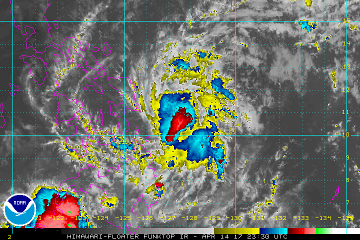
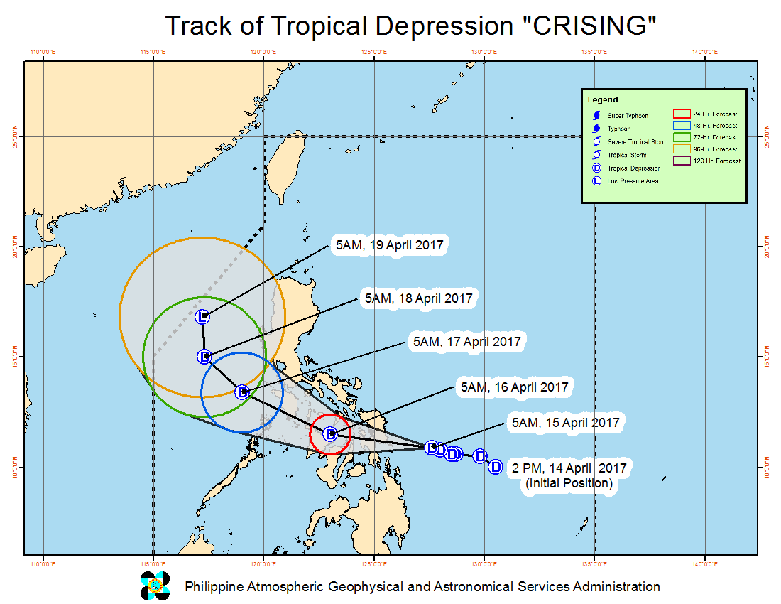
MANILA, Philippines – Tropical Depression Crising maintained its strength early Saturday morning, April 15, as it headed for the Samar area, where it is expected to make landfall in the afternoon.
In a bulletin issued 8 am on Black Saturday, state weather bureau PAGASA said Crising is already 185 kilometers east of Guiuan, Eastern Samar. It continues to move west northwest but at a slightly slower 20 kilometers per hour (km/h) compared to the previous 22 km/h.
Crising still has maximum winds of 55 km/h and gustiness of up to 68 km/h.
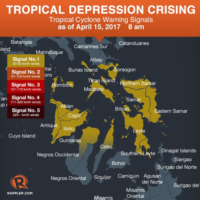
The following areas are under signal number 1:
- Sorsogon
- Burias Island
- Romblon
- Masbate including Ticao Island
- Aklan
- Antique
- Iloilo
- Capiz
- northern part of Cebu
- northern part of Negros Occidental
- Northern Samar
- Eastern Samar
- Samar
- Biliran
- Leyte
- Southern Leyte
Moderate to heavy rain is expected within Crising’s 250-km diameter, which could bring flash floods and landslides. Residents and Holy Week travelers in the tropical depression’s path are advised to be on alert.
Based on the PAGASA forecast, Crising will not intensify into a tropical storm. It is expected to weaken into a low pressure area (LPA) on Tuesday, April 18.
– Rappler.com
Add a comment
How does this make you feel?
There are no comments yet. Add your comment to start the conversation.