SUMMARY
This is AI generated summarization, which may have errors. For context, always refer to the full article.

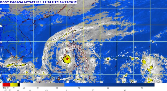
MANILA, Philippines (UPDATED) – Northern Palawan was hit by a weakened typhoon Pablo (Bopha) Wednesday morning, December 5, as it made its way out of the country.
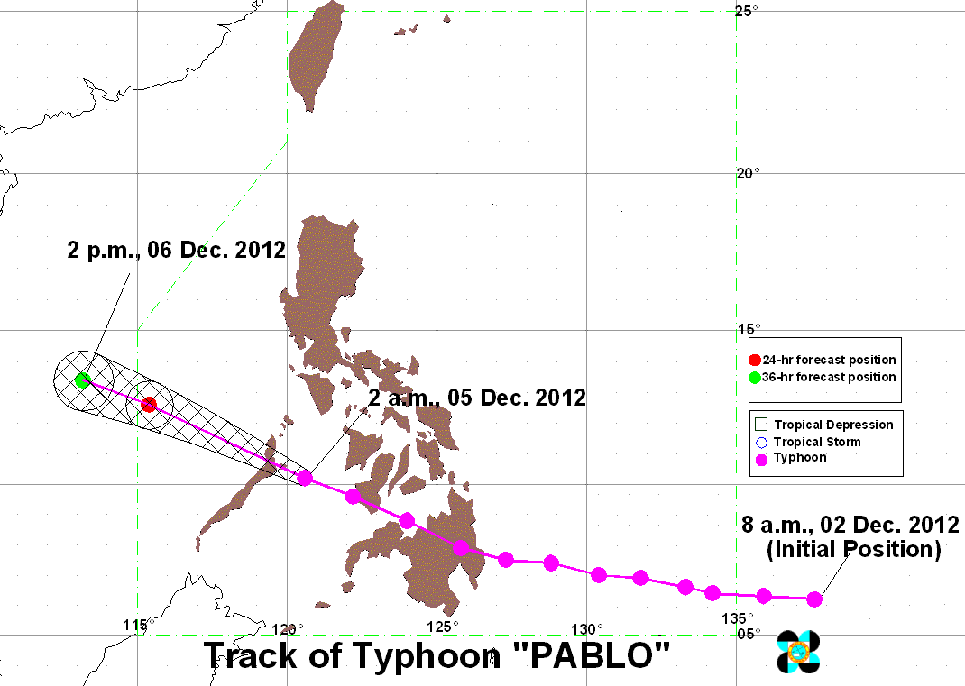
The typhoon was last spotted 120 km northeast of Puerto Princesa City (10.7°N, 119.4°E), carrying maximum sustained winds of 120 km/h and gusts of up to 150 km/h.
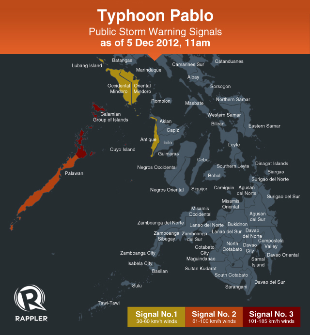
Public storm warning signal number 3 is still in effect over northern Palawan and the Calamian Islands. These areas are expected to experience winds between 101-185 km/h.
Signal number 2, meanwhile, has been raised over the rest of Palawan, while signal number 1 is still hoisted over Occidental Mindoro, Oriental Mindoro, and Antique.

Elsewhere, storm signals have been lowered, state weather bureau PAGASA said in its 11 am bulletin.
Typhoon Pablo, now with a diameter of 400 km, is expected to bring heavy to intense rainfall (10-18 mm/h) over the affected areas.

Pablo, moving at a speed of 19 km/h, is expected to be 440 km northwest of Puerto Princesa by Thursday morning, and 780 km west of Calapan, Oriental Mindoro by Friday morning.
It is expected to be out of the Philippine Area of Responsibility (PAR) by Thursday.
“Residents living in low lying and mountainous areas under public storm warning signals are alerted against possible flashfloods and landslides,” the bureau warned.
Coastal areas affected by Typhoon Pablo are expected to experience storm surges and big waves, and seacraft are advised to stay ashore. – Rappler.com
Add a comment
How does this make you feel?
There are no comments yet. Add your comment to start the conversation.