SUMMARY
This is AI generated summarization, which may have errors. For context, always refer to the full article.

What’s the weather like in your area? Report the situation through Rappler’s Agos or tweet us at @rapplerdotcom.
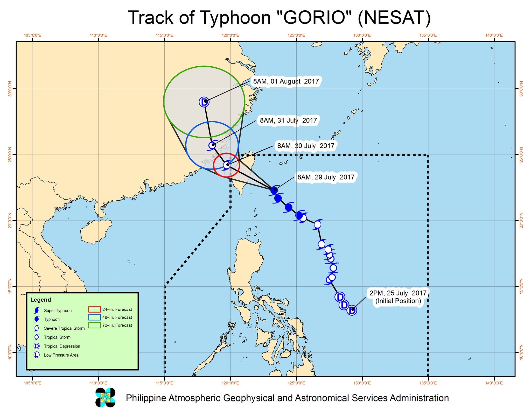
MANILA, Philippines – Typhoon Gorio (Nesat) maintained its strength late Saturday morning, July 29, as it headed for Taiwan.
By Saturday night, Gorio is expected to make landfall in Taiwan, which is still included in the Philippine Area of Responsibility (PAR). (READ: Taiwan braces for its 1st typhoon of the year)
In a bulletin issued 11 am on Saturday, Philippine weather bureau PAGASA said Gorio is already 265 kilometers north northeast of Basco, Batanes, moving northwest at a slightly slower 15 kilometers per hour (km/h) from the previous 17 km/h.
The typhoon continues to have maximum winds of 145 km/h and gustiness of up to 180 km/h.
Batanes remains under signal number 2, while the Babuyan Group of Islands is still under signal number 1.
Aside from Gorio, PAGASA continues to monitor a tropical depression located outside PAR, at 435 kilometers west of Laoag City, Ilocos Norte. This weather disturbance could move near the PAR boundary, but it only has a slim chance of actually entering.
Both the tropical depression and Gorio, however, are still enhancing the southwest monsoon.
Monsoon rain which may trigger flash floods and landslides will continue in Ilocos, Cordillera, Bataan, and Zambales.
The rest of Luzon, including Metro Manila, have light to moderate rain, while the Visayas and Mindanao only have isolated rainshowers.
PAGASA also warned that sea travel is risky in the seaboards of Northern Luzon and the western seaboard of Central Luzon and Southern Luzon. Fishing boats and other small seacraft are advised not to venture out into these areas, while large sea vessels should watch out for big waves.
Gorio will leave PAR on Sunday morning, July 30. Once it exits, areas still experiencing heavy monsoon rains will gradually begin seeing better weather.
Several areas and schools again suspended classes for Saturday. – Rappler.com
Add a comment
How does this make you feel?


There are no comments yet. Add your comment to start the conversation.