SUMMARY
This is AI generated summarization, which may have errors. For context, always refer to the full article.
What’s the weather like in your area? Report the situation through Rappler’s Agos or tweet us at @rapplerdotcom.
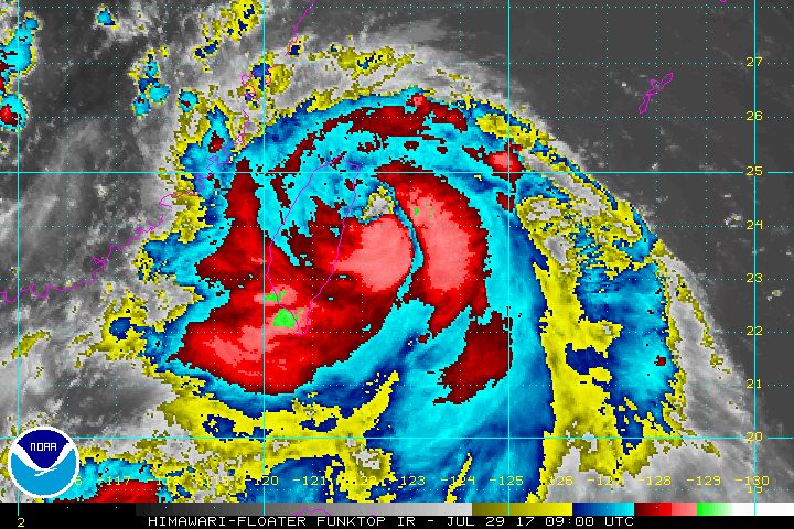
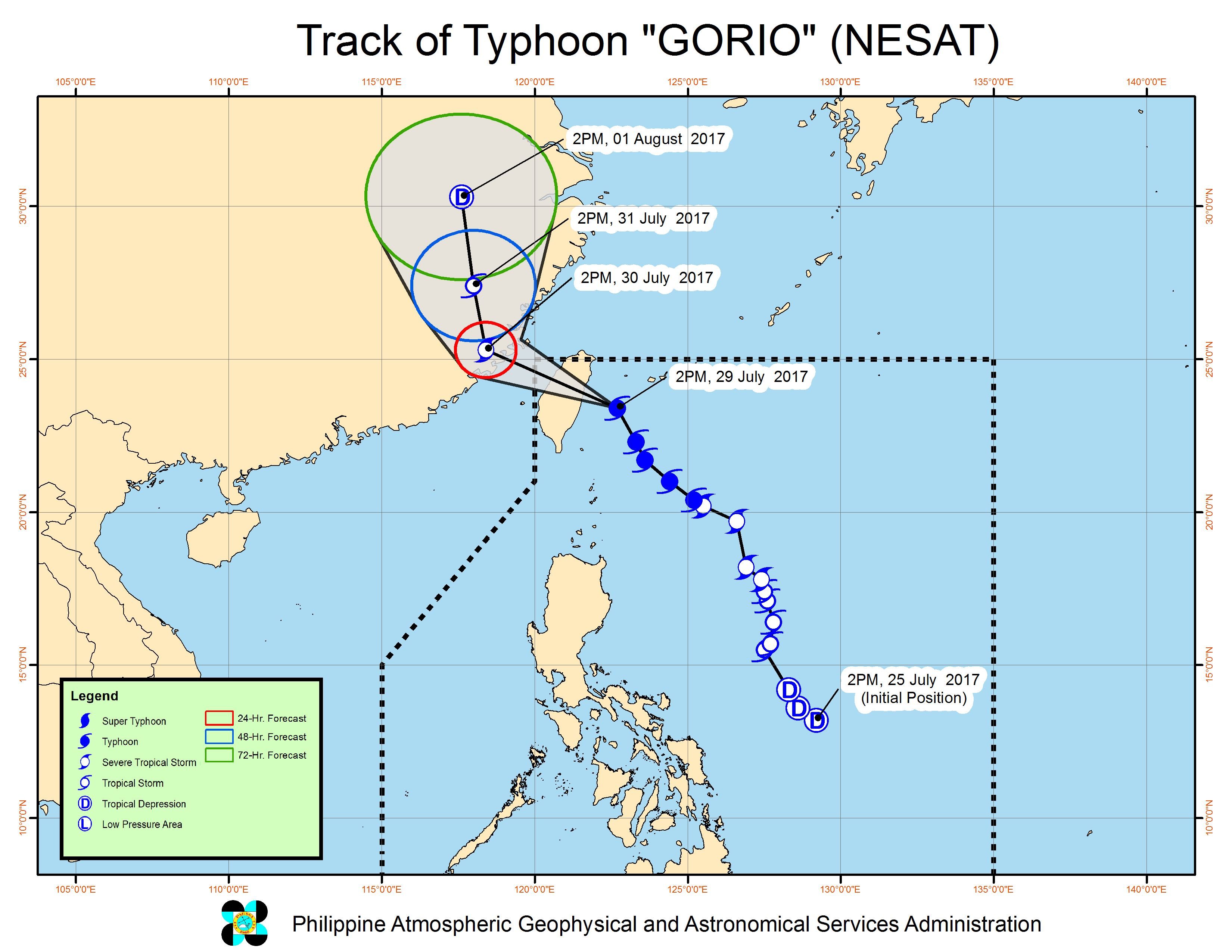
MANILA, Philippines – Typhoon Gorio (Nesat) slightly accelerated late Saturday afternoon, July 29, shortly before its expected landfall in Taiwan in the evening. (READ: Taiwan braces for its 1st typhoon of the year)
In a bulletin issued 5 pm on Saturday, Philippine weather bureau PAGASA said Gorio is already 360 kilometers north of Basco, Batanes, moving northwest at a faster 19 kilometers per hour (km/h) from the previous 15 km/h.
The typhoon continues to have maximum winds of 145 km/h and gustiness of up to 180 km/h.
Batanes is under signal number 1 – downgraded from signal number 2 – while the tropical cyclone warning signal over the Babuyan Group of Islands has been lifted.
Meanwhile, the tropical depression outside the Philippine Area of Responsibility (PAR) that PAGASA has been monitoring already intensified into a tropical storm.
The tropical storm, given the international name Haitang, is now 370 kilometers west of Laoag City, Ilocos Norte, moving northeast at 20 km/h. It has maximum winds of 90 km/h and gustiness of up to 115 km/h.
Haitang might enter the northwestern boundary of PAR on Sunday afternoon or evening, July 30, according to PAGASA forecaster Sheilla Reyes. If it enters PAR, it will be named Huaning.
In the meantime, both Haitang and Gorio are still enhancing the southwest monsoon.
Monsoon rain which may trigger flash floods and landslides will continue in Ilocos, Cordillera, Bataan, and Zambales. There will also be light to moderate rain in the rest of Central Luzon and in Cagayan Valley.
The rest of Luzon, as well as the Visayas and Mindanao, will only have isolated rainshowers or thunderstorms.
PAGASA also warned that sea travel is risky in the seaboards of Northern Luzon and the western seaboard of Central Luzon and Southern Luzon. Fishing boats and other small seacraft are advised not to venture out into these areas, while large sea vessels should watch out for big waves.
Based on its forecast track, Gorio will leave PAR on Sunday morning, just hours before Haitang’s potential entry.
Several areas and schools again suspended classes for Saturday. – Rappler.com
Add a comment
How does this make you feel?
There are no comments yet. Add your comment to start the conversation.