SUMMARY
This is AI generated summarization, which may have errors. For context, always refer to the full article.
What’s the weather like in your area? Report the situation through Rappler’s Agos or tweet us at @rapplerdotcom.
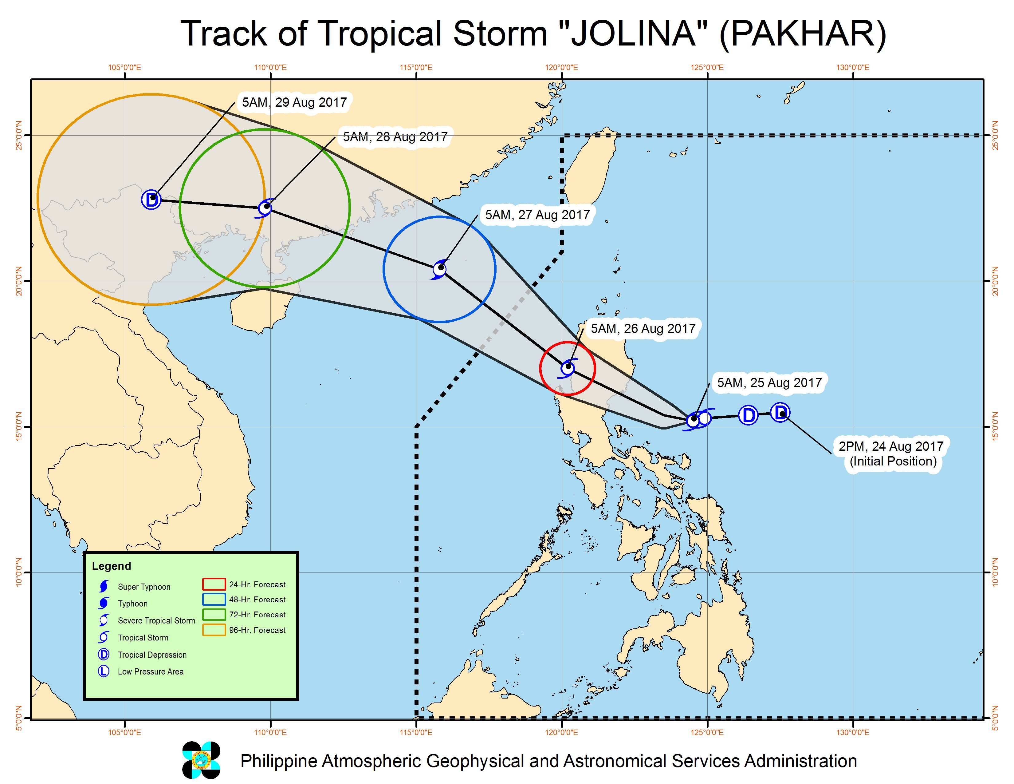
MANILA, Philippines – Tropical Storm Jolina (Pakhar) maintained its intensity and direction early Friday morning, August 25, as it headed for the Isabela-Aurora area.
In a bulletin issued past 8 am on Friday, state weather bureau PAGASA said Jolina is already 275 kilometers east southeast of Casiguran, Aurora, still moving west northwest at 19 kilometers per hour (km/h).
The tropical storm continues to have maximum winds of 65 kilometers per hour (km/h) and gustiness of up to 80 km/h.
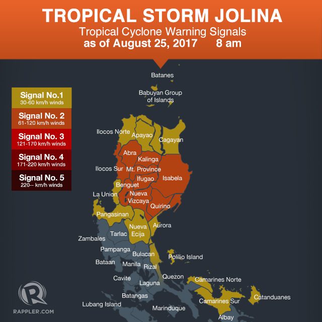
Signal number 2 is raised over the following areas:
- Isabela
- northern Aurora
- Quirino
- Kalinga
- Mountain Province
- Ifugao
- Ilocos Sur
- Benguet
- Abra
- Nueva Vizcaya
Signal number 1, meanwhile, is up in:
- Cagayan including Babuyan Group of Islands
- Apayao
- La Union
- rest of Aurora
- Ilocos Norte
- Nueva Ecija
- Pangasinan
- northern Quezon including Polillo Island
- Catanduanes
- Camarines Norte
- Camarines Sur
PAGASA said Jolina is expected to further intensify before making landfall in the Isabela-Aurora area on Friday evening. (READ: Isabela prepares for Tropical Storm Jolina’s landfall)
Meanwhile, moderate to heavy rain is also expected in most parts of Luzon beginning Friday. Residents should watch out for possible flash floods and landslides.
PAGASA also warned that sea travel is risky in the seaboard of Northern Luzon and in the eastern seaboards of Central Luzon and Southern Luzon.
Jolina is expected to leave the Philippine Area of Responsibility (PAR) on Saturday evening, August 26.
– Rappler.com
Add a comment
How does this make you feel?
There are no comments yet. Add your comment to start the conversation.