SUMMARY
This is AI generated summarization, which may have errors. For context, always refer to the full article.
What’s the weather like in your area? Report the situation through Rappler’s Agos or tweet us at @rapplerdotcom.
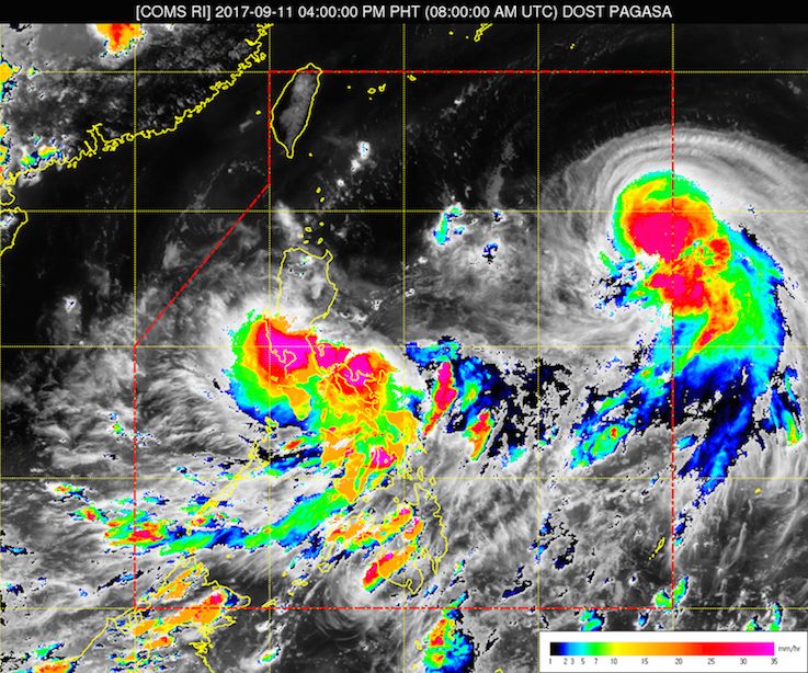
MANILA, Philippines – There are now two tropical cyclones inside the Philippine Area of Responsibility (PAR) as of Monday afternoon, September 11.
State weather bureau PAGASA announced in a press briefing late Monday afternoon that the typhoon with the international name Talim entered PAR at 2 pm. It has been given the local name Lannie.
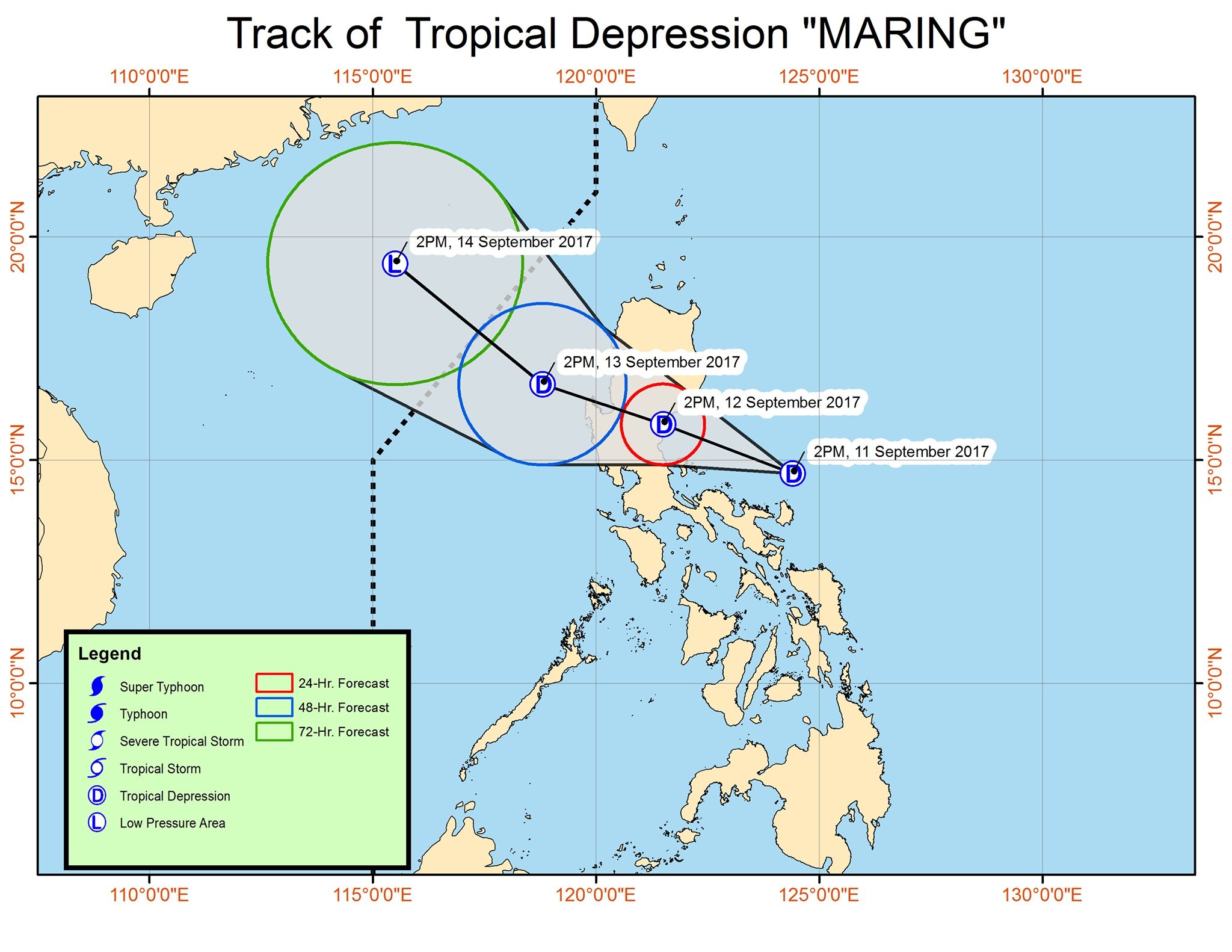
The low pressure area (LPA) east of Southern Luzon also strengthened into a tropical depression at around 3 pm, and was named Maring.
Of the two, Maring is expected to bring more rain to the Philippines compared to Lannie, because of its forecast track.
Tropical Depression Maring
PAGASA said Maring, which is now located 300 kilometers east of Infanta, Quezon, is expected to make landfall on Tuesday, September 12, in the Aurora-Quezon area. It is moving west northwest at 13 kilometers per hour (km/h).
The tropical depression has maximum winds of 45 km/h and gustiness of up to 60 km/h.
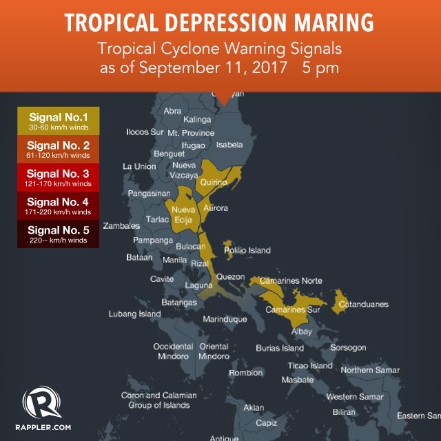
Signal number 1 is raised in the following areas due to Maring:
- Catanduanes
- Camarines Norte
- Camarines Sur
- northern Quezon including Polillo Island
- Aurora
- Quirino
- Nueva Ecija
Maring will also trigger moderate to heavy rain from Monday to Tuesday in the regions of Bicol, Calabarzon, Mimaropa, and Metro Manila, as well as the provinces of Aurora, Bataan, Zambales, and Pangasinan. These areas should watch out for floods and landslides.
PAGASA also warned that sea travel is risky in the eastern seaboards of Aurora, Quezon, and Bicol.
Typhoon Lannie
Lannie, in contrast, is moving west northwest at 28 km/h toward the Batanes-Taiwan area. It is already 1,370 kilometers east of Aparri, Cagayan.
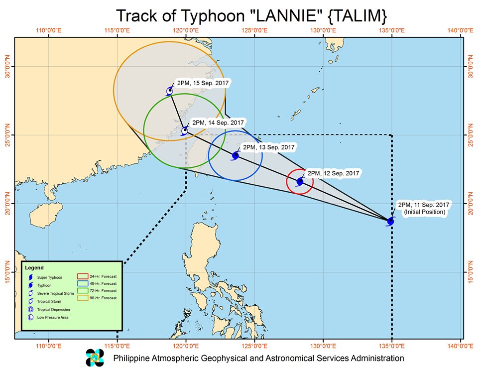
The typhoon has maximum winds of 120 km/h and gustiness of up to 145 km/h.
There are no areas under tropical cyclone warning signals due to Lannie.
– Rappler.com
Add a comment
How does this make you feel?
There are no comments yet. Add your comment to start the conversation.