SUMMARY
This is AI generated summarization, which may have errors. For context, always refer to the full article.
What’s the weather like in your area? Report the situation through Rappler’s Agos or tweet us at @rapplerdotcom.
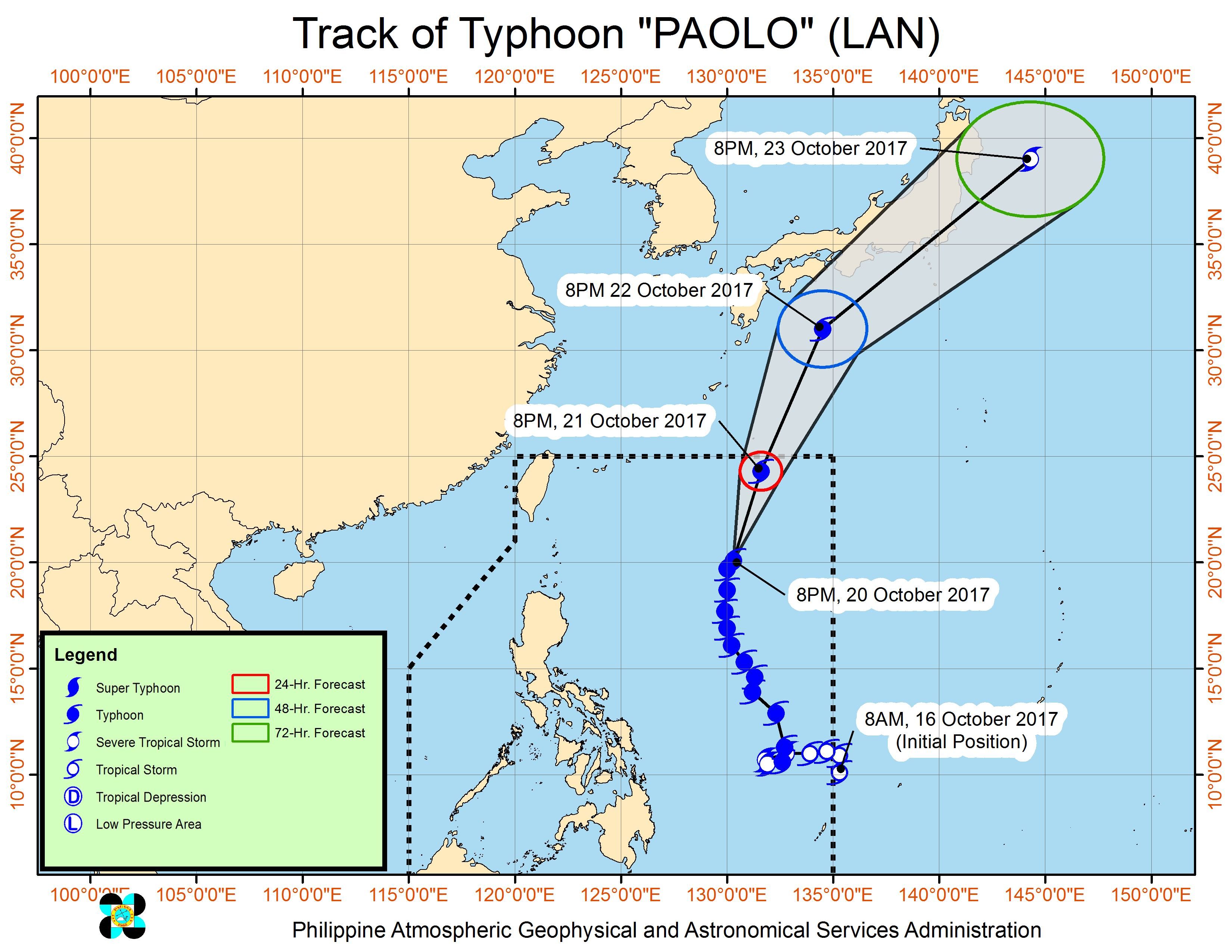
MANILA, Philippines – Typhoon Paolo (Lan) began to slowly move away from the country on Friday evening, October 20.
In a bulletin issued 11 pm on Friday, state weather bureau PAGASA said Paolo is already 870 kilometers east of Basco, Batanes, moving north northeast at 17 kilometers per hour (km/h).
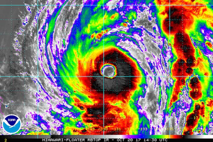
The typhoon now has maximum winds of 145 km/h from the previous 140 km/h, and gustiness of up to 180 km/h.
No areas were placed under tropical cyclone warning signals as Paolo has stayed far from land since it entered the Philippine Area of Responsibility (PAR) as a tropical storm last Monday, October 16. (READ: FAST FACTS: Tropical cyclones, rainfall advisories)
Paolo, however, gradually strengthened inside PAR until it reached typhoon status, with its outer rainbands bringing rain across the Philippines. It now has an even wider diameter of 1,600 kilometers.
Though the typhoon is beginning to move away, its outer rainbands will continue to trigger moderate to heavy rain in Bicol, Mimaropa, and the Visayas. Residents in these areas should remain on alert for flash floods and landslides. (READ: Heavy rain triggers floods in Dumaguete)
The rest of the country, including Metro Manila, will only have isolated rainshowers or thunderstorms, mostly in the afternoon or evening.
Sea travel remains risky in the seaboard of Northern Luzon, the eastern seaboard of Central Luzon, the seaboard of Southern Luzon and the Visayas, and the western, northern, and eastern seaboards of Mindanao.
Paolo is expected to leave PAR early Sunday, October 22.
The low pressure area (LPA) off Mimaropa dissipated on Friday afternoon. – Rappler.com
Add a comment
How does this make you feel?
There are no comments yet. Add your comment to start the conversation.