SUMMARY
This is AI generated summarization, which may have errors. For context, always refer to the full article.
What’s the weather like in your area? Report the situation through Rappler’s Agos or tweet us at @rapplerdotcom.
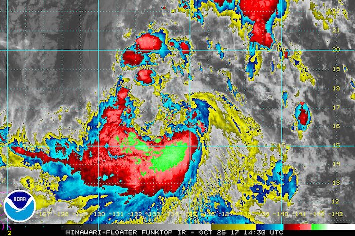
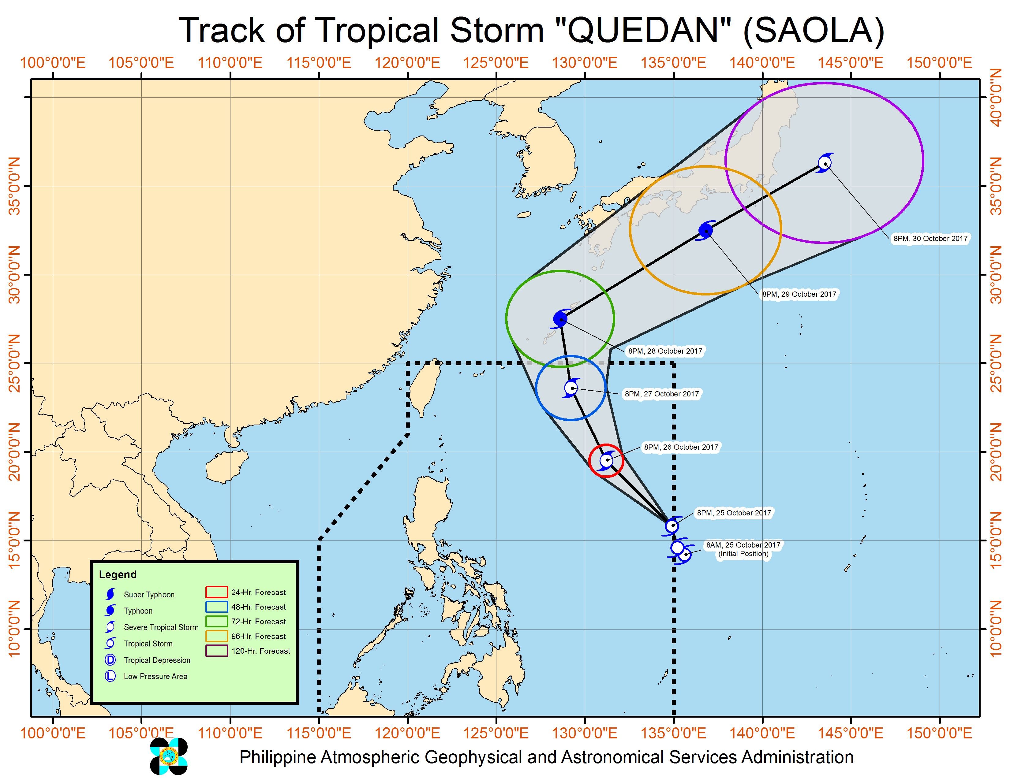
MANILA, Philippines – Tropical Storm Quedan (Saola) maintained its strength as it continued to move over the Philippine Sea on Wednesday evening, October 25.
In a bulletin issued 11 pm on Wednesday, state weather bureau PAGASA said Quedan is already 1,345 kilometers east of Casiguran, Aurora, still moving northwest at 21 kilometers per hour (km/h).
The tropical storm still has maximum winds of 80 km/h and gustiness of up to 95 km/h.
Quedan is not expected to make landfall in the Philippines, but its outer rainbands are bringing rain to Bicol and the Visayas.
Sea travel is also risky in the seaboards of Northern Luzon. (READ: FAST FACTS: Tropical cyclones, rainfall advisories)
Based on its latest forecast track, Quedan will leave the Philippine Area of Responsibility (PAR) on Saturday, October 28.
PAGASA also warned earlier that the intertropical convergence zone (ITCZ) will trigger rain in Palawan and Mindanao. The ITCZ is a belt near the equator where the trade winds of the Northern Hemisphere and Southern Hemisphere meet. – Rappler.com
Add a comment
How does this make you feel?
![[In This Economy] A counter-rejoinder in the economic charter change debate](https://www.rappler.com/tachyon/2024/04/TL-counter-rejoinder-apr-20-2024.jpg?resize=257%2C257&crop=267px%2C0px%2C720px%2C720px)
![[Vantage Point] Joey Salceda says 8% GDP growth attainable](https://www.rappler.com/tachyon/2024/04/tl-salceda-gdp-growth-04192024.jpg?resize=257%2C257&crop_strategy=attention)
![[ANALYSIS] A new advocacy in race to financial literacy](https://www.rappler.com/tachyon/2024/04/advocacy-race-financial-literacy-April-19-2024.jpg?resize=257%2C257&crop_strategy=attention)


There are no comments yet. Add your comment to start the conversation.