SUMMARY
This is AI generated summarization, which may have errors. For context, always refer to the full article.
What’s the weather like in your area? Report the situation through Rappler’s Agos or tweet us at @rapplerdotcom.
MANILA, Philippines – Signal number 1 was already lifted for parts of the Visayas late Thursday afternoon, November 9, though parts of Luzon are still under the warning signal due to Tropical Depression Salome.
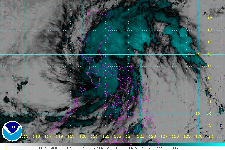
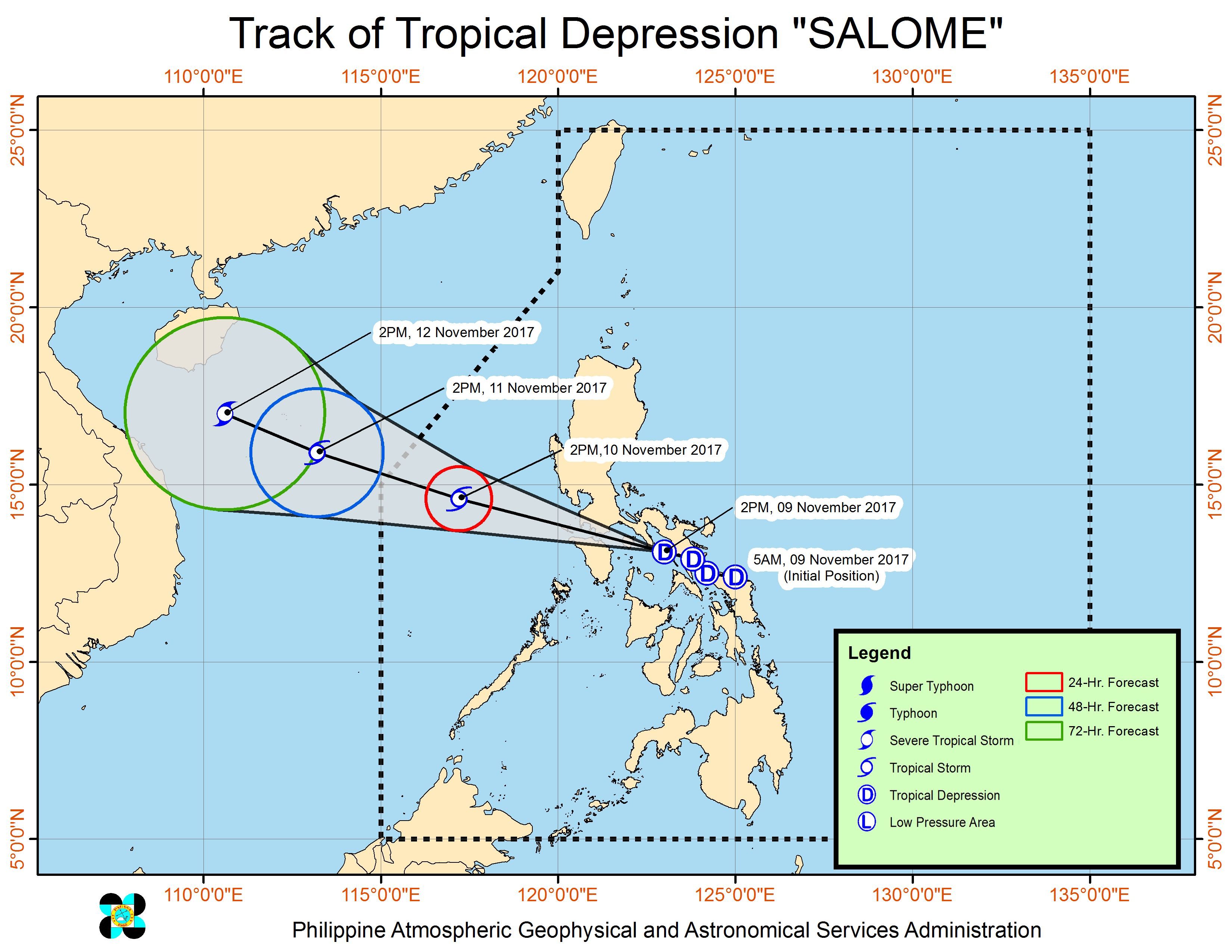
In a bulletin issued 5 pm on Thursday, state weather bureau PAGASA said Salome is already 65 kilometers southwest of Pili, Camarines Sur, still moving west northwest at 25 kilometers per hour (km/h).
The tropical depression is heading now for the southern Quezon-Marinduque area. It will be closest to Metro Manila between 8 pm and midnight on Thursday.
Salome continues to have maximum winds of 55 km/h and gustiness of up to 90 km/h, but PAGASA warned that it may become a tropical storm within the next 24 hours.
With its current speed, the tropical depression is expected to leave the Philippine Area of Responsibility (PAR) early Saturday morning, November 11 – before leaders of the Association of Southeast Asian Nations arrive in the country for the 31st ASEAN Summit. (READ: Bad weather results in cancelled flights on Thursday, Nov 9)
Most ASEAN leaders will arrive on Sunday, November 12, coming from the ongoing Asia-Pacific Economic Cooperation (APEC) Summit in Vietnam, which Philippine President Rodrigo Duterte is also attending. PAGASA said the weather will likely be better by then, as long as no new low pressure area or tropical cyclone develops.
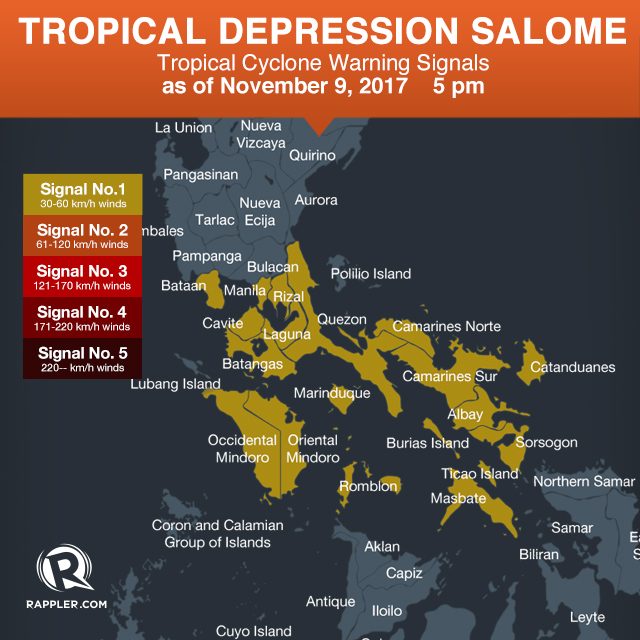
Signal number 1 is raised in the following areas:
- Metro Manila
- Rizal
- Bataan
- Camarines Norte
- Camarines Sur
- Catanduanes
- Albay
- Sorsogon
- Masbate including Ticao and Burias Islands
- Romblon
- Marinduque
- Quezon
- Laguna
- Cavite
- Batangas
- Oriental Mindoro
- Occidental Mindoro
There is moderate to heavy rainfall within the 250-kilometer diameter of the tropical depression. Flash floods and landslides are possible.
Aside from areas under signal number 1, PAGASA also warned the eastern part of Central Luzon to be on alert for flash floods and landslides as well. (READ: FAST FACTS: Tropical cyclones, rainfall advisories)
Sea travel remains suspended in areas under signal number 1 due to moderate to rough seas. PAGASA warned fishing boats and other vessels not to venture out into sea.
Based on Salome’s latest forecast track, it will cross the northern Mindoro-Batangas area on Thursday night or early Friday morning, November 10.
It will then eventually exit PAR early Saturday.
– Rappler.com
Add a comment
How does this make you feel?
There are no comments yet. Add your comment to start the conversation.