SUMMARY
This is AI generated summarization, which may have errors. For context, always refer to the full article.
What’s the weather like in your area? Report the situation through Rappler’s Agos or tweet us at @rapplerdotcom.
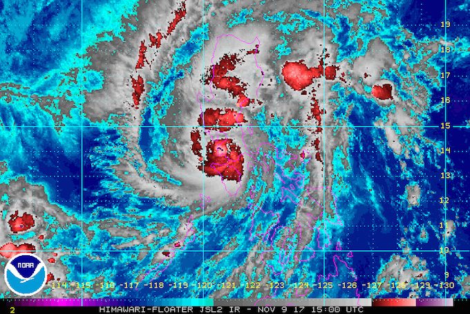
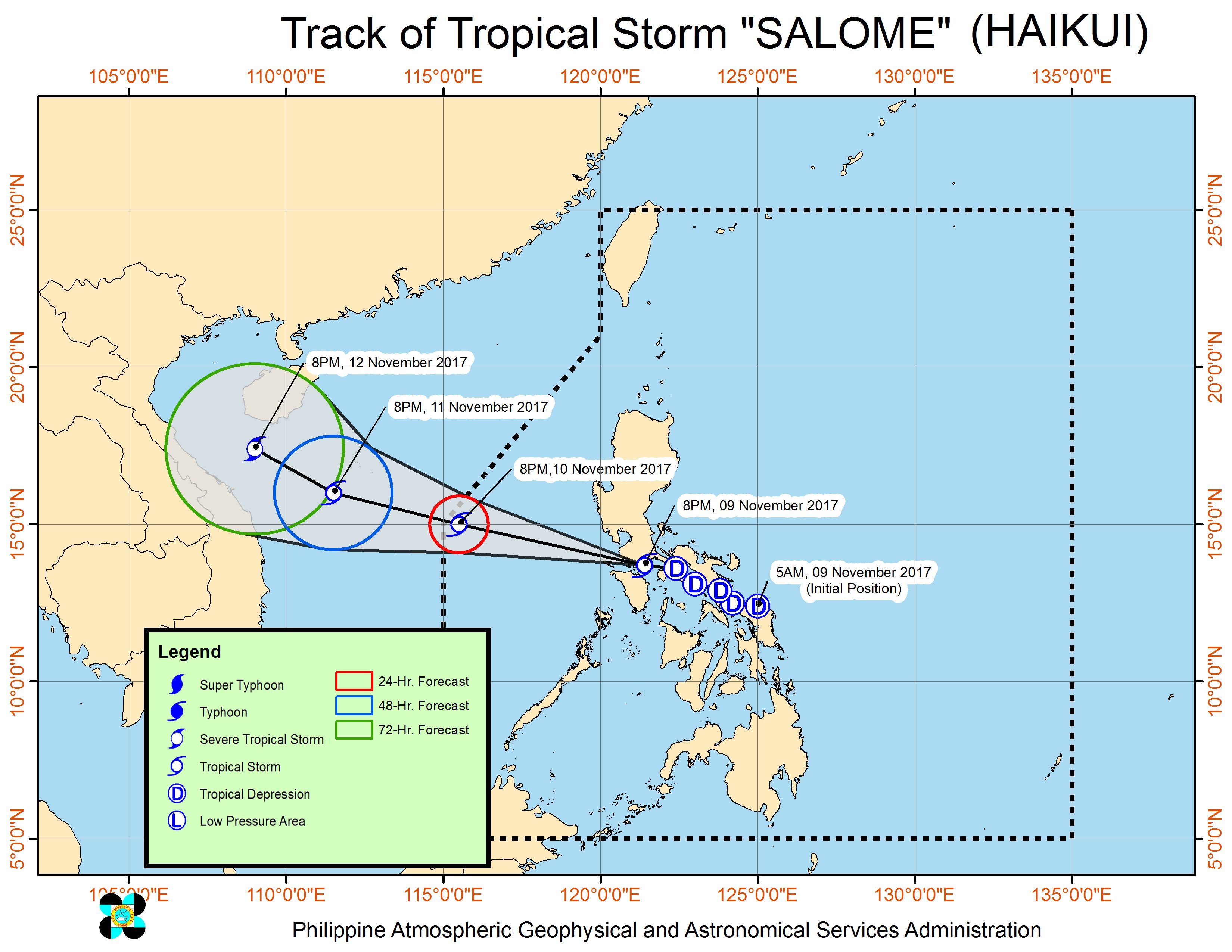
MANILA, Philippines – Tropical Depression Salome intensified into a tropical storm late Thursday evening, November 9, as it crossed the Batangas-Cavite area. It has been given the international name Haikui.
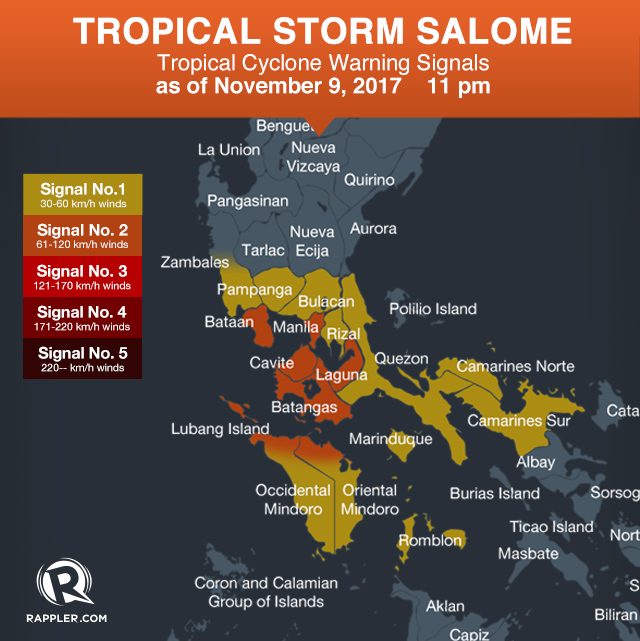
In a bulletin issued 11 pm on Thursday, state weather bureau PAGASA said Salome now has maximum winds of 65 kilometers per hour (km/h) from the previous 55 km/h, and gustiness of up to 110 km/h from the previous 90 km/h.
The tropical storm is already in the vicinity of Mataas na Kahoy, Batangas, still moving west northwest at 25 km/h. It is also at its closest point to Metro Manila.
Signal number 2 is now raised in the following areas:
- Metro Manila
- Bataan
- Cavite
- Laguna
- Batangas
- northern Oriental Mindoro
- northern Occidental Mindoro
Signal number 1, meanwhile, is up over:
- Bulacan
- Pampanga
- southern Zambales
- Rizal
- Camarines Norte
- Camarines Sur
- Romblon
- Marinduque
- Quezon
- southern Oriental Mindoro
- southern Occidental Mindoro
There is moderate to heavy rainfall within the 250-kilometer diameter of the tropical storm. Flash floods and landslides are possible.
Aside from areas under signal numbers 1 and 2, PAGASA warned Central Luzon to be on alert for flash floods and landslides as well. (READ: FAST FACTS: Tropical cyclones, rainfall advisories)
“Bukas inaasahan natin na unti-unting mas gaganda ang panahon, lalo na bandang tanghali. Ngayong gabi ang peak o pinakamalakas na epekto ng bagyo,” said PAGASA forecaster Obet Badrina in a briefing late Thursday evening.
(We expect the weather to gradually begin improving on Friday, especially around lunchtime. Thursday night is the peak or the time that we are feeling the strongest effects of the tropical storm.)
Sea travel remains suspended in areas under signal numbers 1 and 2 due to rough to very rough seas. PAGASA warned fishing boats and other vessels not to venture out into sea.
Classes have again been suspended in parts of Luzon for Friday, November 10.
Based on its latest forecast track, Salome will exit landmass on Friday morning, then leave the Philippine Area of Responsibility (PAR) early Saturday morning, November 11 – before leaders of the Association of Southeast Asian Nations arrive in the country for the 31st ASEAN Summit. (READ: Bad weather results in cancelled flights on Thursday, Nov 9)
Most ASEAN leaders will arrive on Sunday, November 12, coming from the ongoing Asia-Pacific Economic Cooperation (APEC) Summit in Vietnam, which Philippine President Rodrigo Duterte is also attending. PAGASA said the weather will likely be better by then, as long as no new low pressure area or tropical cyclone develops.
– Rappler.com
Add a comment
How does this make you feel?


There are no comments yet. Add your comment to start the conversation.