SUMMARY
This is AI generated summarization, which may have errors. For context, always refer to the full article.
What’s the weather like in your area? Report the situation through Rappler’s Agos or tweet us at @rapplerdotcom.
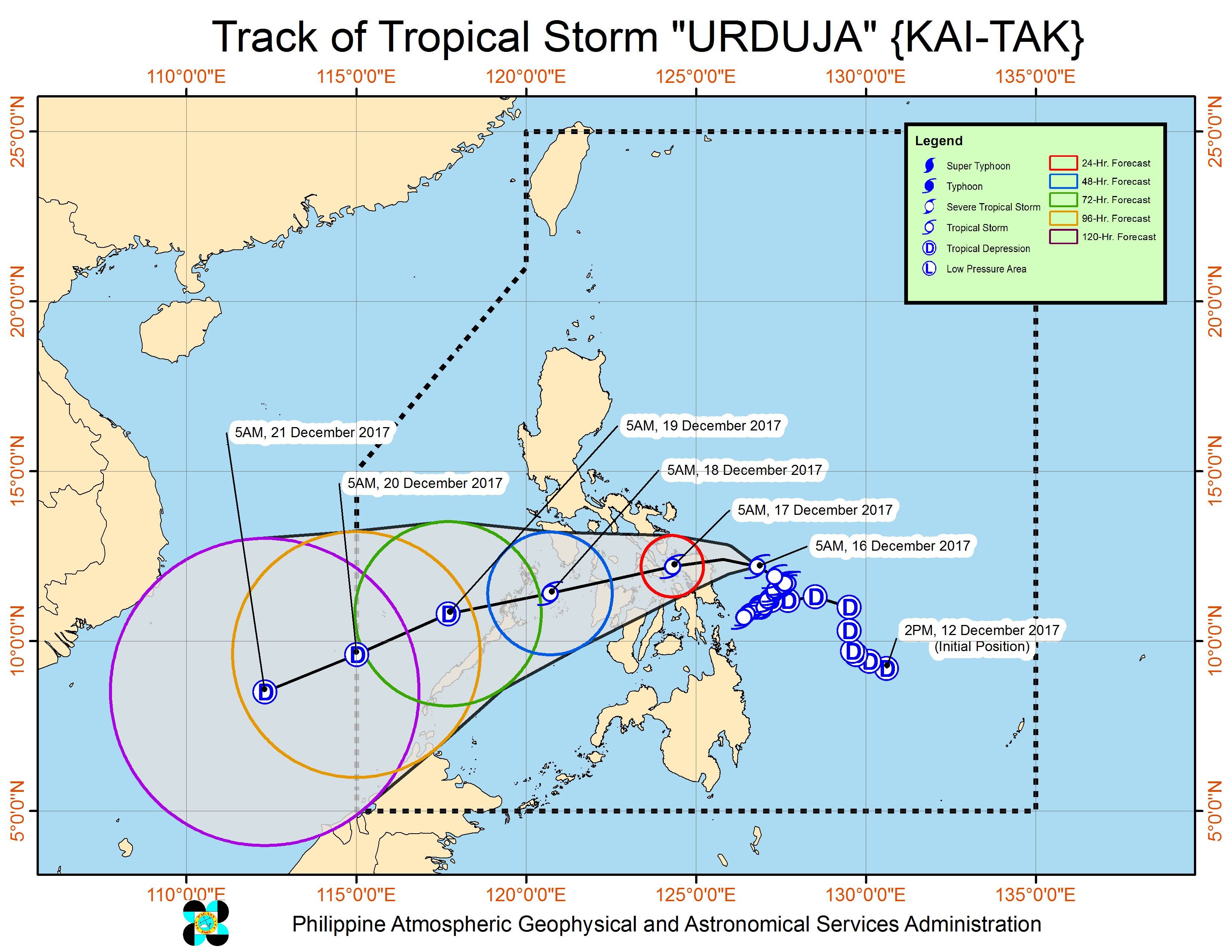
MANILA, Philippines – Tropical Storm Urduja headed for the Eastern Samar-Northern Samar area early Saturday morning, December 16, ahead of its expected landfall within the day.
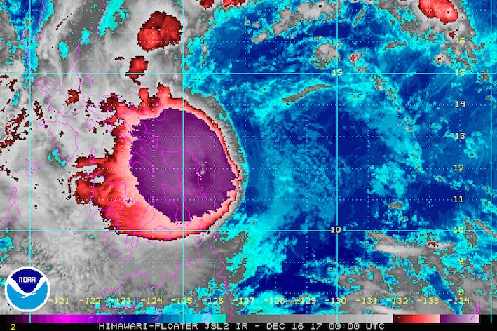
In a bulletin issued 8 am on Saturday, PAGASA said Urduja is already 125 kilometers east northeast of Borongan, Eastern Samar, moving west at 10 kilometers per hour (km/h). This speed is still slow, but it is slightly faster now compared to when it was barely moving on Friday, December 15.
PAGASA forecaster Aldczar Aurelio earlier explained that the tropical storm’s interaction with the northeast monsoon and the tail-end of a cold front had been preventing it from advancing faster.
Ahead of its landfall on Saturday afternoon or evening, Urduja has maximum winds of 80 km/h and gustiness of up to 95 km/h. (READ: EXPLAINER: How tropical cyclones form)
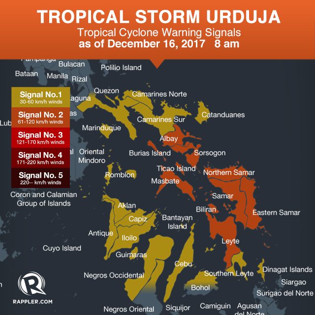
Signal number 2 is raised over:
- Albay
- Sorsogon
- Masbate including Burias and Ticao Islands
- Eastern Samar
- Northern Samar
- Samar
- Biliran
- Leyte
Signal number 1, meanwhile, is up in:
- southern Quezon
- Marinduque
- Romblon
- Catanduanes
- Camarines Norte
- Camarines Sur
- Aklan
- Antique
- Capiz
- Iloilo
- Guimaras
- Negros Occidental
- northern Negros Oriental
- Cebu
- northern Bohol
- Southern Leyte
- Dinagat Islands
Floods and landslides have hit Eastern Samar, while Tacloban City is under a state of calamity.
PAGASA said residents of provinces in the tropical storm’s path “must undertake appropriate measures against flooding and landslides and coordinate with their respective local government and disaster risk reduction and management offices.” (READ: FAST FACTS: Tropical cyclones, rainfall advisories)
Below are the top 5 areas which received the most rainfall in terms of millimeters (mm), from 8 am of Thursday, December 14, to 8 am of Friday, or a 24-hour period. Guiuan, Eastern Samar is the hardest-hit as it received nearly two months’ worth of rain in just one day.
- Guiuan, Eastern Samar – 780 mm (normal monthly rainfall: 440 mm)
- Borongan, Eastern Samar – 343 mm (normal monthly rainfall: 674.8 mm)
- Catbalogan, Samar – 215 mm (normal monthly rainfall: 322.7 mm)
- Tacloban, Leyte – 192.4 mm (normal monthly rainfall: 386 mm)
- Maasin, Southern Leyte – 95.4 mm (normal monthly rainfall: 226.1 mm)
Sea travel also remains risky in seaboards of areas under tropical cyclone warning signals.
The Department of Social Welfare and Development (DSWD) earlier activated the government’s national disaster response operation to assist areas affected by the tropical storm.
Based on its forecast track, Urduja will eventually get downgraded back to a tropical depression by Tuesday, December 19, then leave the Philippine Area of Responsibility (PAR) on Wednesday, December 20.
– Rappler.com
Add a comment
How does this make you feel?
There are no comments yet. Add your comment to start the conversation.