SUMMARY
This is AI generated summarization, which may have errors. For context, always refer to the full article.
What’s the weather like in your area? Report the situation through Rappler’s Agos or tweet us at @rapplerdotcom.
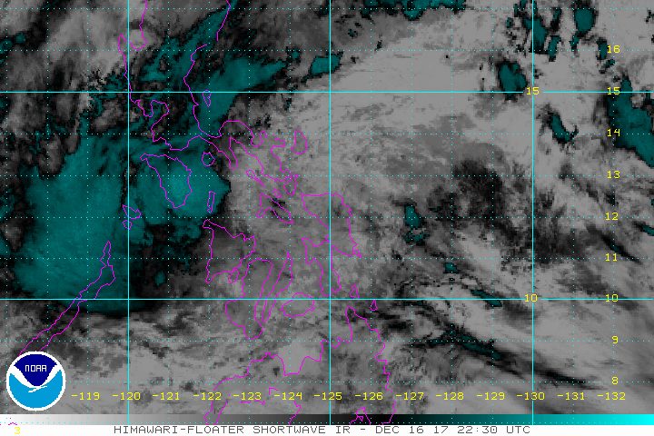
MANILA, Philippines – Tropical Storm Urduja (Kai-tak) continued to move slowly over the northern part of Samar province before dawn on Sunday, December 17, bringing more heavy rain.
The tropical storm has left at least 3 people dead and 6 others missing, according to the National Disaster Risk Reduction and Management Council (NDRRMC). It had made landfall in San Policarpo, Eastern Samar early Saturday afternoon, December 16.
In a bulletin issued 5 am on Sunday, state weather bureau PAGASA said Urduja is already in the vicinity of Calbayog, Samar, still moving west at 13 kilometers per hour (km/h).
The tropical storm continues to have maximum winds of 65 km/h and gustiness of up to 110 km/h. (READ: EXPLAINER: How tropical cyclones form)
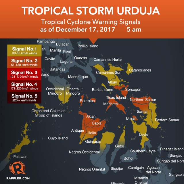
Signal number 2 is raised over:
- Sorsogon
- Masbate including Ticao Island
- Romblon
- Cuyo Island
- Northern Samar
- northern part of Samar
- Biliran
- Aklan
- Capiz
- northern Antique
- northern Iloilo
Signal number 1, meanwhile, is up in:
- southern Oriental Mindoro
- southern Occidental Mindoro
- Catanduanes
- Camarines Sur
- Albay
- Burias Island
- northern Palawan including Calamian Group of Islands
- southern Iloilo
- southern Antique
- Guimaras
- northern Negros Occidental
- northern Cebu
- Leyte
- Eastern Samar
- southern part of Samar
Floods and landslides have hit Eastern Samar, while parts of Leyte are under a state of calamity. (LOOK: Houses in Eastern Samar flooded due to Urduja)
PAGASA said residents of provinces in the tropical storm’s path “must undertake appropriate measures against flooding and landslides and coordinate with their respective local government and disaster risk reduction and management offices.” (READ: FAST FACTS: Tropical cyclones, rainfall advisories)
Below are the top 5 areas which received the most rainfall in terms of millimeters (mm) on Friday, December 15.
- Catarman, Northern Samar – 347.4 mm (normal monthly rainfall: 628.2 mm)
- Catbalogan, Samar – 331.2 mm (normal monthly rainfall: 322.7 mm)
- Juban, Sorsogon – 162 mm (no amount given for normal monthly rainfall)
- Borongan, Eastern Samar – 155 mm (normal monthly rainfall: 674.8 mm)
- Guiuan, Eastern Samar – 109.6 mm (normal monthly rainfall: 440.1 mm)
In a 24-hour period that began last Thursday, December 14, Guiuan had received nearly two months’ worth of rainfall in just one day, making it the hardest-hit overall, so far.
Meanwhile, sea travel remains risky in seaboards of areas under tropical cyclone warning signals. Thousands of passengers have been stranded at various ports.
The Department of Social Welfare and Development (DSWD) earlier activated the government’s national disaster response operation to assist areas affected by the tropical storm. (READ: #ReliefPH: Help victims of Urduja)
Based on its forecast track, Urduja will eventually get downgraded back to a tropical depression by Sunday, December 17, then leave the Philippine Area of Responsibility (PAR) on Wednesday, December 20.
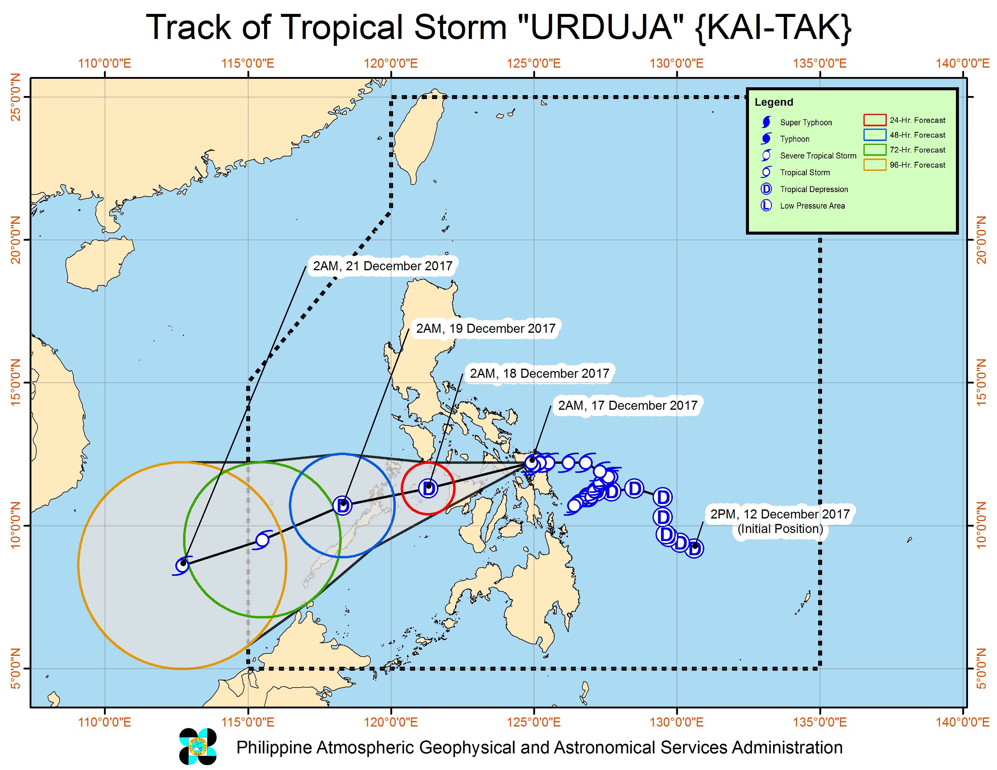
Aside from Urduja, PAGASA is also monitoring a tropical depression located 2,040 kilometers east of Mindanao, still outside PAR. It has maximum winds of 40 km/h and gustiness of up to 50 km/h.
The tropical depression will be given the local name Vinta once it enters next week. – Rappler.com
Add a comment
How does this make you feel?
There are no comments yet. Add your comment to start the conversation.