SUMMARY
This is AI generated summarization, which may have errors. For context, always refer to the full article.
What’s the weather like in your area? Report the situation through Rappler’s Agos or tweet us at @rapplerdotcom.
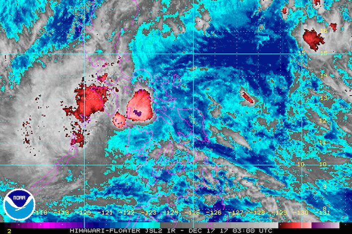
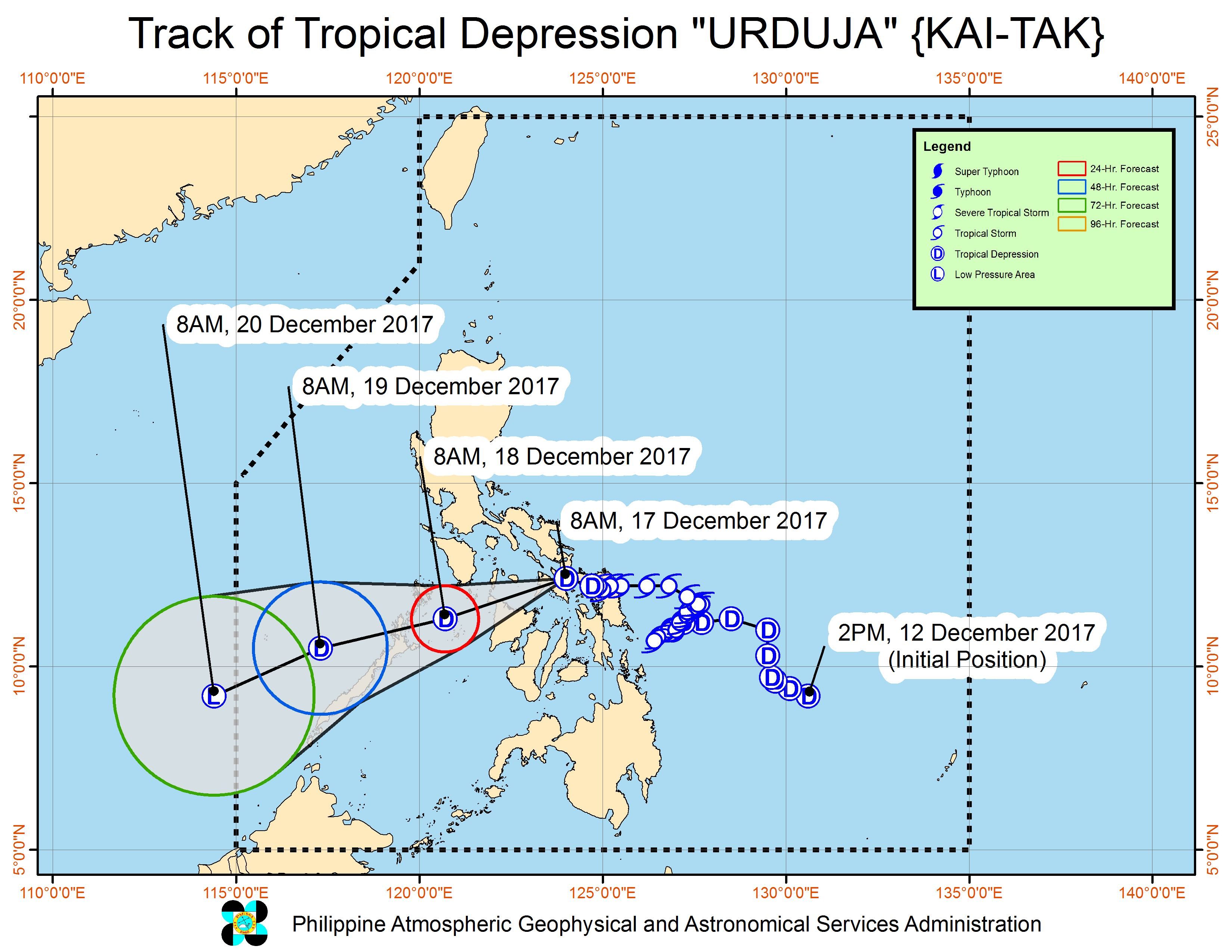
MANILA, Philippines – Tropical Depression Urduja (Kai-tak) weakened further late Sunday morning, December 17, after crossing Samar Island.
Urduja has left at least 3 people dead and 6 others missing, according to the National Disaster Risk Reduction and Management Council (NDRRMC). It had made landfall in San Policarpo, Eastern Samar early Saturday afternoon, December 16.
In a bulletin issued 11 am on Sunday, state weather bureau PAGASA said Urduja is already in the vicinity of Mobo, Masbate, moving west southwest at 15 kilometers per hour (km/h).
The tropical depression now has maximum winds of 55 km/h from the previous 60 km/h and gustiness of up to 90 km/h. (READ: EXPLAINER: How tropical cyclones form)
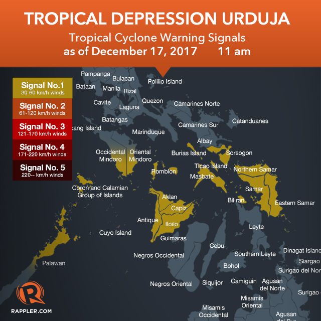
There are fewer areas under signal number 1:
- southern Occidental Mindoro
- southern Oriental Mindoro
- Romblon
- Sorsogon
- Masbate including Burias and Ticao Islands
- northern Palawan including Cuyo Island and Calamian Group of Islands
- Aklan
- Antique
- Capiz
- Iloilo
- Northern Samar
- Eastern Samar
- Samar
- Biliran
Floods and landslides have hit Eastern Samar, while parts of Leyte are under a state of calamity. (LOOK: Houses in Eastern Samar flooded due to Urduja)
PAGASA said residents of provinces in the tropical depression’s path “must undertake appropriate measures against flooding and landslides and coordinate with their respective local government and disaster risk reduction and management offices.” (READ: FAST FACTS: Tropical cyclones, rainfall advisories)
Below are the top 5 areas which received the most rainfall in terms of millimeters (mm) on Friday, December 15.
- Catarman, Northern Samar – 347.4 mm (normal monthly rainfall: 628.2 mm)
- Catbalogan, Samar – 331.2 mm (normal monthly rainfall: 322.7 mm)
- Juban, Sorsogon – 162 mm (no amount given for normal monthly rainfall)
- Borongan, Eastern Samar – 155 mm (normal monthly rainfall: 674.8 mm)
- Guiuan, Eastern Samar – 109.6 mm (normal monthly rainfall: 440.1 mm)
In a 24-hour period that began last Thursday, December 14, Guiuan had received nearly two months’ worth of rainfall in just one day, making it the hardest-hit overall, so far.
Meanwhile, sea travel remains risky in seaboards of areas under signal number 1. Thousands of passengers have been stranded at various ports. (LOOK: Passengers stranded in Tacloban transport terminal)
The Department of Social Welfare and Development (DSWD) earlier activated the government’s national disaster response operation.
The DSWD said on Sunday that around 221,386 persons or 50,653 families across 4 regions are affected. (READ: #ReliefPH: Help victims of Urduja)
Based on its latest forecast track, Urduja will leave the Philippine Area of Responsibility (PAR) on Wednesday, December 20.
Aside from Urduja, PAGASA is also monitoring a tropical depression located 1,990 kilometers east of Mindanao, still outside PAR. It has maximum winds of 40 km/h and gustiness of up to 50 km/h.
The tropical depression will be given the local name Vinta once it enters PAR either on Wednesday or Thursday, December 21. – Rappler.com
Add a comment
How does this make you feel?
There are no comments yet. Add your comment to start the conversation.