SUMMARY
This is AI generated summarization, which may have errors. For context, always refer to the full article.
What’s the weather like in your area? Report the situation through Rappler’s Agos or tweet us at @rapplerdotcom.
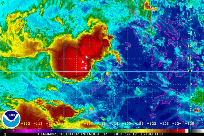
MANILA, Philippines – Tropical Depression Urduja (Kai-tak) continued moving away from the country late Monday evening, December 18, still crossing the West Philippine Sea.
In a bulletin issued past 11 pm on Monday, state weather bureau PAGASA said Urduja is already 145 kilometers west northwest of Puerto Princesa City, Palawan, moving west southwest at 18 kilometers per hour (km/h).
The tropical depression still has maximum winds of 45 km/h and gustiness of up to 60 km/h. (READ: EXPLAINER: How tropical cyclones form)
Palawan remains under signal number 1, but rain in the province is gradually expected to weaken as Urduja moves farther away.
PAGASA warned, however, that sea travel continues to be risky in Palawan. It is not yet advisable to travel by sea there at this time. (READ: FAST FACTS: Tropical cyclones, rainfall advisories)
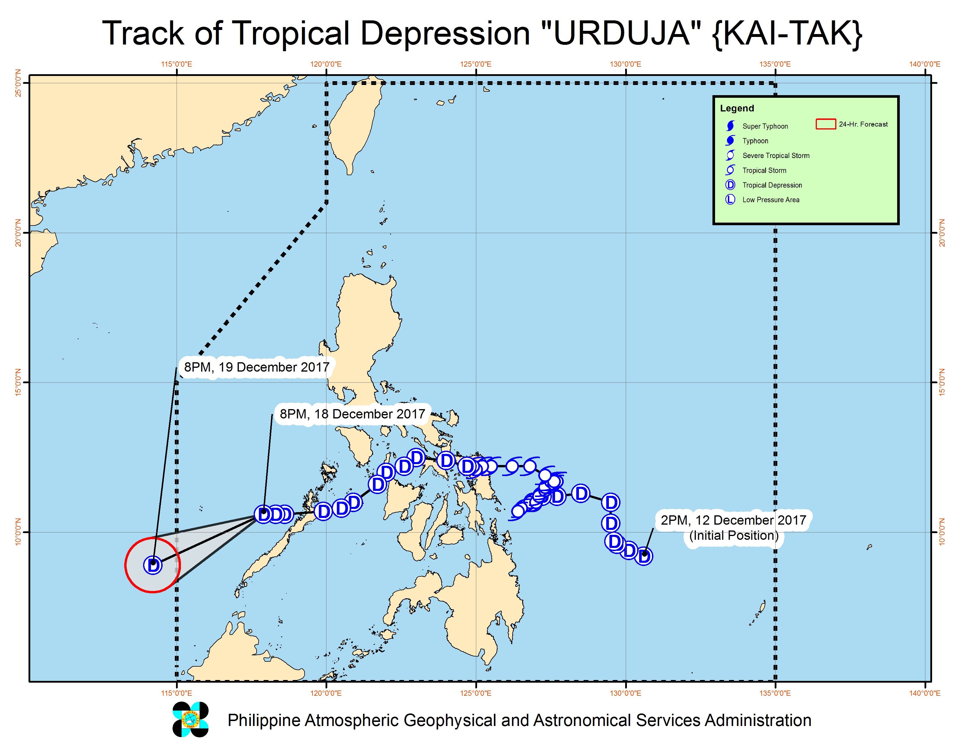
Urduja, which was earlier a tropical storm before weakening into a tropical depression, made landfall in the country 6 times:
- San Policarpo, Eastern Samar – 1:30 pm, Saturday, December 16
- Mobo, Masbate – 10 am, Sunday, December 17
- Sibuyan Island – 12 noon, Sunday, December 17
- Malay, Aklan – 6 pm, Sunday, December 17
- Cuyo Island, Palawan – 11 pm, Sunday, December 17
- Taytay, Palawan – 6 am, Monday, December 18
Malacañang said Urduja left at least 31 people dead and 49 others missing.
Most of the fatalities and missing persons are from the province of Biliran, where President Rodrigo Duterte and some Cabinet members visited on Monday. Duterte promised speedy assistance for areas affected by Urduja. (READ: DOE targets restoring power in Biliran before Christmas)
P37.6 million in food packs and non-food items have been readied for those affected. Around 356,000 food packs are on standby. (READ: #ReliefPH: Help victims of Urduja)
Based on its latest forecast track, Urduja will leave the Philippine Area of Responsibility (PAR) on Tuesday, December 19.
Low pressure area
Meanwhile, the low pressure area (LPA) outside PAR – which used to be a tropical depression – is now located 1,435 kilometers east of Mindanao.
PAGASA advised the public and local officials to continue monitoring updates on the LPA, since it could still redevelop into a tropical cyclone and enter PAR before Christmas.
“Kapag malayo pa ‘yung system, very unstable, very uncertain, kaya hindi pa tayo makapagbigay ng direktang sagot kung ano ang mangyayari,” said PAGASA forecaster Obet Badrina in a news briefing late Monday morning.
(When the system is still far, it’s very unstable, very uncertain, that’s why we can’t give a definite answer yet on what will happen.)
In the meantime, the tail-end of a cold front will bring light to heavy rain to Isabela, Aurora, and Quezon. Residents of these areas should watch out for possible flash floods.
The northeast monsoon is also affecting Metro Manila, Ilocos, Cordillera, the rest of Cagayan Valley, and the rest of Central Luzon, which will experience scattered rainshowers. Temperatures are also lower due to the surge of the northeast monsoon.
The rest of the country will only have isolated thunderstorms. – Rappler.com
Add a comment
How does this make you feel?
There are no comments yet. Add your comment to start the conversation.