SUMMARY
This is AI generated summarization, which may have errors. For context, always refer to the full article.
What’s the weather like in your area? Report the situation through Rappler’s Agos or tweet us at @rapplerdotcom.
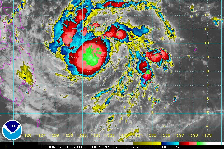
MANILA, Philippines – More areas were placed under signal number 1 as Tropical Depression Vinta slightly intensified on Wednesday evening, December 20, while moving over the Philippine Sea.
In a bulletin issued past 11 pm on Wednesday, state weather bureau PAGASA said Vinta is already 605 kilometers east of Hinatuan, Surigao del Sur, still moving west at 20 kilometers per hour (km/h).
The tropical depression now has maximum winds of 55 km/h from the previous 45 km/h and gustiness of up to 65 km/h from the previous 60 km/h. (READ: EXPLAINER: How tropical cyclones form)
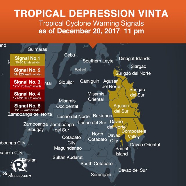
Signal number 1 is now raised in the following areas:
- Surigao del Norte
- Surigao del Sur
- Agusan del Norte
- Agusan del Sur
- Davao del Norte
- Compostela Valley
- northern Davao Oriental
PAGASA also warned that scattered to widespread rains are expected in Eastern Visayas, Caraga, and Davao within the next 24 hours. Residents of these areas should be on alert for possible flash floods and landslides. (READ: FAST FACTS: Tropical cyclones, rainfall advisories)
Eastern Visayas is still reeling from the damage wrought by Tropical Depression Urduja (Kai-tak), which battered the region as a tropical storm. National disaster management authorities said 41 people were killed and 45 others remain missing. Urduja had just left the Philippine Area of Responsibility (PAR) on Tuesday, December 19.
“Kung ikukumpara sa Bagyong Urduja mas mabilis ‘yung ine-expect natin na movement ng Bagyong Vinta pero magdadala pa rin siya ng mga pag-ulan…. Mas mabagal ang Urduja, ‘yun ‘yung nagdala ng maraming ulan [sa Eastern Visayas]…. Posibleng mas kaunti ‘yung dalin [ni Vinta na] pag-ulan but again, hindi iyon dahilan para maging kampante ‘yung mga kababayan natin,” said PAGASA forecaster Obet Badrina in a news briefing late Wednesday afternoon.
(If we compare it to Urduja, Vinta is moving faster but it will still bring heavy rain…. Urduja was slower so it lingered and dumped massive amounts of rainfall over Eastern Visayas. It’s possible Vinta will bring less rain but again, that’s not a reason for the public to be complacent.)
PAGASA also said sea travel is risky in the eastern seaboard of Mindanao, as waters will be moderate to rough.
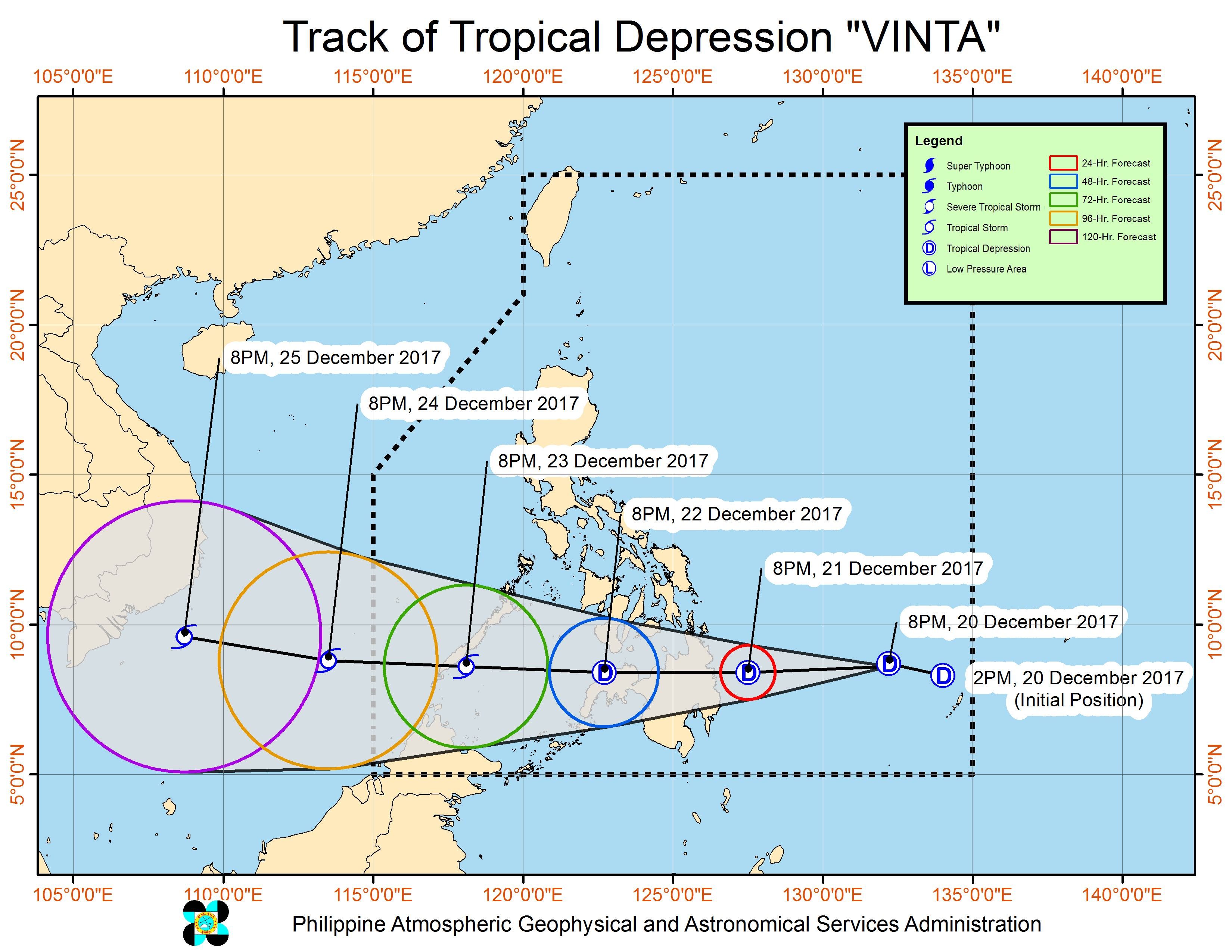
Based on its latest forecast track, Vinta could intensify into a tropical storm before it makes landfall in the Surigao del Sur-Davao Oriental area between Thursday evening, December 21 to Friday morning, December 22.
After landfall, Vinta is expected to cross Caraga, Northern Mindanao, the Zamboanga Peninsula, and southern Palawan.
It will then leave PAR on Christmas Eve, December 24.
Meanwhile, the tail-end of a cold front is affecting Bicol and Quezon including Polillo Island. Those areas should also watch out for possible flash floods and landslides, with light to heavy rain expected.
The northeast monsoon is also affecting Metro Manila, Ilocos, Cagayan Valley, Cordillera, Central Luzon, and the rest of Calabarzon, but PAGASA said there will be “no significant impact” from the scattered rainshowers.
The rest of Visayas as well as Mimaropa will only have isolated rainshowers or thunderstorms. – Rappler.com
Add a comment
How does this make you feel?
There are no comments yet. Add your comment to start the conversation.