SUMMARY
This is AI generated summarization, which may have errors. For context, always refer to the full article.

What’s the weather like in your area? Report the situation through Rappler’s Agos or tweet us at @rapplerdotcom.
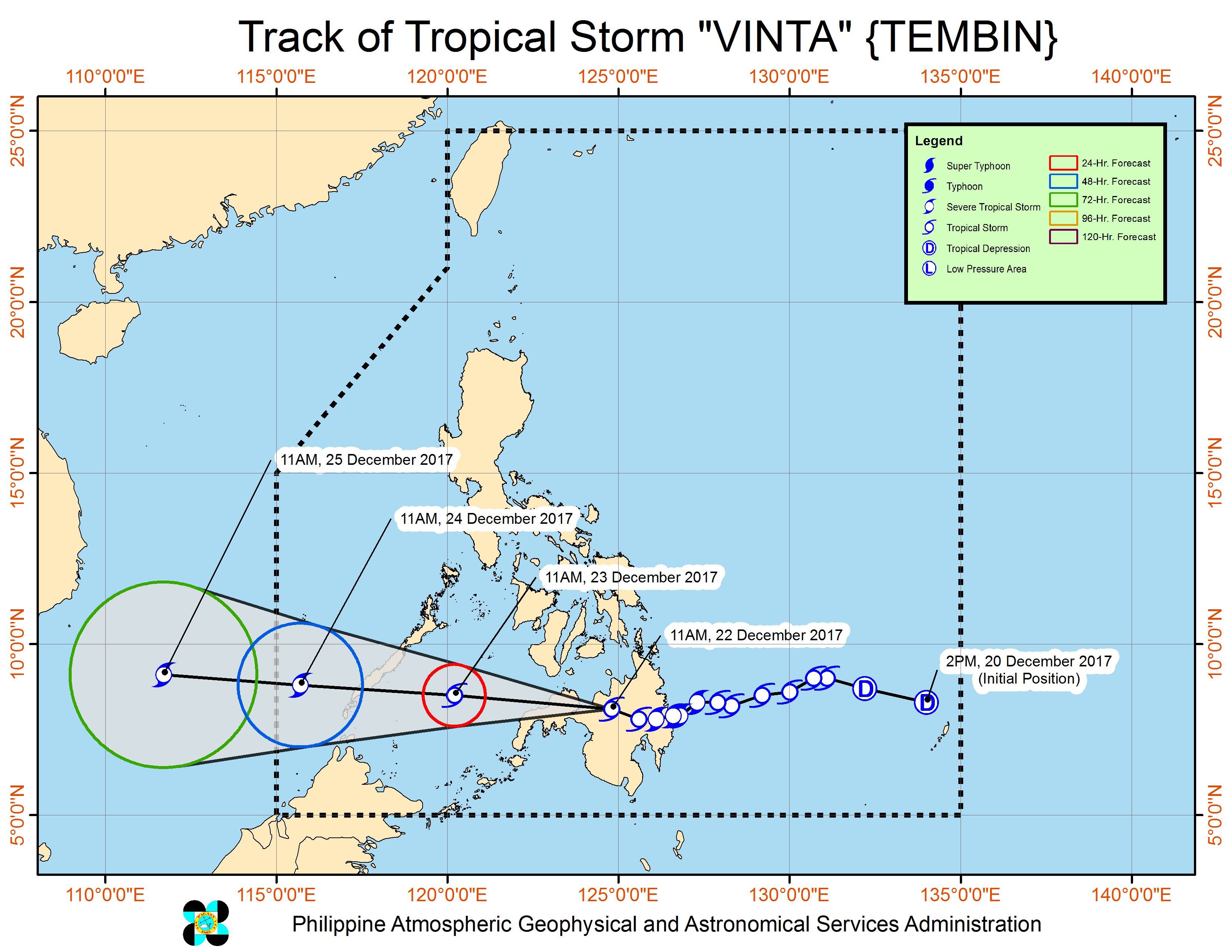
MANILA, Philippines – Tropical Storm Vinta (Tembin) further weakened early Friday afternoon, December 22, while in the vicinity of Marawi City, Lanao del Sur.
In a bulletin issued 2 pm on Friday, state weather bureau PAGASA said Vinta is moving west toward the Misamis Occidental-Zamboanga del Norte area at a slightly faster 20 kilometers per hour (km/h) from the previous 18 km/h.
It had made landfall in Cateel, Davao Oriental at 1:45 am on Friday. (READ: Nearly 16,000 evacuate as Vinta hits Davao Oriental)
Vinta now has maximum winds of 65 km/h from the previous 80 km/h and gustiness of up to 110 km/h from the previous 130 km/h. (READ: EXPLAINER: How tropical cyclones form)
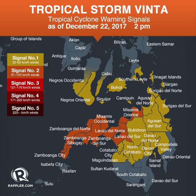
Fewer areas are under signal number 2:
- Misamis Oriental
- Misamis Occidental
- Lanao del Norte
- Lanao del Sur
- Zamboanga del Norte
- Zamboanga del Sur
- Zamboanga Sibugay
Signal number 1, meanwhile, is up over:
- Southern Leyte
- Bohol
- southern Cebu
- Negros Oriental
- southern Negros Occidental
- Siquijor
- Dinagat Islands
- Agusan del Sur
- Agusan del Norte
- Bukidnon
- Davao del Norte
- northern Davao del Sur (Davao City)
- North Cotabato
- Surigao del Norte
- Surigao del Sur
- Camiguin
- Compostela Valley
- Maguindanao
Though Vinta has weakened further, scattered to widespread rains will continue in the Visayas and Western Mindanao within the next 24 hours. Heavy flooding has already been reported in Lanao del Sur.
Sea travel is also risky in areas under signal numbers 1 and 2. Thousands of passengers have been stranded due to Vinta. (READ: FAST FACTS: Tropical cyclones, rainfall advisories)
The tropical storm is still expected to cross Northern Mindanao, the Zamboanga Peninsula, and southern Palawan.
It will then leave PAR on Christmas Eve, December 24.
Eastern Visayas is still reeling from the damage wrought by Tropical Depression Urduja (Kai-tak), which battered the region as a tropical storm. National disaster management authorities said 45 people were killed and 46 others remain missing. Urduja left the Philippine Area of Responsibility (PAR) last Tuesday, December 19.
Meanwhile, the northeast monsoon will bring scattered rain to Luzon, but PAGASA said there will be “no significant impact.” – Rappler.com
Add a comment
How does this make you feel?


There are no comments yet. Add your comment to start the conversation.