SUMMARY
This is AI generated summarization, which may have errors. For context, always refer to the full article.
What’s the weather like in your area? Report the situation through Rappler’s Agos or tweet us at @rapplerdotcom.
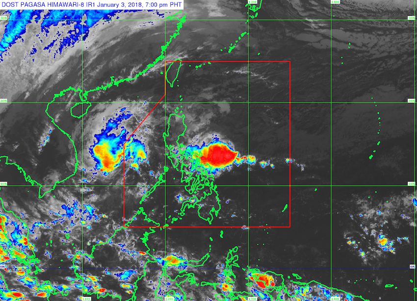
MANILA, Philippines – More rain is expected in parts of Luzon and the Visayas on Thursday, January 4, even after Tropical Storm Agaton (Bolaven) left the Philippine Area of Responsibility (PAR) on Wednesday afternoon, January 3.
In a bulletin issued 4 pm on Wednesday, state weather bureau PAGASA said the tail-end of a cold front is affecting the eastern part of Southern Luzon. In particular, it is bringing moderate to heavy rain to Bicol, Quezon, and Northern Samar, which should be on alert for flash floods and landslides.
A cold front forms when an advancing cold air mass displaces warmer air in its path, causing the displaced warm air to rise, which then leads to the formation of clouds and precipitation. (READ: FAST FACTS: Tropical cyclones, rainfall advisories)
Amid the heavy rain, Rappler is tracking class suspensions for Thursday here.
Flash floods and landslides are also possible in Mimaropa and the rest of Calabarzon, as the trough or extension of Agaton – even if it is already outside PAR – will trigger scattered rainshowers.
The northeast monsoon will also bring isolated rainshowers to the rest of Luzon, including Metro Manila, but PAGASA said there will be “no significant impact.”
Mindanao and the rest of the Visayas will only have localized thunderstorms, but these could still trigger flash floods or landslides if the downpour becomes heavy.
– Rappler.com
Add a comment
How does this make you feel?


There are no comments yet. Add your comment to start the conversation.