SUMMARY
This is AI generated summarization, which may have errors. For context, always refer to the full article.
What’s the weather like in your area? Report the situation through Rappler’s Agos or tweet us at @rapplerdotcom.
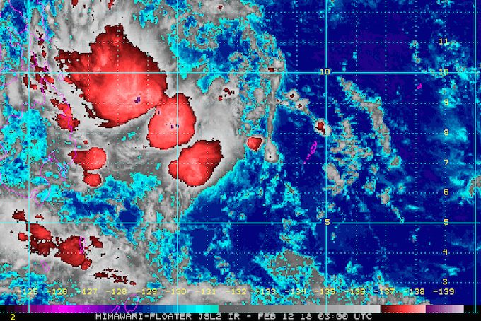
MANILA, Philippines – Tropical Storm Basyang (Sanba) slightly slowed down again late Monday morning, February 12, as more parts of the Visayas and Mindanao were placed under warning signals.
In a bulletin issued 11 am on Monday, state weather bureau PAGASA said Basyang is 620 kilometers east southeast of Hinatuan, Surigao del Sur, moving west northwest at 22 kilometers per hour (km/h) from the previous 25 km/h.
The tropical storm continues to have maximum winds of 65 km/h and gustiness of up to 80 km/h. In a news briefing on Monday, PAGASA said it is unlikely that Basyang would intensify further into a severe tropical storm.
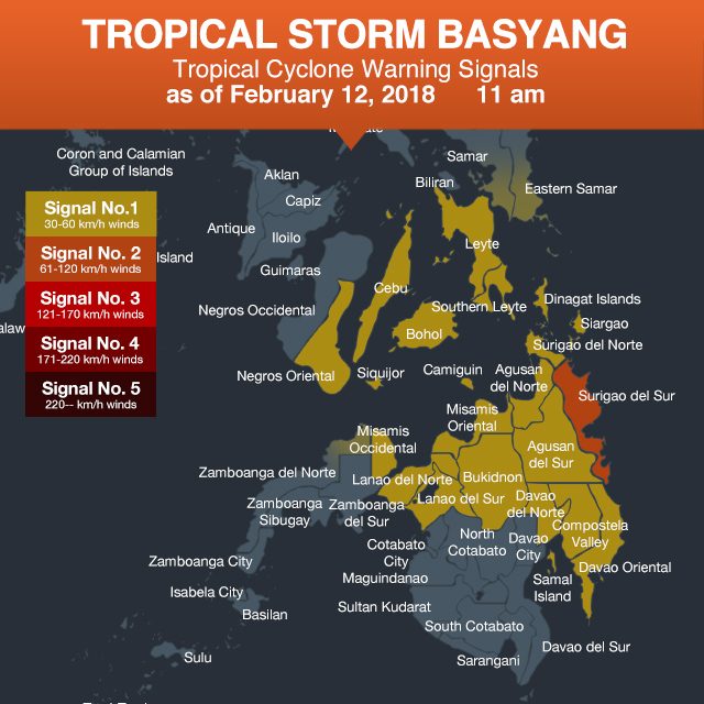
Signal number 2 remains raised in Surigao del Sur.
Even more areas were placed under signal number 1, including:
- southern part of Samar
- southern part of Eastern Samar
- Leyte
- Southern Leyte
- Bohol
- Cebu
- Negros Oriental
- Siquijor
- Dinagat Islands
- Surigao del Norte
- Agusan del Norte
- Agusan del Sur
- Camiguin
- Compostela Valley
- Davao Oriental
- Davao del Norte
- Misamis Oriental
- Misamis Occidental
- Lanao del Norte
- Lanao del Sur
- Bukidnon
- northern part of Zamboanga del Norte
PAGASA warned Eastern Visayas, Central Visayas, Caraga, Northern Mindanao, Davao, and the Zamboanga Peninsula to brace for moderate to heavy rain within 24 hours. Residents of these areas should watch out for possible flash floods and landslides.
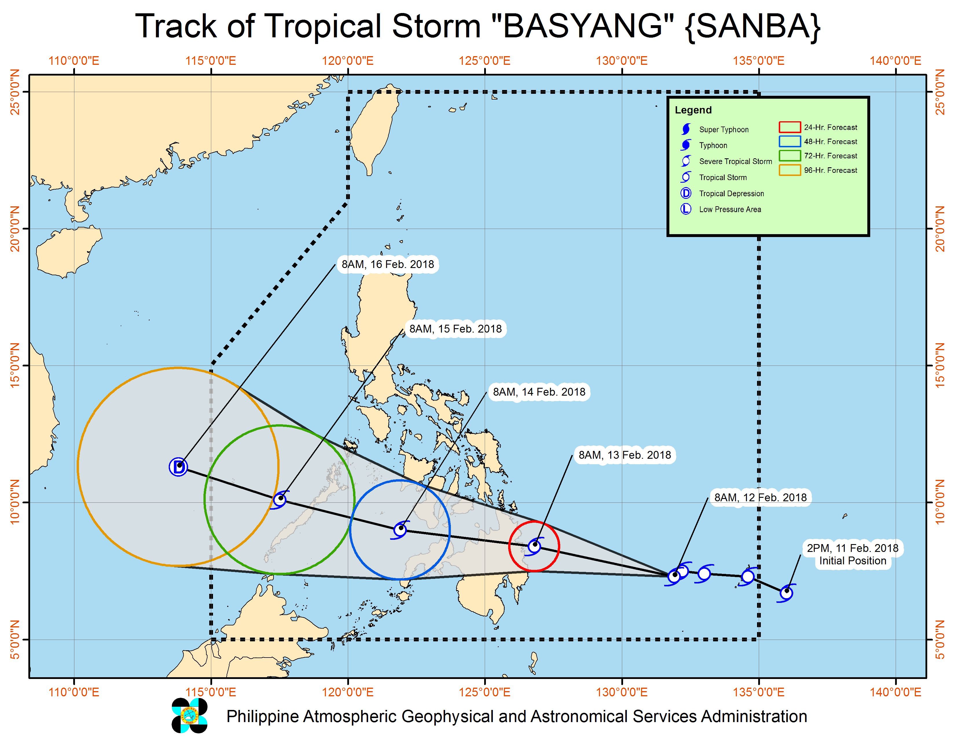
Basyang is expected to make landfall in Caraga on Tuesday morning, February 13. After hitting land, it will cross Caraga as well as Northern Mindanao and Palawan.
“Expected kasi na pagtama bukas (Tuesday), siguro around before noon, doon pa lang magsisimula ‘yung malalakas na ulan sa area, then within 24 hours after landfall, medyo delikado po ‘yung area ng Northern Mindanao as well as ‘yung Visayas, dahil po doon sa pagtahak niya… So ngayon pa lamang po sinasabihan na natin ‘yung mga kababayan natin sa area na sana mag-ingat, maghanda,” said PAGASA Assistant Weather Services chief Robert Sawi in the news briefing.
(We expect that when Basyang makes landfall around before noon tomorrow, that’s when heavy rain will begin in the area, then within 24 hours after landfall, the areas of Northern Mindanao and the Visayas would face risks as the tropical storm crosses… So as early as now we are telling our countrymen to be careful, to prepare.)
Based on its forecast track, Basyang will leave the Philippine Area of Responsibility (PAR) early Friday, February 16, by then likely downgraded to a tropical depression.
Sea travel is risky in areas under signal numbers 1 and 2, the seaboards of Northern Luzon, the eastern seaboards of Central Luzon and Southern Luzon, and Eastern Visayas due to Basyang and the surge of the northeast monsoon.
In a separate advisory issued on Sunday, February 11, the Philippine Coast Guard (PCG) said its districts and stations in the Visayas, Northern Mindanao, and Palawan are on alert for Basyang’s possible effects.
The PCG said all district commanders in the path of the tropical storm have been ordered to “ensure the readiness of all assets and personnel to respond during emergency situations.”
The PCG added that it is coordinating with the Philippine Ports Authority (PPA) to prepare facilities and supplies in case passengers get stranded.
Meanwhile, the northeast monsoon will continue to bring scattered rainshowers to the regions of Cagayan Valley, Cordillera, and Ilocos, as well as the provinces of Aurora and Quezon, but PAGASA said there will be “no significant impact.”
The rest of the country, including Metro Manila, will only have localized thunderstorms. (READ: FAST FACTS: Tropical cyclones, rainfall advisories)
– Rappler.com
Add a comment
How does this make you feel?
There are no comments yet. Add your comment to start the conversation.