SUMMARY
This is AI generated summarization, which may have errors. For context, always refer to the full article.
What’s the weather like in your area? Report the situation through Rappler’s Agos or tweet us at @rapplerdotcom.
MANILA, Philippines – State weather bureau PAGASA is monitoring a tropical depression set to enter the Philippine Area of Responsibility, a low pressure area that’s already inside PAR, and the southwest monsoon.
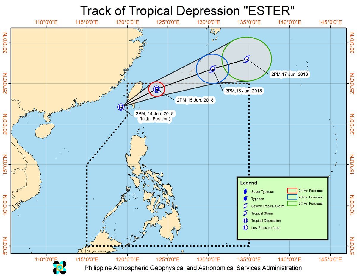
In a Facebook Live video shortly before 6 pm on Thursday, June 14, PAGASA weather specialist Obet Badrina said the tropical depression is expected to enter PAR between Thursday evening and Friday morning, June 15. It will be given the local name Ester, and will be the Philippines’ 5th tropical cyclone for 2018.
Right now, the tropical depression is located 335 kilometers west northwest of Basco, Batanes, moving east northeast towards PAR at 15 kilometers per hour (km/h). It has maximum winds of 55 km/h near the center and gustiness of up to 65 km/h.
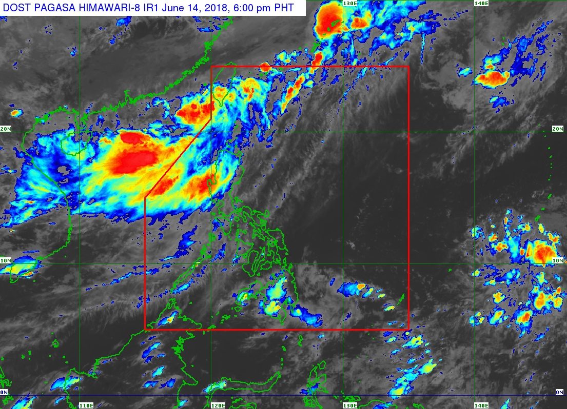
The tropical depression’s forecast track shows it is not expected to make landfall in the country. However, it will enhance the southwest monsoon, which would bring more rain until this weekend.
Though the tropical depression has yet to enter PAR, the province of Batanes has already been placed under signal number 1. This means it should expect moderate to heavy rain and winds of 30 to 60 km/h in at least 36 hours. (READ: FAST FACTS: Tropical cyclones, rainfall advisories)
The tropical depression will only stay briefly inside PAR. It will leave either Friday or Saturday, June 16.
There’s also an LPA located 440 kilometers east southeast of Hinatuan, Surigao del Sur. PAGASA said it only has a slim chance of developing into another tropical depression.
The southwest monsoon, meanwhile, will bring more moderate to heavy rain to Metro Manila, Ilocos, Cordillera Administrative Region, Babuyan Group of Islands, Tarlac, Pampanga, Bulacan, Cavite, Batangas, Bataan, and Zambales. Residents of these areas should be on alert for floods and landslides.
It will also trigger light to moderate rain in Mimaropa, the rest of Cagayan Valley, the rest of Central Luzon, and the rest of Calabarzon. There could be floods in low-lying areas.
Bicol, the Visayas, and Mindanao will only have isolated rainshowers or thunderstorms “with no significant impact.”
PAGASA added that a gale warning has been issued for Batanes, Calayan, Babuyan, Cagayan, Ilocos Norte, Ilocos Sur, Isabela, La Union, Pangasinan, Zambales, and Bataan. This means sea conditions will be rough to very rough, with wave heights reaching 2.8 meters to 4.5 meters.
“Fishing boats and other small seacraft are advised not to venture out into the sea while larger sea vessels are alerted against big waves,” said PAGASA.
The state weather bureau declared the start of the rainy season last June 8. – Rappler.com
Add a comment
How does this make you feel?


There are no comments yet. Add your comment to start the conversation.