SUMMARY
This is AI generated summarization, which may have errors. For context, always refer to the full article.
What’s the weather like in your area? Report the situation through Rappler’s Agos or tweet us at @rapplerdotcom.
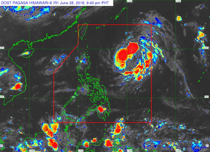
MANILA, Philippines – The low pressure area (LPA) inside the Philippine Area of Responsibility (PAR) could still develop into a tropical depression, though it is not expected to make landfall.
In a bulletin issued 4 pm on Thursday, June 28, state weather bureau PAGASA said the LPA is located 1,125 kilometers east of Aparri, Cagayan.
According to PAGASA weather specialist Aldczar Aurelio, the LPA may just approach the direction of southern Taiwan – which is within PAR – then eventually exit PAR by Sunday, July 1.
This means the LPA or potential tropical depression will not make landfall in the Philippines.
If the LPA becomes a tropical depression, it would be given the local name Florita. (READ: LIST: PAGASA’s names for tropical cyclones in 2018)
In the meantime, isolated rainshowers and thunderstorms will continue to affect the Philippines on Friday, June 29. The public should watch out for light to heavy rain which may trigger flash floods and landslides. (READ: FAST FACTS: Tropical cyclones, rainfall advisories)
PAGASA had declared the start of the rainy season last June 8. – Rappler.com
Add a comment
How does this make you feel?
There are no comments yet. Add your comment to start the conversation.