SUMMARY
This is AI generated summarization, which may have errors. For context, always refer to the full article.
What’s the weather like in your area? Report the situation through Rappler’s Agos or tweet us at @rapplerdotcom.
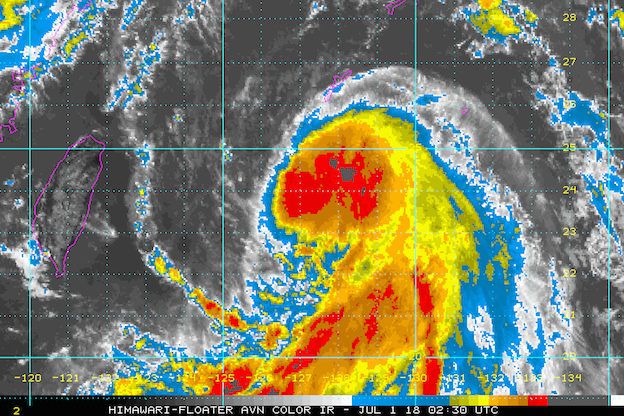
MANILA, Philippines – Tropical Storm Florita (Prapiroon) intensified into a severe tropical storm on Sunday morning, July 1, as it continued moving over the northern part of the Philippine Sea.
In a bulletin issued 11 am on Sunday, state weather bureau PAGASA said Florita now has maximum winds of 90 kilometers per hour (km/h) from the previous 85 km/h and gustiness of up to 115 km/h from the previous 105 km/h.
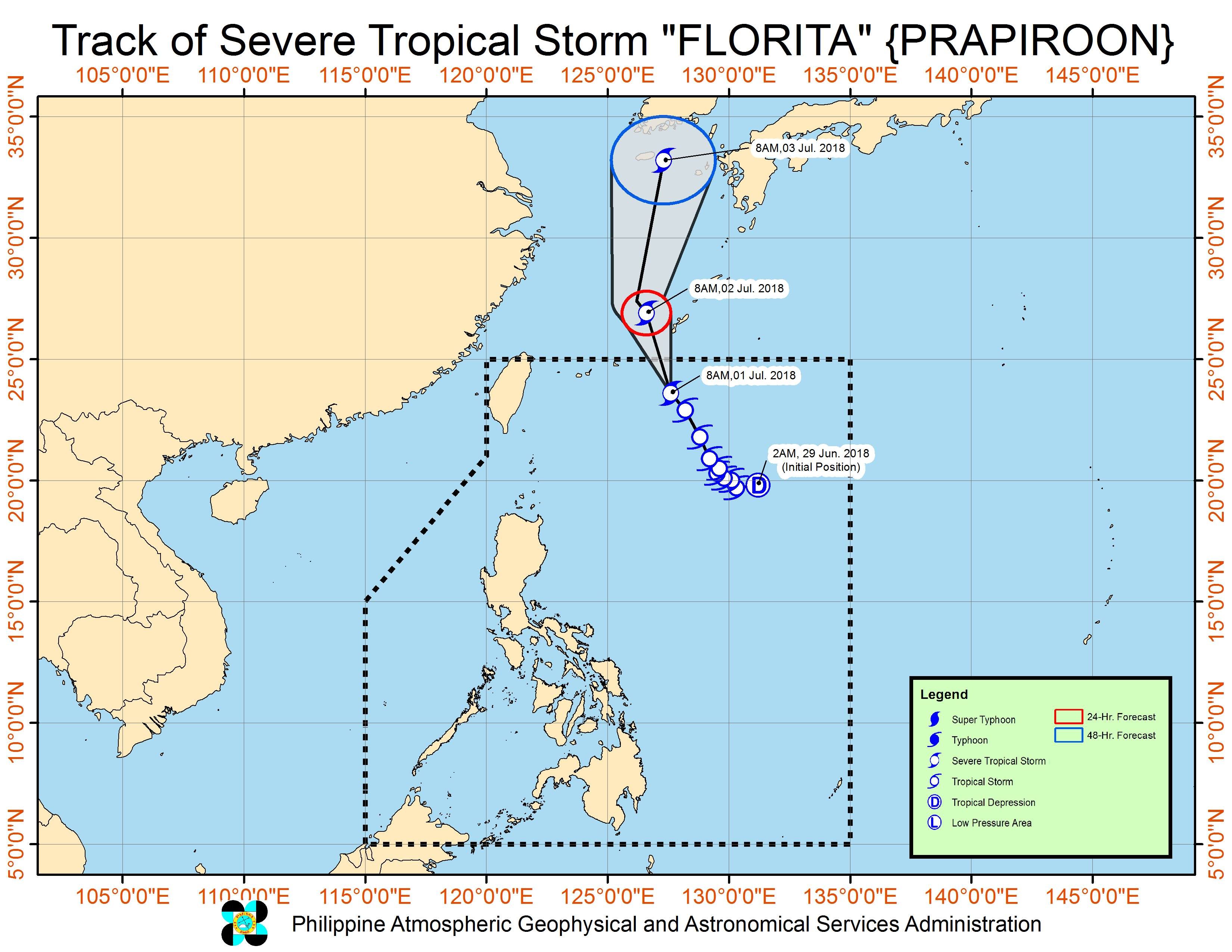
The severe tropical storm is located 695 kilometers northeast of Basco, Batanes, moving north northwest at 17 km/h.
Since its direction is upward, Florita will not make landfall in the Philippines. There are also no areas under tropical cyclone warning signals.
But the trough or elongated region of the severe tropical storm is enhancing the southwest monsoon. Scattered rainshowers and thunderstorms are expected in Luzon on Sunday.
Residents of Luzon, especially those in low-lying and mountainous areas, should watch out for possible flash floods and landslides. (READ: FAST FACTS: Tropical cyclones, rainfall advisories)
Based on its latest forecast track, Florita is expected to leave the Philippine Area of Responsibility (PAR) on Sunday.
Meanwhile, the Visayas and Mindanao, which are not affected by Florita and the enhanced southwest monsoon, will also have isolated rainshowers and thunderstorms. Flash floods and landslides are possible, too.
PAGASA had declared the start of the rainy season last June 8. – Rappler.com
Add a comment
How does this make you feel?
There are no comments yet. Add your comment to start the conversation.