SUMMARY
This is AI generated summarization, which may have errors. For context, always refer to the full article.
What’s the weather like in your area? Report the situation through Rappler’s Agos or tweet us at @rapplerdotcom.
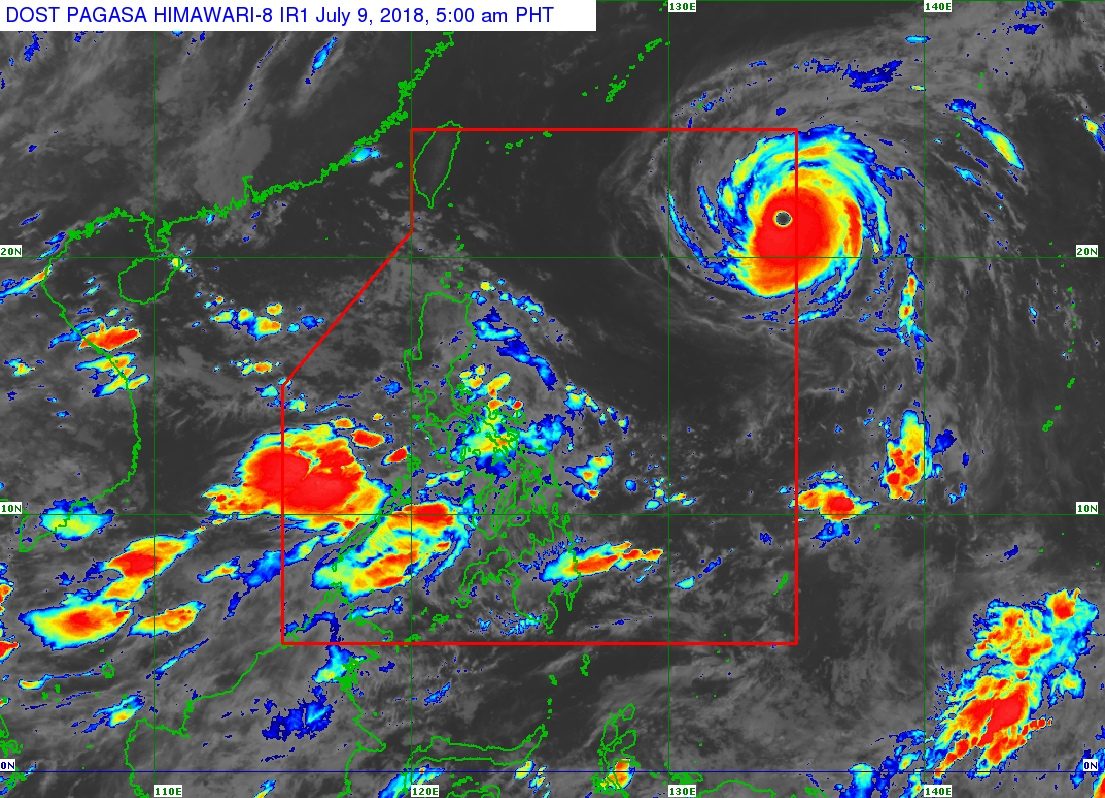
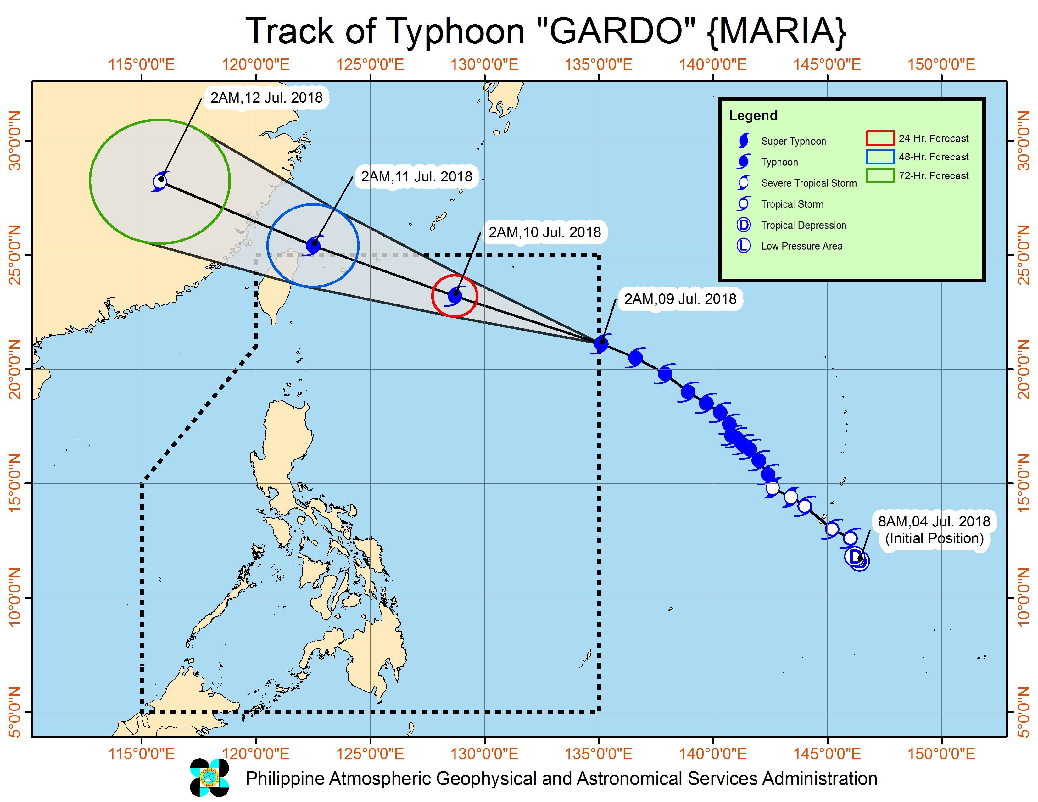
MANILA, Philippines – Typhoon Maria slightly strengthened and accelerated further as it entered the Philippine Area of Responsibility (PAR) before dawn on Monday, July 9. It’s been given the local name Gardo, becoming the country’s 7th tropical cyclone for 2018.
Typhoon Gardo is not expected to make landfall in the Philippines, but it will enhance the southwest monsoon or hanging habagat.
In a bulletin issued 5 am on Monday, state weather bureau PAGASA said Gardo is already 1,325 kilometers east of Basco, Batanes, moving west northwest at a faster 30 kilometers per hour (km/h) from the previous 23 km/h.
The typhoon now has maximum winds of 200 km/h from the previous 190 km/h and gustiness of up to 245 km/h from the previous 235 km/h.
Since Gardo is not expected to make landfall, tropical cyclone warning signals will not be raised in any area. The typhoon has no direct effect on the country.
But Gardo will enhance the southwest monsoon, which is affecting Luzon and the Visayas.
There will be monsoon rain in Mimaropa and Western Visayas, plus occasional rain in Metro Manila, Calabarzon, Bicol, Zambales, Bataan, and Aurora, from Monday until Tuesday, July 10.
Monsoon rain could also affect most of Luzon, especially its western part, on Wednesday, July 11.
Residents of those regions and provinces to be affected by the southwest monsoon, especially those in low-lying and in mountainous areas, should be on alert for possible flash floods and landslides. (READ: FAST FACTS: Tropical cyclones, rainfall advisories)
Due to the expected heavy rain on Monday, some areas in Luzon have suspended classes. (READ: #WalangPasok: Class suspensions, Monday, July 9)
The Philippine Coast Guard (PCG) also alerted its units in Bicol, Metro Manila, Central Luzon, Palawan, and Southern Tagalog to be on standby for any possible emergencies.
As of 7 am on Monday, no stranded passengers or vessels have been reported.
Based on its latest forecast track, Gardo will leave PAR early Wednesday morning, exiting just off Taiwan. Taiwan is still within PAR, an area set by the World Meteorological Organization (WMO) for PAGASA to monitor, as weather disturbances here directly or indirectly affect the Philippines.
PAGASA had declared the start of the rainy season last June 8. – Rappler.com
Add a comment
How does this make you feel?
There are no comments yet. Add your comment to start the conversation.