SUMMARY
This is AI generated summarization, which may have errors. For context, always refer to the full article.
What’s the weather like in your area? Report the situation through Rappler’s Agos or tweet us at @rapplerdotcom.
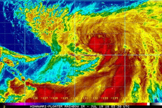
MANILA, Philippines – Tropical Storm Inday (Ampil) slightly intensified while moving over the Philippine Sea on Thursday morning, July 19.
In a bulletin released past 11 am on Thursday, state weather bureau PAGASA said Inday now has maximum winds of 75 kilometers per hour (km/h) from the previous 65 km/h and gustiness of up to 90 km/h from the previous 80 km/h.
The tropical storm is already 935 kilometers east of Basco, Batanes, moving east northeast at a much faster 20 km/h after hardly moving before dawn on Thursday.
Inday is not expected to make landfall in the Philippines, and there are no areas under tropical cyclone warning signals. It will, however, continue enhancing the southwest monsoon.
Moderate to heavy monsoon rain is being experienced in the Ilocos Region, the Cordillera Administrative Region, Zambales, and Bataan intermittently, or at irregular intervals.
Scattered rainshowers, ranging from light to heavy, are also expected in the rest of Luzon until Saturday, July 21.
Residents of Luzon, especially those in low-lying or in mountainous areas, should remain on alert for possible flash floods and landslides. (READ: FAST FACTS: Tropical cyclones, rainfall advisories)
Some areas in Luzon suspended classes for Thursday. There were no more class suspensions in Metro Manila as the weather in the capital region has improved compared to the previous days. (READ: #WalangPasok: Class suspensions, Thursday, July 19)
PAGASA also warned that sea travel remains risky in the eastern seaboard of Northern Luzon and in the seaboards of Central Luzon, as the southwest monsoon combined with Inday will trigger rough to very rough seas.
Based on its latest forecast track, Inday is expected to leave the Philippine Area of Responsibility (PAR) on Saturday morning.
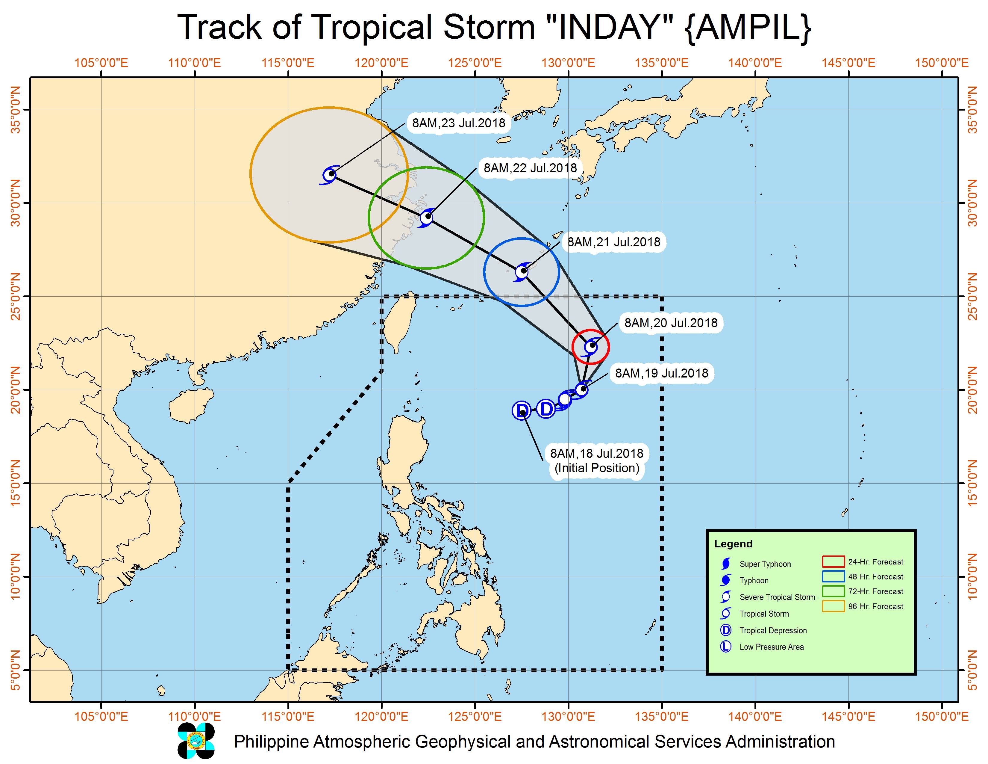
Inday is the Philippines’ 9th tropical cyclone for 2018. The country usually gets an average of 20 tropical cyclones per year. (READ: LIST: PAGASA’s names for tropical cyclones in 2018)
PAGASA declared the start of the rainy season last June 8. – Rappler.com
Add a comment
How does this make you feel?
There are no comments yet. Add your comment to start the conversation.