SUMMARY
This is AI generated summarization, which may have errors. For context, always refer to the full article.
What’s the weather like in your area? Report the situation through Rappler’s Agos or tweet us at @rapplerdotcom.
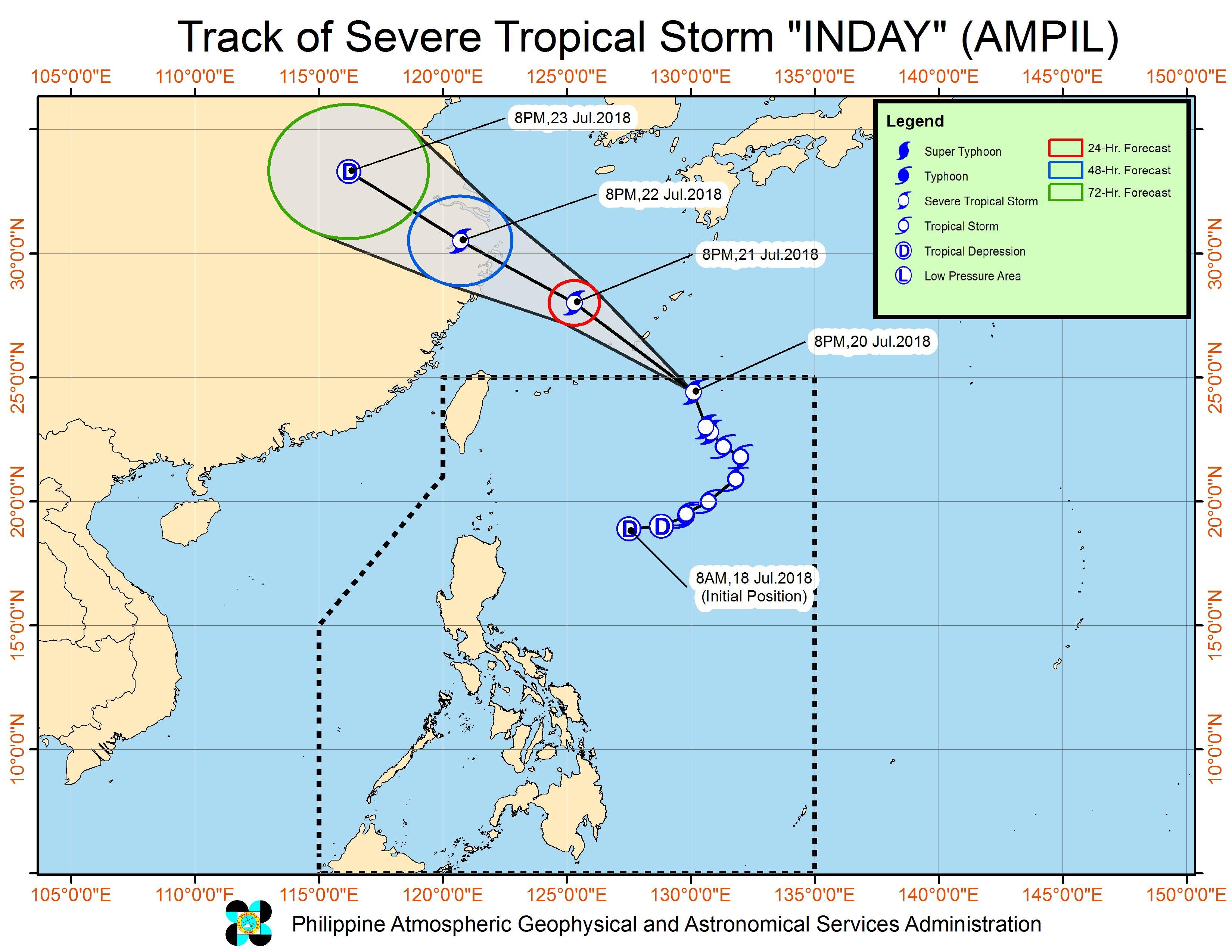
MANILA, Philippines – Severe Tropical Storm Inday (Ampil) accelerated and maintained its strength as it prepared to exit the Philippine Area of Responsibility (PAR) on Friday evening, July 20. While Inday is leaving, however, there is a low pressure area (LPA) that is expected to enter PAR this weekend.
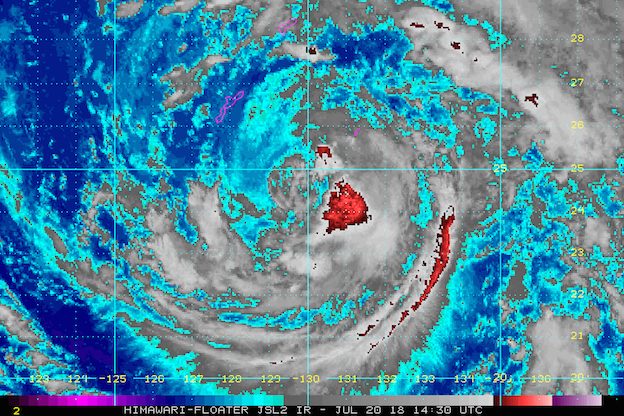
In a bulletin issued 11 pm on Friday, state weather bureau PAGASA said Inday is already 925 kilometers east northeast of Basco, Batanes, moving north northwest at a faster 25 kilometers per hour (km/h) after its slow pace in the afternoon.
The severe tropical storm continues to have maximum winds of 90 km/h and gustiness of up to 115 km/h.
Inday did not hit land in the Philippines and there were no areas placed under tropical cyclone warning signals. But the severe tropical storm has been enhancing the southwest monsoon or hanging habagat.
Also enhancing the southwest monsoon – the LPA that’s still outside PAR, located 380 kilometers west of Laoag City, Ilocos Norte. If the LPA enters PAR and then becomes a tropical depression, it will be given the local name Josie. (READ: LIST: PAGASA’s names for tropical cyclones in 2018)
Until Saturday, July 21, the southwest monsoon enhanced by Inday and the LPA will trigger moderate to heavy rain in the Ilocos Region, the Cordillera Administrative Region, Zambales, Bataan, Pampanga, Bulacan, Tarlac, and Nueva Ecija. The frequency will still be intermittent or at irregular intervals.
There will also be occasional rainshowers in the rest of Luzon, ranging from light to heavy, due to the southwest monsoon.
Residents of Luzon, especially those in low-lying or in mountainous areas, should stay on alert for possible flash floods and landslides. Floods already hit various areas in the past few days. (READ: FAST FACTS: Tropical cyclones, rainfall advisories)
The Visayas and Mindanao, which are not affected by the southwest monsoon, will only have isolated rainshowers or thunderstorms. But PAGASA advised residents of these island regions to still watch out for possible flash floods and landslides, in case thunderstorms dump heavy rain.
PAGASA also warned that sea travel remains risky in the western seaboards of Northern Luzon and Central Luzon due to the southwest monsoon.
Inday is the Philippines’ 9th tropical cyclone for 2018, and the potential Josie would be the 10th. The country usually gets an average of 20 tropical cyclones per year.
PAGASA declared the start of the rainy season last June 8. – Rappler.com
Add a comment
How does this make you feel?
There are no comments yet. Add your comment to start the conversation.