SUMMARY
This is AI generated summarization, which may have errors. For context, always refer to the full article.
What’s the weather like in your area? Report the situation through Rappler’s Agos or tweet us at @rapplerdotcom.
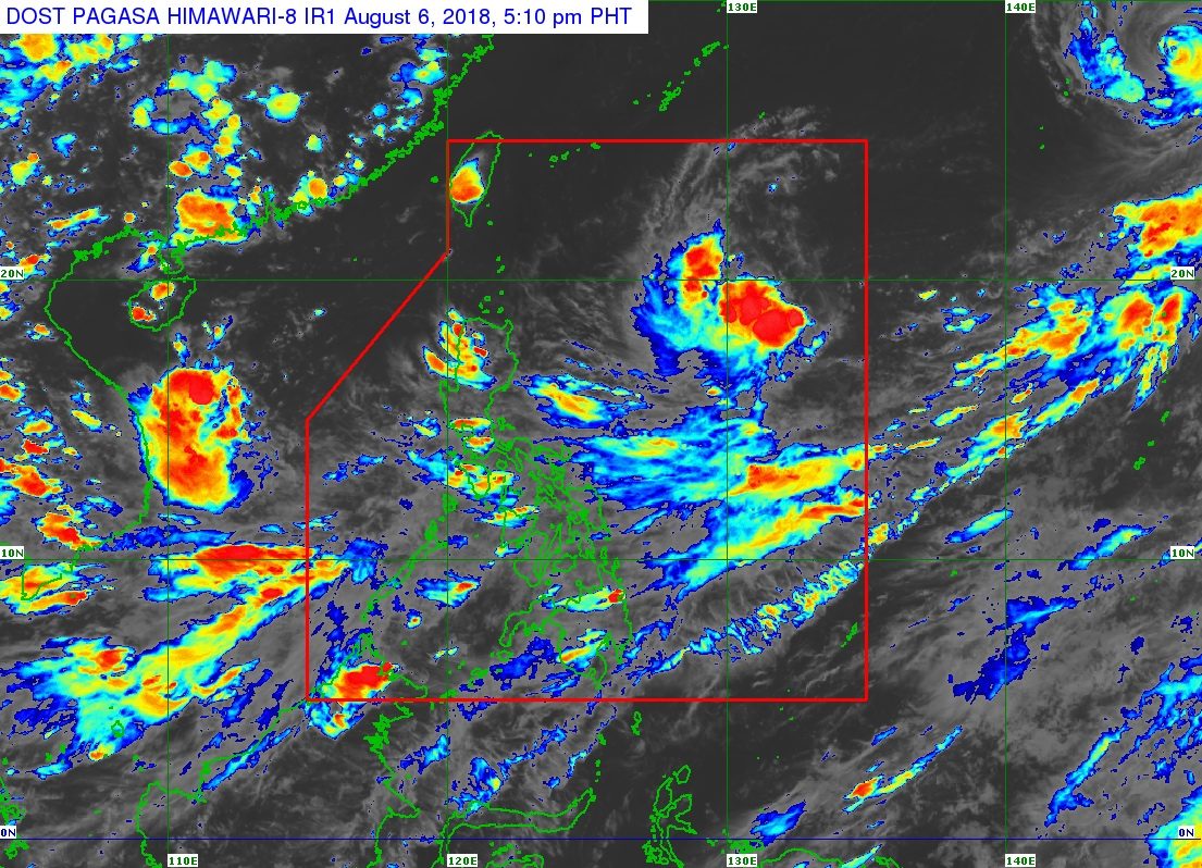
MANILA, Philippines – There are still two low pressure areas (LPAs) being monitored inside the Philippine Area of Responsibility (PAR), and a typhoon that’s outside.
In a Facebook Live video past 5 pm on Monday, August 6, the Philippine Atmospheric, Geophysical, and Astronomical Services Administration (PAGASA) said the first LPA is located 1,285 kilometers east of Aparri, Cagayan.
This LPA now has a big chance of developing into a tropical depression within the next 12 to 24 hours. If it does, it would be given the local name Karding. (READ: LIST: PAGASA’s names for tropical cyclones in 2018)
But PAGASA Weather Specialist Ariel Rojas said the LPA appears to be veering away from land.
The second LPA, meanwhile, is located 545 kilometers west of Subic, Zambales. It is expected to stay an LPA within the next few days, then possibly develop into a tropical depression, too.
As for the typhoon, it has the international name Shanshan. It is still very far from PAR, located 2,560 kilometers east northeast of extreme Northern Luzon and moving north northwest at 20 kilometers per hour (km/h).
Typhoon Shanshan has maximum winds of 130 km/h and gustiness of up to 160 km/h. It has no direct effect on the country at the moment.
But PAGASA said the 3 weather systems are enhancing the southwest monsoon, which is affecting Southern Luzon, the Visayas, and Mindanao.
Scattered rainshowers and thunderstorms are expected in Zambales, Bataan, Cavite, Batangas, Mimaropa, Western Visayas, the Zamboanga Peninsula, and the Autonomous Region in Muslim Mindanao until Tuesday, August 7.
Isolated rains will also hit Metro Manila, Bicol, the rest of Calabarzon, the rest of Central Luzon, the rest of the Visayas, and the rest of Mindanao.
Residents of areas affected by the southwest monsoon should be on alert for possible flash floods and landslides, in case the rains become moderate or heavy. (READ: FAST FACTS: Tropical cyclones, rainfall advisories)
The rest of Luzon, meanwhile, will only have localized thunderstorms.
PAGASA earlier said 2 to 3 tropical cyclones could enter or develop within PAR in August.
The Philippines has had 10 tropical cyclones in 2018, so far. The country usually gets an average of 20 tropical cyclones per year.
PAGASA declared the start of the rainy season last June 8. – Rappler.com
Add a comment
How does this make you feel?
There are no comments yet. Add your comment to start the conversation.