SUMMARY
This is AI generated summarization, which may have errors. For context, always refer to the full article.
What’s the weather like in your area? Report the situation through Rappler’s Agos or tweet us at @rapplerdotcom.
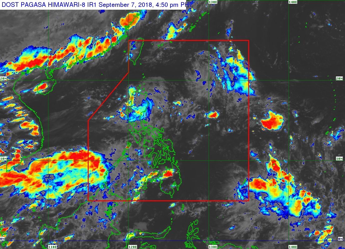
MANILA, Philippines – A low pressure (LPA) and the southwest monsoon or hanging habagat will continue to bring rain to parts of Luzon and Western Visayas until Saturday, September 8.
In a bulletin issued 4 pm on Friday, September 7, the Philippine Atmospheric, Geophysical, and Astronomical Services Administration (PAGASA) said the LPA is already in the vicinity of Rosales, Pangasinan.
This LPA, which is also enhancing the southwest monsoon, will bring scattered rains and thunderstorms to the Ilocos Region, the Cordillera Administrative Region, Cagayan Valley, and Central Luzon.
In a Facebook Live video past 5 pm on Friday, PAGASA Weather Specialist Gener Quitlong said the LPA is expected to cross Northern Luzon and then exit landmass possibly via Tuguegarao City, Cagayan, on Saturday.
Then it would be over the Balintang Channel or near the Batanes area on Sunday, September 9, and then between Batanes and Taiwan on Monday, September 10.
It has a chance of intensifying into a tropical depression on Monday. If it does, it would be named Neneng.
The LPA or potential Neneng might then leave the Philippine Area of Responsibility (PAR) on Tuesday, September 11.
Meanwhile, the enhanced southwest monsoon is expected to bring more rain to Palawan, Oriental Mindoro, Occidental Mindoro, and Western Visayas on Saturday.
Residents of areas affected by the LPA and the southwest monsoon should watch out for flash floods and landslides. (READ: FAST FACTS: Tropical cyclones, rainfall advisories)
The rest of the country will only have localized thunderstorms on Saturday. But flash floods and landslides are also possible if the thunderstorms become severe.
The other LPA that PAGASA was monitoring on Thursday, September 6, already left PAR around noontime on Friday and no longer has any effect on the country.
PAGASA is also monitoring another LPA, which is located outside PAR, over the Pacific Ocean.
Quitlong said this LPA could intensify into a tropical depression and approach the PAR boundary possibly on Wednesday, September 12. If it enters PAR, it would be named Ompong – assuming the LPA already inside PAR would become Neneng.
So far, the Philippines has had 13 tropical cyclones in 2018. The country usually gets an average of 20 tropical cyclones per year. (READ: LIST: PAGASA’s names for tropical cyclones in 2018)
PAGASA declared the start of the rainy season last June 8. – Rappler.com
Add a comment
How does this make you feel?
There are no comments yet. Add your comment to start the conversation.