SUMMARY
This is AI generated summarization, which may have errors. For context, always refer to the full article.
What’s the weather like in your area? Report the situation through Rappler’s Agos or tweet us at @rapplerdotcom.
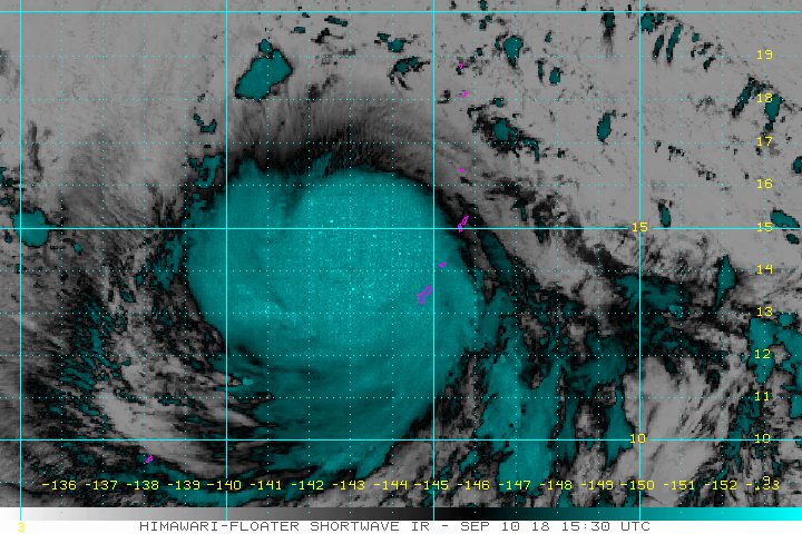
MANILA, Philippines – Typhoon Mangkhut, located outside the Philippine Area of Responsibility (PAR), strengthened further and slowed down on Monday evening, September 10.
In a Facebook Live video past 11 pm on Monday, the Philippine Atmospheric, Geophysical, and Astronomical Services Administration (PAGASA) said Mangkhut now has maximum winds of 160 kilometers per hour (km/h) from the previous 150 km/h and gustiness of up to 195 km/h from the previous 185 km/h.
The typhoon is located 2,160 kilometers east of southern Luzon, moving west at a slower 25 km/h from the previous 35 km/h.
Since it remains over water, it might still strengthen into a super typhoon, the strongest tropical cyclone category. (READ: FAST FACTS: Tropical cyclones, rainfall advisories)
Mangkhut could enter PAR on Wednesday, September 12. If it does, it would be given the local name Ompong. (READ: LIST: PAGASA’s names for tropical cyclones in 2018)
Signal No. 1 could be raised in parts of Cagayan Valley as early as Thursday, September 13.
The typhoon might then cross the Cagayan-Batanes area around Saturday, September 15.
PAGASA warned that heavy rain and strong winds are possible in Cagayan, Isabela, Apayao, Kalinga, Abra, Ilocos Norte, and Batanes. Seas in these areas would be rough to very rough as well.
The state weather bureau on Monday afternoon advised residents of Northern Luzon and Central Luzon to already prepare for Mangkhut or the potential Ompong.
PAGASA is also monitoring Tropical Depression Neneng, which is bringing rain to Northern Luzon. Read the forecast on Neneng as of Monday evening here.
PAGASA declared the start of the rainy season last June 8. – Rappler.com
Add a comment
How does this make you feel?
There are no comments yet. Add your comment to start the conversation.