SUMMARY
This is AI generated summarization, which may have errors. For context, always refer to the full article.
What’s the weather like in your area? Report the situation through Rappler’s Agos or tweet us at @rapplerdotcom.
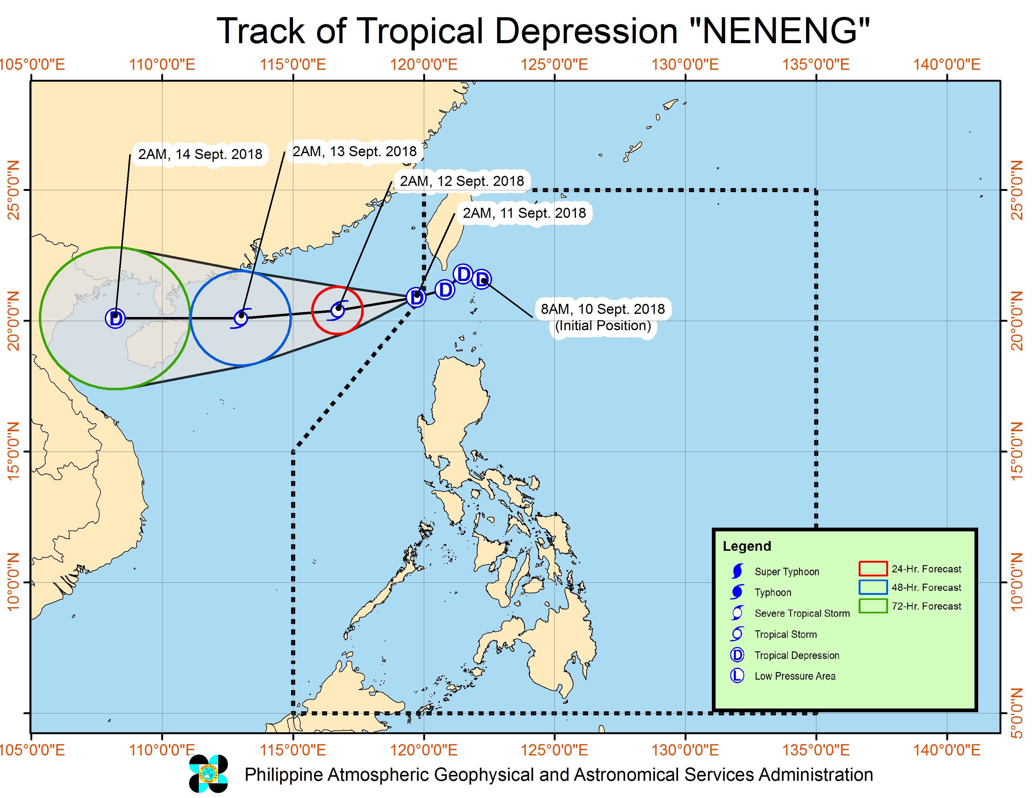
MANILA, Philippines – Tropical Depression Neneng left the Philippine Area of Responsibility (PAR) before dawn on Tuesday, September 11.
In a bulletin issued 5 am on Tuesday, the Philippine Atmospheric, Geophysical, and Astronomical Services Administration (PAGASA) said Neneng is already 295 kilometers west of Basco, Batanes, moving west southwest at a slightly faster 20 kilometers per hour (km/h) from the previous 15 km/h.
The tropical depression slightly intensified as it left PAR. It now has maximum winds of 60 km/h from the previous 55 km/h and gustiness of up to 75 km/h from the previous 65 km/h.
Signal No. 1 has been lifted in Batanes, where Neneng brought occasional rains with gusty winds.
But the trough or extension of the tropical depression will continue to trigger scattered rains, ranging from light to heavy, in Ilocos Norte, Ilocos Sur, the Cordillera Administrative Region, and Cagayan Valley.
Those areas must remain on alert for possible flash floods and landslides. (READ: FAST FACTS: Tropical cyclones, rainfall advisories)
Neneng was the Philippines’ 14th tropical cyclone for 2018. The country usually gets an average of 20 tropical cyclones per year. (READ: LIST: PAGASA’s names for tropical cyclones in 2018)
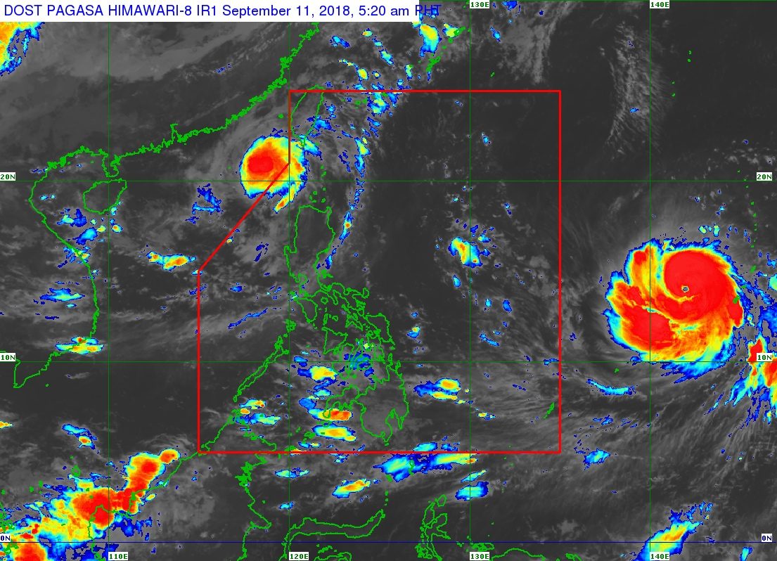
Meanwhile, PAGASA continues to monitor Typhoon Mangkhut outside PAR.
Mangkhut is already 1,820 kilometers east of Southern Luzon, moving west at a slightly faster 30 km/h from the previous 25 km/h.
It maintained its strength, with maximum winds of 160 km/h and gustiness of up to 195 km/h.
Since it remains over water, it might still strengthen into a super typhoon, the strongest tropical cyclone category. (READ: FAST FACTS: Tropical cyclones, rainfall advisories)
Mangkhut could enter PAR on Wednesday, September 12. If it does, it would be given the local name Ompong. (READ: LIST: PAGASA’s names for tropical cyclones in 2018)
Signal No. 1 could be raised in parts of Cagayan Valley as early as Thursday, September 13.
The typhoon might then cross the Cagayan-Batanes area around Saturday, September 15.
PAGASA warned that heavy rain and strong winds are possible in Cagayan, Isabela, Apayao, Kalinga, Abra, Ilocos Norte, and Batanes. Seas in these areas would be rough to very rough as well.
The state weather bureau on Monday afternoon, September 10, advised residents of Northern Luzon and Central Luzon to already prepare for Mangkhut or the potential Ompong.
PAGASA declared the start of the rainy season last June 8. – Rappler.com
Add a comment
How does this make you feel?
There are no comments yet. Add your comment to start the conversation.