SUMMARY
This is AI generated summarization, which may have errors. For context, always refer to the full article.
What’s the weather like in your area? Report the situation through Rappler’s Agos or tweet us at @rapplerdotcom.
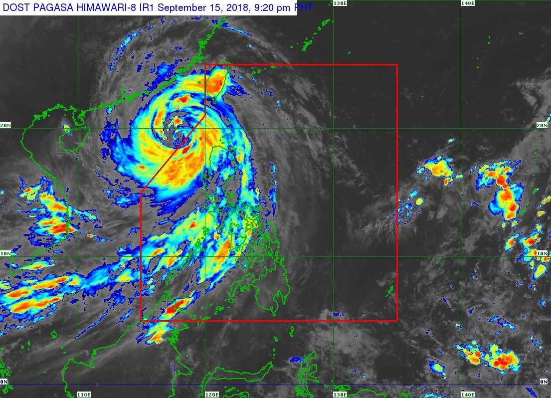
MANILA, Philippines – Typhoon Ompong (Mangkhut) left the Philippine Area of Responsibility (PAR) at 9 pm on Saturday, September 15, but it continues to enhance the southwest monsoon or hanging habagat.
In a tweet at 9:34 pm, the Philippine Atmospheric, Geophysical, and Astronomical Services Administration (PAGASA) said Ompong is already 355 kilometers west of Calayan, Cagayan, outside PAR. It later said in an 11 pm bulletin that the typhoon is moving west northwest at 25 kilometers per hour (km/h),
The typhoon is now heading for the southern part of China after leaving at least 7 people dead in the Philippines. (LOOK: 5 dead in Baguio City due to Typhoon Ompong flood)
It slightly weakened as it left PAR, and now has maximum winds of 145 km/h from the previous 160 km/h and gustiness of up to 180 km/h from the previous 195 km/h.
Though Ompong is already outside, however, tropical cyclone warning signals remain raised in some areas affected by the typhoon’s outer rainbands.
Signal No. 2:
- Ilocos Norte
- Ilocos Sur
- La Union
- Batanes
Signal No. 1:
- Bataan
- Cagayan including the Babuyan Group of Islands
- Abra
- Apayao
- Kalinga
- Mountain Province
- Ifugao
- Benguet
- Pangasinan
- Zambales
PAGASA also earlier warned that the typhoon would continue to enhance the southwest monsoon even after its exit from PAR, since it has a wide diameter. (READ: COMPARISON: Typhoon Ompong and previous Philippine typhoons)
The enhanced southwest monsoon will trigger gusty winds and light to heavy rain in Western Visayas and Mimaropa. Residents of areas affected by the southwest monsoon should stay on alert for flash floods and landslides. (READ: FAST FACTS: Tropical cyclones, rainfall advisories)
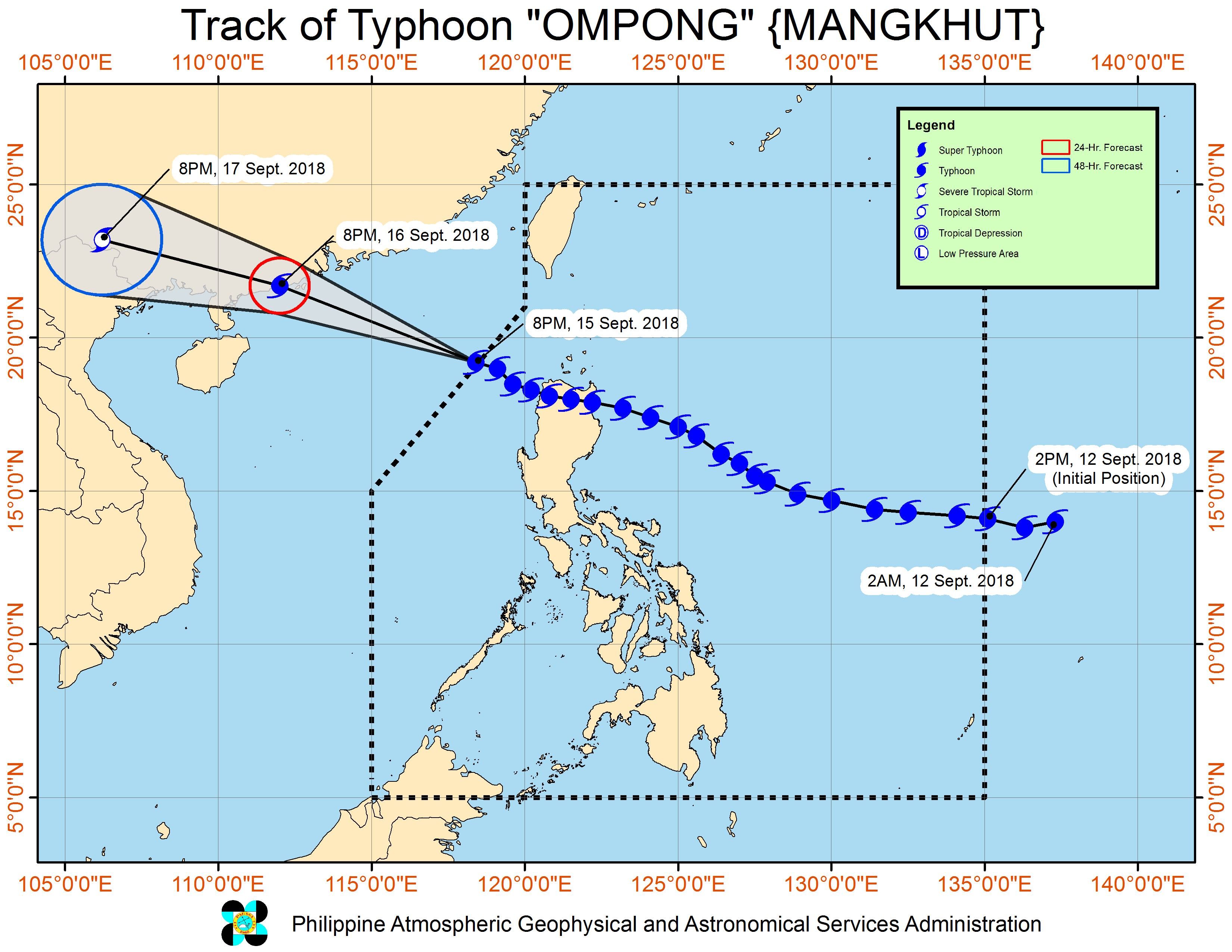
Ompong had made landfall in Baggao, Cagayan at 1:40 am on Saturday. The typhoon swept away the roof of the Cagayan provincial capitol and damaged the Tuguegarao Airport. (READ: 126,700 Filipinos affected hours after Ompong landfall)
Ompong was the Philippines’ 15th tropical cyclone for 2018. The country usually gets an average of 20 tropical cyclones per year. (READ: LIST: PAGASA’s names for tropical cyclones in 2018)
PAGASA declared the start of the rainy season last June 8. – Rappler.com
News you can use during Typhoon Ompong (Mangkhut):
- Weather updates and storm signals
- Reports on evacuation, emergencies, and rescue and relief efforts
- Typhoon Ompong: Free parking at SM, Ayala, Robinsons, Megaworld malls
- #WalangPasok: Class suspensions for September 13, 14, 15
- Canceled flights due to Typhoon Ompong
- Will Typhoon Ompong be the same as Super Typhoon Lawin?
- COMPARISON: Typhoon Ompong and previous Philippine typhoons
- What gov’t has done so far to prepare for Typhoon Ompong
- Fact-check on viral stories related to Typhoon Ompong
- DFA giving P5,000 aid for OFWs stranded due to Typhoon Ompong
- 3 dams release water due to Typhoon Ompong
- Power lines affected by Typhoon Ompong
- Roads closed due to Typhoon Ompong
- Telco problems in Typhoon Ompong areas
- #ReliefPH: Help victims of Typhoon Ompong
Add a comment
How does this make you feel?
There are no comments yet. Add your comment to start the conversation.