SUMMARY
This is AI generated summarization, which may have errors. For context, always refer to the full article.
What’s the weather like in your area? Report the situation through Rappler’s Agos or tweet us at @rapplerdotcom.
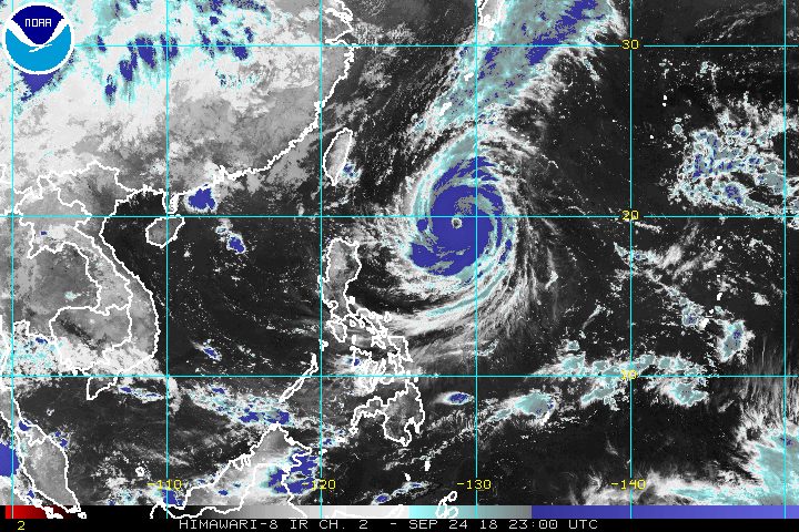
MANILA, Philippines – Typhoon Paeng (Trami) strengthened further and slowed down again before dawn on Tuesday, September 25, with its trough or extension expected to affect parts of the country.
In a Facebook Live video at 5 am on Tuesday, the Philippine Atmospheric, Geophysical, and Astronomical Services Administration (PAGASA) said Paeng now has maximum winds of 200 kilometers per hour (km/h) from the previous 185 km/h and gustiness of up to 240 km/h from the previous 225 km/h.
The typhoon is already 740 kilometers east of Basco, Batanes. It is moving west northwest at a slower 10 km/h from the previous 15 km/h.
There are no areas under tropical cyclone warning signals, but Paeng’s trough will trigger light to heavy rain in Western Visayas, the Zamboanga Peninsula, Autonomous Region in Muslim Mindanao, and Soccsksargen. Flash floods and landslides are possible.
The rest of the country will only have localized thunderstorms on Tuesday, unrelated to the typhoon. But flash floods and landslides are also possible if the thunderstorms bring heavy rain.
PAGASA added that Paeng may bring light to moderate rain to Northern Luzon on Friday, September 28. (READ: FAST FACTS: Tropical cyclones, rainfall advisories)
Sea travel is also risky in the northern and eastern seaboards of Luzon.
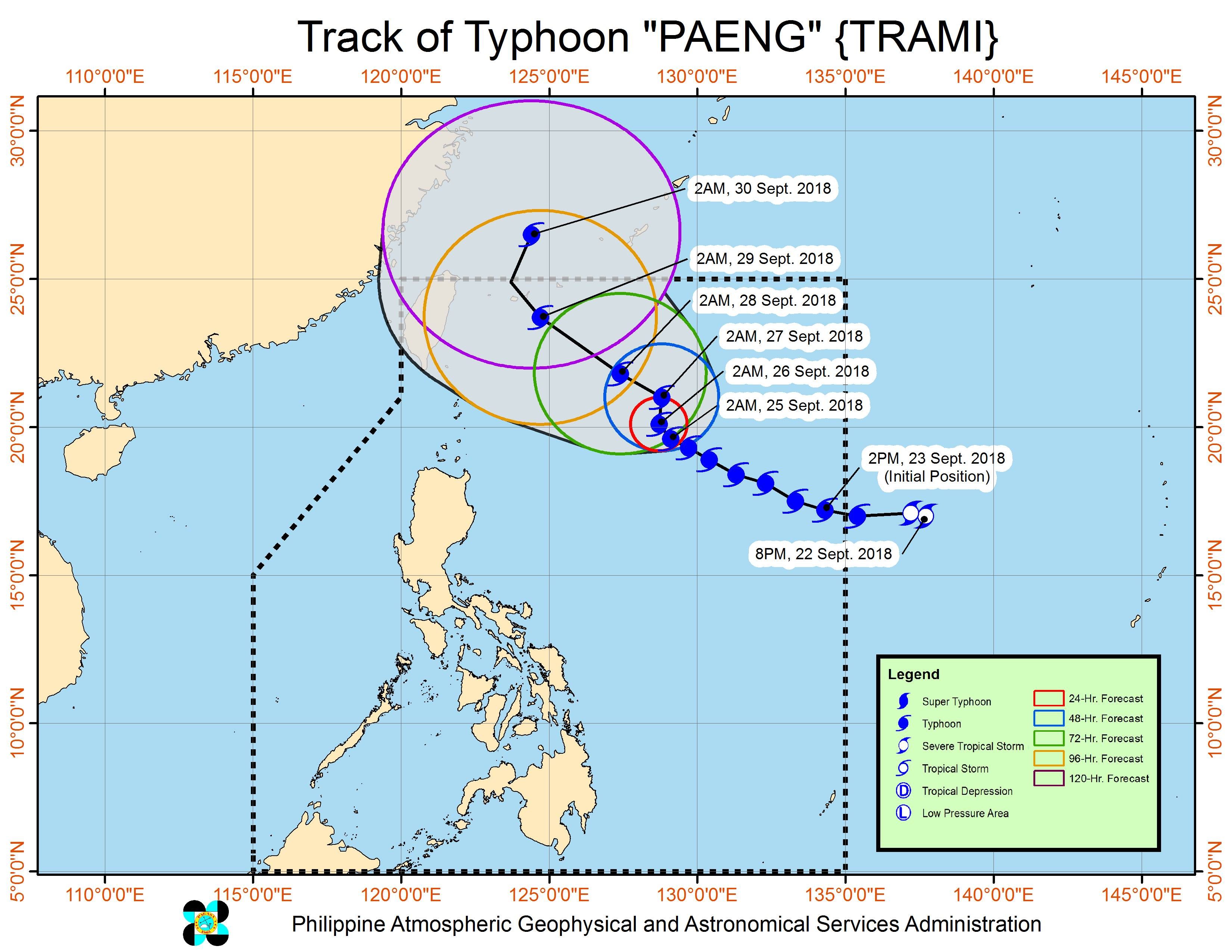
Based on its latest forecast track, Paeng could leave the Philippine Area of Responsibility on Saturday, September 29.
After Paeng, around 4 more tropical cyclones are expected in 2018. The Philippines usually gets an average of 20 tropical cyclones per year. (READ: LIST: PAGASA’s names for tropical cyclones in 2018)
Parts of Luzon are still reeling from the impact of Typhoon Ompong (Mangkhut), which left nearly a hundred people dead and caused destruction in provinces up north. Dozens of people remain missing. (READ: Areas under state of calamity due to Typhoon Ompong)
PAGASA declared the start of the rainy season last June 8. – Rappler.com
Add a comment
How does this make you feel?
There are no comments yet. Add your comment to start the conversation.