SUMMARY
This is AI generated summarization, which may have errors. For context, always refer to the full article.
What’s the weather like in your area? Report the situation through Rappler’s Agos or tweet us at @rapplerdotcom.
MANILA, Philippines – Aside from the slow-moving Typhoon Paeng (Trami) which does not pose a threat to the Philippines, forecasters are now monitoring a low pressure area (LPA) outside the Philippine Area of Responsibility (PAR).
In a Facebook Live video at 5 pm on Thursday, September 27, the Philippine Atmospheric, Geophysical, and Astronomical Services Administration (PAGASA) said the LPA is located 3,225 kilometers east of Mindanao.
It might enter PAR either on Monday, October 1, or Tuesday, October 2. If it enters as a tropical cyclone or develops into a tropical cyclone inside PAR, it would be given the local name Queenie.
Since the LPA remains very far from PAR, it is still uncertain how strong it would be or which path it would take. PAGASA is expected to give details in the coming days.
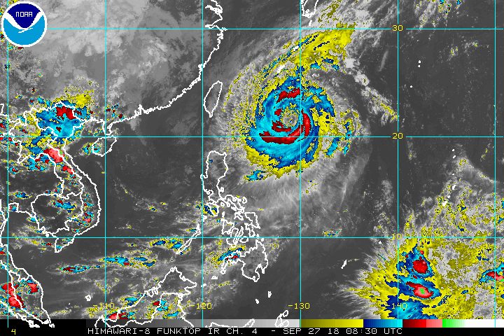
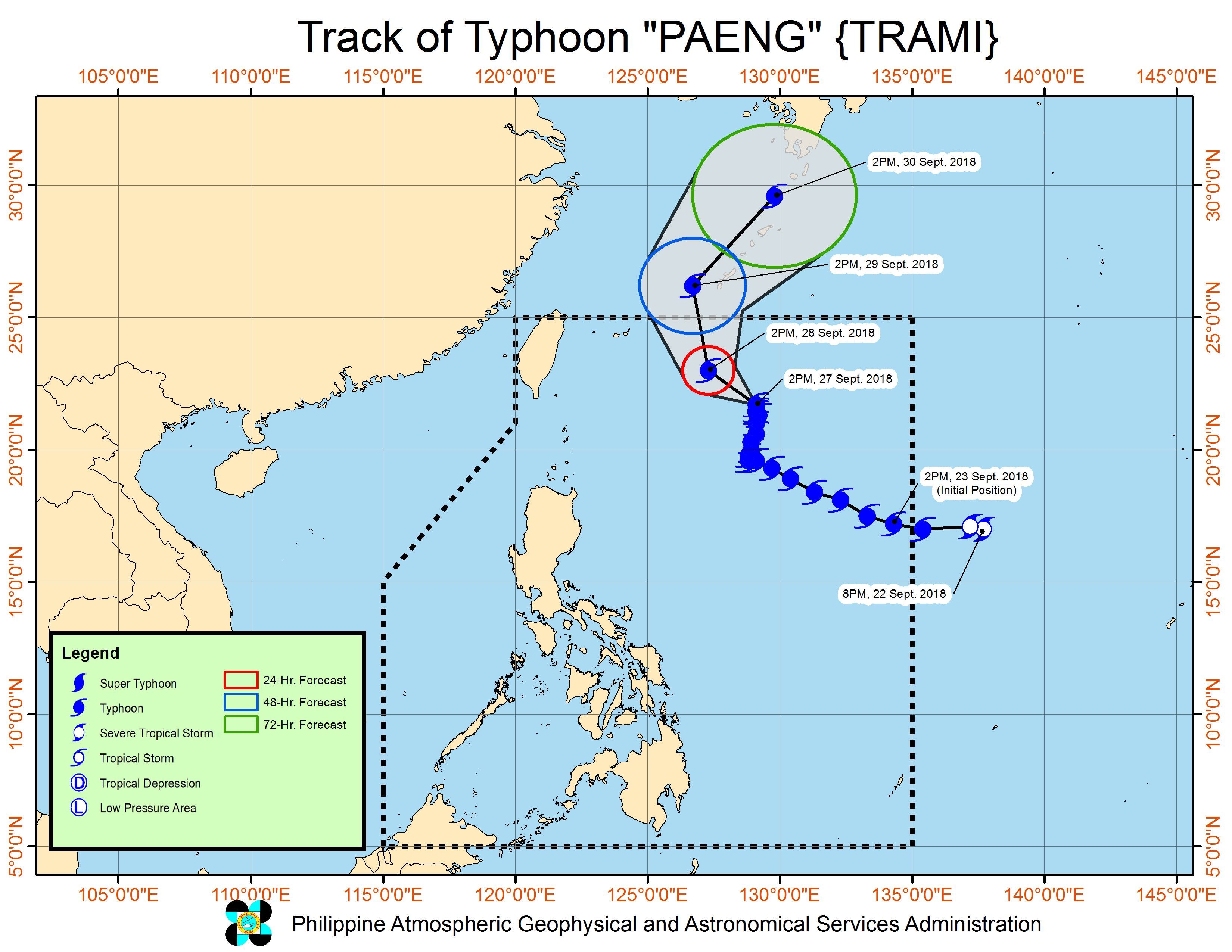
Meanwhile, Paeng is now 735 kilometers east northeast of Basco, Batanes, still slowly moving north toward Japan.
The typhoon maintained its strength, with maximum winds of 160 kilometers per hour (km/h) and gustiness of up to 195 km/h.
There are no areas under tropical cyclone warning signals, and signals are unlikely to be raised given Paeng’s path away from the Philippines.
But the typhoon could bring light to moderate rain to Northern Luzon on Friday, September 28. (READ: FAST FACTS: Tropical cyclones, rainfall advisories)
Paeng is also enhancing the southwest monsoon or hanging habagat, which will affect parts of the country on Friday.
The southwest monsoon is expected to trigger light to heavy rain in the regions of Zamboanga Peninsula and Northern Mindanao, as well as in the provinces of Palawan, Oriental Mindoro, Occidental Mindoro, Basilan, Sulu, and Tawi-Tawi. Residents of these areas should watch out for possible flash floods and landslides.
The rest of the country will only have localized thunderstorms on Friday. But flash floods and landslides are also possible if the thunderstorms bring heavy rain.
As for sea conditions, PAGASA warned that travel remains risky in the northern and eastern seaboards of Luzon and in the eastern seaboard of the Visayas, due to Paeng.
A gale warning was issued at 5 pm on Thursday for Batanes, the Babuyan Group of Islands, Calayan, the northern and eastern coasts of Cagayan, Isabela, Aurora, the eastern coast of Quezon including Polillo Island, Camarines Norte, Camarines Sur, Catanduanes, the eastern coast of Sorsogon, Northern Samar, and Eastern Samar.
Seas off those areas are rough to very rough, with wave heights reaching 2.8 meters to 4.5 meters.
PAGASA advised fishermen and others with small vessels not to set sail in areas covered by the gale warning. Larger vessels should watch out for big waves.
Based on its latest forecast track, Paeng could leave PAR on Saturday, September 29.
Paeng is the Philippines’ 16th tropical cyclone for 2018. The country usually gets an average of 20 tropical cyclones per year. (READ: LIST: PAGASA’s names for tropical cyclones in 2018)
PAGASA declared the start of the rainy season last June 8. – Rappler.com
Add a comment
How does this make you feel?
There are no comments yet. Add your comment to start the conversation.