SUMMARY
This is AI generated summarization, which may have errors. For context, always refer to the full article.
What’s the weather like in your area? Report the situation through Rappler’s Agos or tweet us at @rapplerdotcom.
MANILA, Philippines – The low pressure area outside the Philippine Area of Responsibility (PAR) became a tropical depression on Friday afternoon, September 28.
In a Facebook Live video past 4 pm on Friday, the Philippine Atmospheric, Geophysical, and Astronomical Services Administration (PAGASA) said the tropical depression is now 2,625 kilometers east of Mindanao, moving northwest at 15 kilometers per hour (km/h).
At the moment, it has maximum winds of 45 km/h and gustiness of up to 60 km/h. But since it is still over water, it could strengthen further.
PAGASA said the tropical depression could enter PAR on Tuesday, October 2. If it does enter, it would become the Philippines’ 17th tropical cyclone for 2018 and would be given the local name Queenie.
The country usually gets an average of 20 tropical cyclones per year. (READ: LIST: PAGASA’s names for tropical cyclones in 2018)
Since the tropical depression remains far from PAR, it is still uncertain how strong it would be or which path it would take. PAGASA is expected to give details in the coming days.
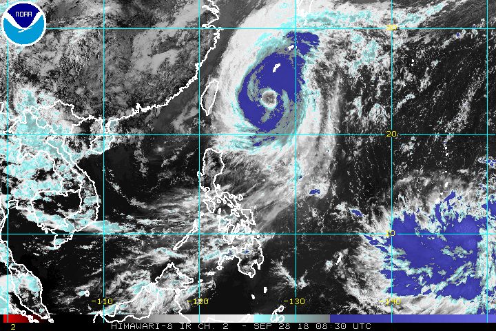
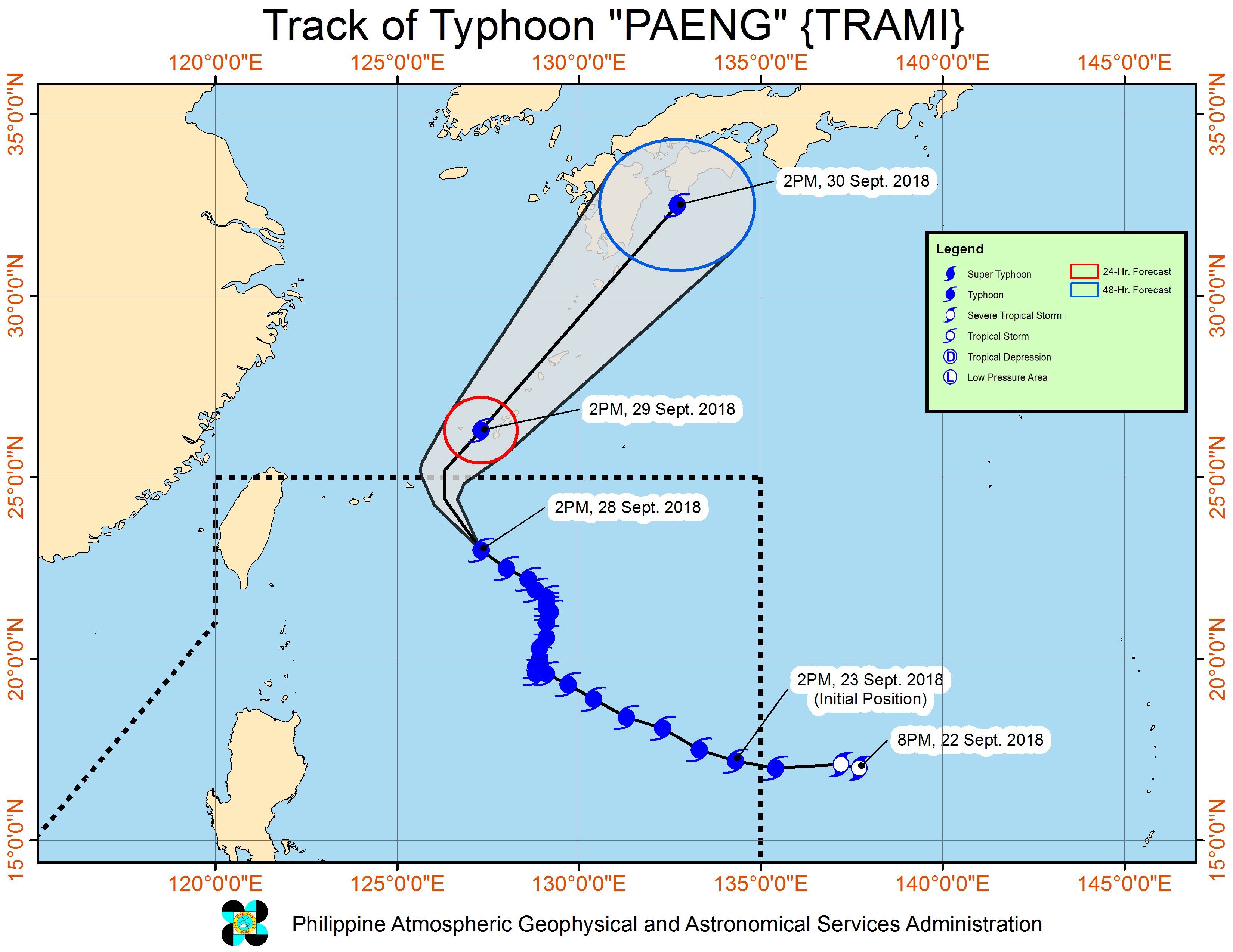
Meanwhile, Typhoon Paeng (Trami) is already 615 kilometers east northeast of Basco, Batanes. It slightly accelerated while making its way out of PAR, and is now moving northwest at 15 km/h.
The typhoon maintained its strength, with maximum winds of 160 km/h and gustiness of up to 195 km/h.
Fortunately, Paeng has stayed away from land and there are no areas under tropical cyclone warning signals. (READ: FAST FACTS: Tropical cyclones, rainfall advisories)
But the typhoon has been affecting seas off some provinces. A gale warning was issued at 5 pm on Friday for Batanes, the Babuyan Group of Islands, Calayan, Ilocos Norte, the northern and eastern coasts of Cagayan, Isabela, Aurora, the eastern coast of Quezon including Polillo Island, Camarines Norte, Camarines Sur, Catanduanes, the eastern coast of Sorsogon, Northern Samar, and Eastern Samar.
Seas off those areas are rough to very rough, with wave heights reaching 2.8 meters to 4.5 meters.
PAGASA advised fishermen and others with small vessels not to set sail in areas covered by the gale warning. Larger vessels should watch out for big waves.
Based on its latest forecast track, Paeng is expected to leave PAR on Saturday, September 29.
The whole country will only have localized thunderstorms on Saturday. But flash floods and landslides are still possible if the thunderstorms bring heavy rain.
PAGASA declared the start of the rainy season last June 8. – Rappler.com
Add a comment
How does this make you feel?
There are no comments yet. Add your comment to start the conversation.