SUMMARY
This is AI generated summarization, which may have errors. For context, always refer to the full article.
What’s the weather like in your area? Report the situation through Rappler’s Agos or tweet us at @rapplerdotcom.
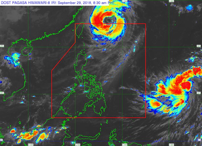
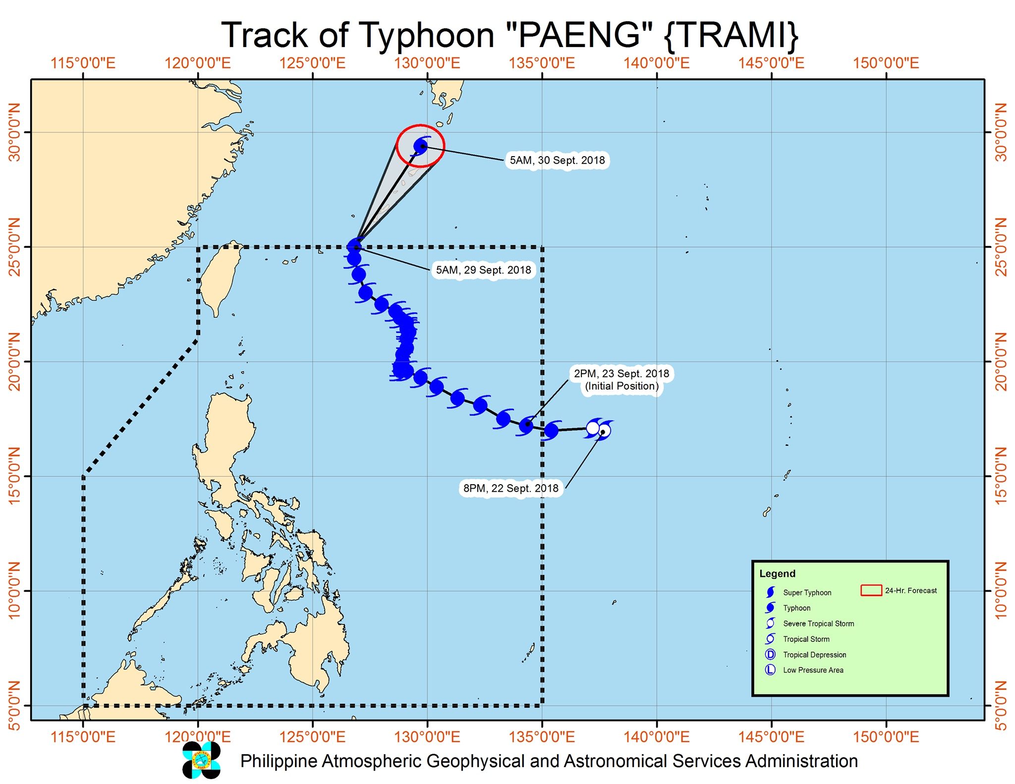
MANILA, Philippines – Typhoon Paeng (Trami) left the Philippine Area of Responsibility (PAR) at 6 am on Saturday, September 29, though sea travel remains risky in some areas.
In a bulletin issued 7:30 am on Saturday, the Philippine Atmospheric, Geophysical, and Astronomical Services Administration (PAGASA) said Paeng is now 730 kilometers northeast of Basco, Batanes, moving north at 15 kilometers per hour (km/h).
The typhoon maintained its strength as it left PAR, with maximum winds of 160 km/h and gustiness of up to 195 km/h.
Paeng did not make landfall in the Philippines and there were no areas placed under tropical cyclone warning signals. (READ: FAST FACTS: Tropical cyclones, rainfall advisories)
But PAGASA warned that sea travel remains risky in the northern and eastern seaboards of Luzon due to the typhoon.
A gale warning was issued at 5 am on Saturday for Batanes, the Babuyan Group of Islands, Calayan, Ilocos Norte, the northern and eastern coasts of Cagayan, Isabela, Aurora, Camarines Norte, Camarines Sur, Catanduanes, the eastern coast of Albay, the eastern coast of Sorsogon, and the eastern coast of Quezon including Polillo Island.
Seas off those areas are rough to very rough, with wave heights reaching 2.8 meters to 4.5 meters.
PAGASA advised fishermen and others with small vessels not to set sail in areas covered by the gale warning. Larger vessels should watch out for big waves.
After Paeng, another tropical cyclone could enter PAR on Tuesday, October 2.
PAGASA continues to monitor a tropical depression outside PAR, which is now 2,245 kilometers east northeast of the Visayas. It accelerated and is now moving northwest at 40 km/h from the previous 15 km/h.
The tropical depression also slightly strengthened. It now has maximum winds of 60 km/h from the previous 45 km/h and gustiness of up to 75 km/h from the previous 60 km/h. Since it is still over water, it could intensify further.
If the tropical depression does enter PAR on Tuesday, it would become the Philippines’ 17th tropical cyclone for 2018 and would be given the local name Queenie.
The country usually gets an average of 20 tropical cyclones per year. (READ: LIST: PAGASA’s names for tropical cyclones in 2018)
Since the tropical depression remains far from PAR, it is still uncertain how strong it would be or which path it would take. PAGASA is expected to give details in the coming days.
Meanwhile, the whole country will only have localized thunderstorms on Saturday. But flash floods and landslides are still possible if the thunderstorms bring heavy rain.
PAGASA declared the start of the rainy season last June 8. – Rappler.com
Add a comment
How does this make you feel?


There are no comments yet. Add your comment to start the conversation.