SUMMARY
This is AI generated summarization, which may have errors. For context, always refer to the full article.
What’s the weather like in your area? Report the situation through Rappler’s Agos or tweet us at @rapplerdotcom.
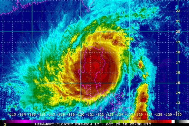
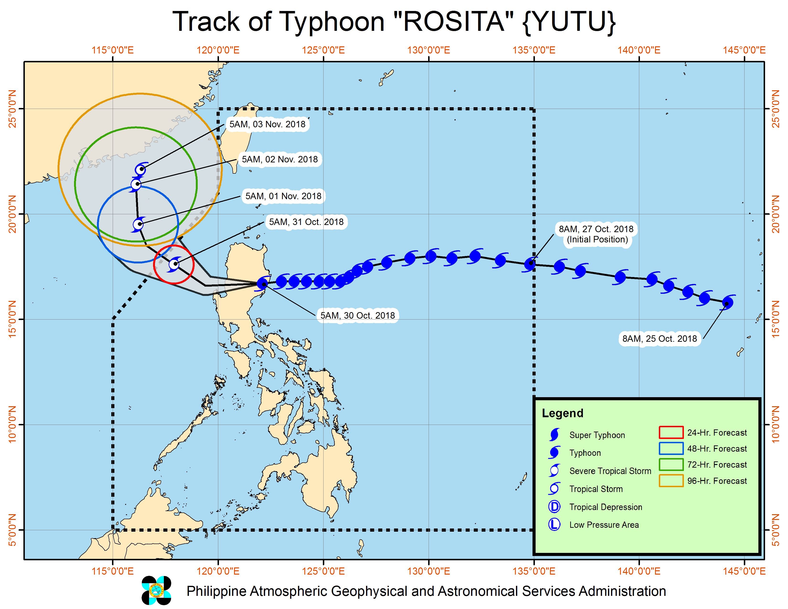
MANILA, Philippines – Typhoon Rosita (Yutu) began heading for Ifugao early Tuesday morning, October 30, after making landfall in Dinapigue, Isabela.
In a bulletin issued 8 am on Tuesday, the Philippine Atmospheric, Geophysical, and Astronomical Services Administration (PAGASA) said Rosita is already in the vicinity of Echague, Isabela. It is moving west toward Ifugao at a slightly faster 25 kilometers per hour (km/h) from the previous 20 km/h.
The typhoon’s maximum winds decreased from 150 km/h to 140 km/h, but its gustiness increased from 210 km/h to 230 km/h. (READ: FAST FACTS: Tropical cyclones, rainfall advisories)
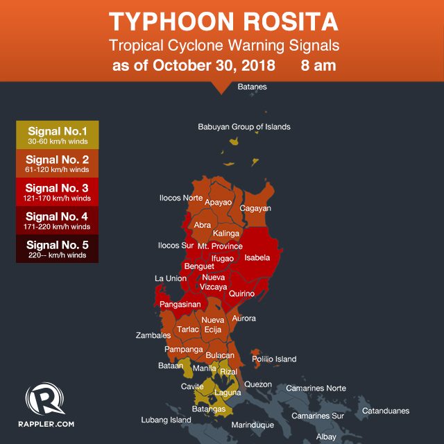
Below are the areas under tropical cyclone warning signals.
Signal No. 3:
- Isabela
- Quirino
- northern part of Aurora
- Nueva Vizcaya
- Ifugao
- Benguet
- La Union
- Ilocos Sur
- Mountain Province
- Pangasinan
Signal No. 2:
- Cagayan
- Ilocos Norte
- Apayao
- Abra
- Kalinga
- Tarlac
- Nueva Ecija
- northern part of Quezon including Polillo Island
- southern part of Aurora
- Zambales
- Pampanga
- Bulacan
Signal No. 1:
- Babuyan Group of Islands
- Rizal
- Metro Manila
- Laguna
- Batangas
- Bataan
- Cavite
Aside from Isabela and Ifugao, Rosita’s path after landfall includes Benguet and La Union. It might exit landmass on Tuesday afternoon.
The typhoon has been bringing heavy rain and strong winds to Northern Luzon and Central Luzon. (READ: Isabela bears brunt of Typhoon Rosita)
PAGASA warned that flash floods and landslides are possible in areas in the typhoon’s path. There might also be storm surges up to 3 meters high in coastal areas of Isabela, Aurora, Ilocos Sur, Ilocos Norte, La Union, and Pangasinan.
Residents of some coastal areas and landslide-prone areas preemptively evacuated ahead of Rosita’s landfall. (READ: Cagayan braces for Typhoon Rosita a month after Ompong)
Sea travel remains risky in the seaboards of areas under tropical cyclone warning signals, and in the eastern and western seaboards of Southern Luzon.
A gale warning was issued at 5 am on Tuesday for the western coast of northern Palawan, Camarines Sur, Catanduanes, the eastern coast of Sorsogon, and the eastern coast of Albay.
Seas off those areas are rough to very rough, with wave heights reaching 2.6 meters to 5.5 meters.
PAGASA advised fishermen and others with small vessels not to set sail in areas covered by the gale warning. Larger vessels should watch out for big waves.
Classes have also been suspended in various areas due to Rosita. (READ: #WalangPasok: Class suspensions, Tuesday, October 30)
Based on the typhoon’s latest forecast track, it will leave the Philippine Area of Responsibility on Wednesday, October 31.
Rosita is the Philippines’ 18th tropical cyclone for 2018. The country usually gets an average of 20 tropical cyclones per year. (READ: LIST: PAGASA’s names for tropical cyclones in 2018)
PAGASA declared the start of the rainy season last June 8. – Rappler.com
Add a comment
How does this make you feel?
There are no comments yet. Add your comment to start the conversation.