SUMMARY
This is AI generated summarization, which may have errors. For context, always refer to the full article.
What’s the weather like in your area? Report the situation through Rappler’s Agos or tweet us at @rapplerdotcom.
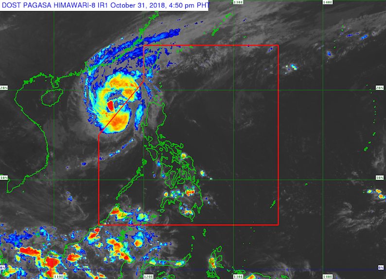
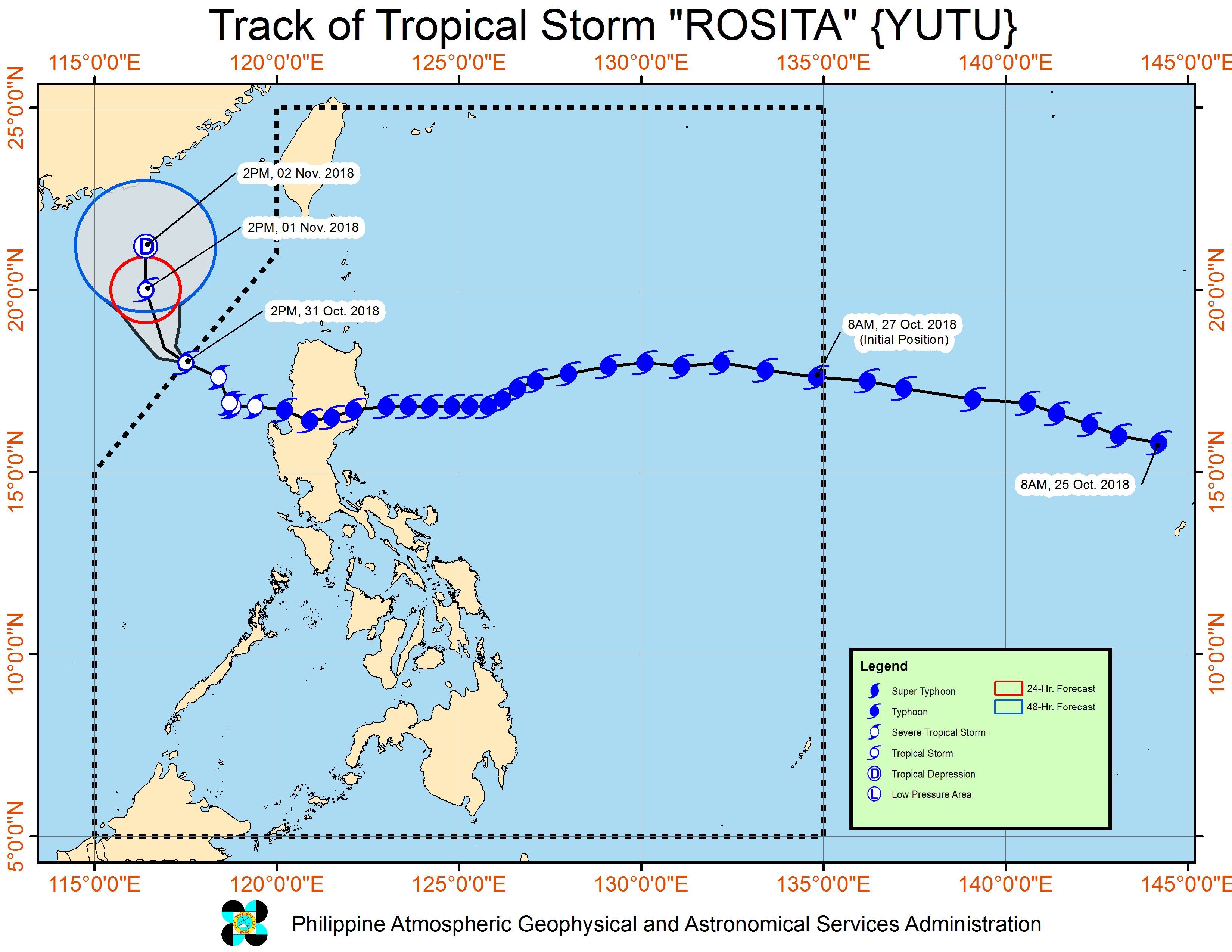
MANILA, Philippines – Rosita (Yutu) weakened further from a severe tropical storm into a tropical storm as it left the Philippine Area of Responsibility (PAR) at 3 pm on Wednesday, October 31.
In a bulletin issued 5 pm on Wednesday, the Philippine Atmospheric, Geophysical, and Astronomical Services Administration (PAGASA) said Rosita is already 325 kilometers west of Laoag City, Ilocos Norte. It is moving west northwest at 15 kilometers per hour (km/h).
Rosita’s maximum winds are down to 85 km/h from the previous 90 km/h, while its gustiness is now at 105 km/h from the previous 115 km/h. (READ: FAST FACTS: Tropical cyclones, rainfall advisories)
Though the tropical storm has left PAR, its trough or extension will still trigger light to moderate rain in the Cordillera Administrative Region, Ilocos Region, Zambales, Batanes, and the Babuyan Group of Islands.
Flash floods and landslides remain possible in those areas, so residents should stay on alert. (READ: Magat Dam breaches spilling level)
In Mountain Province, at least 8 people were killed in a landslide that buried a local office of the Department of Public Works and Highways. A 5-year-old girl was also reported dead in a landslide in Kalinga, while a father and his 3 children were killed in a landslide in Ifugao.
Residents of some coastal areas and landslide-prone areas earlier evacuated ahead of Rosita’s landfall. As of Wednesday, more than 50,000 individuals were in evacuation centers.
Rosita made landfall in Dinapigue, Isabela, as a typhoon at 4 am on Tuesday, October 30. There was serious damage in the province. (IN PHOTOS: Typhoon Rosita’s onslaught in Isabela)
After hitting Isabela, Rosita crossed Nueva Vizcaya, Benguet, and La Union. It then left landmass through La Union at 2 pm on Tuesday. (READ: Clearing operations ongoing in typhoon-hit Isabela)
It then weakened into a severe tropical storm early Tuesday evening.
Sea travel remains risky in the western seaboard of Luzon and in the northern seaboard of Northern Luzon.
A gale warning was issued at 5 pm on Wednesday for Batanes, the Babuyan Group of Islands, Calayan, the northern coast of Cagayan, the northern and western coasts of Ilocos Norte, Ilocos Sur, La Union, Pangasinan, Zambales, Bataan, and the western coast of Palawan.
Seas off those areas are rough to very rough, with wave heights reaching 2.8 meters to 4.5 meters.
PAGASA advised fishermen and others with small vessels not to set sail in areas covered by the gale warning. Larger vessels should watch out for big waves.
Rosita was the Philippines’ 18th tropical cyclone for 2018. The country usually gets an average of 20 tropical cyclones per year. (READ: LIST: PAGASA’s names for tropical cyclones in 2018)
PAGASA said it does not expect any other tropical cyclone for the rest of the week.
On Thursday, November 1, there will be localized thunderstorms in areas not affected by Rosita’s trough. Flash floods and landslides are possible if the thunderstorms bring heavy rain.
PAGASA declared the start of the rainy season last June 8. – Rappler.com
Add a comment
How does this make you feel?
There are no comments yet. Add your comment to start the conversation.