SUMMARY
This is AI generated summarization, which may have errors. For context, always refer to the full article.
What’s the weather like in your area? Report the situation through Rappler’s Agos or tweet us at @rapplerdotcom.
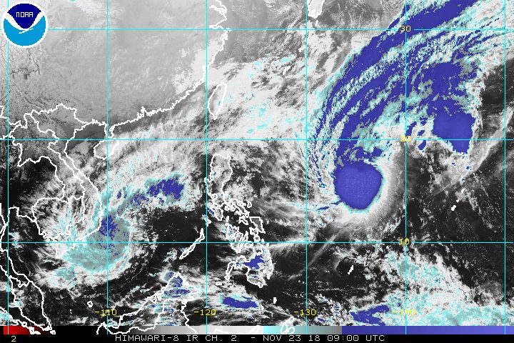
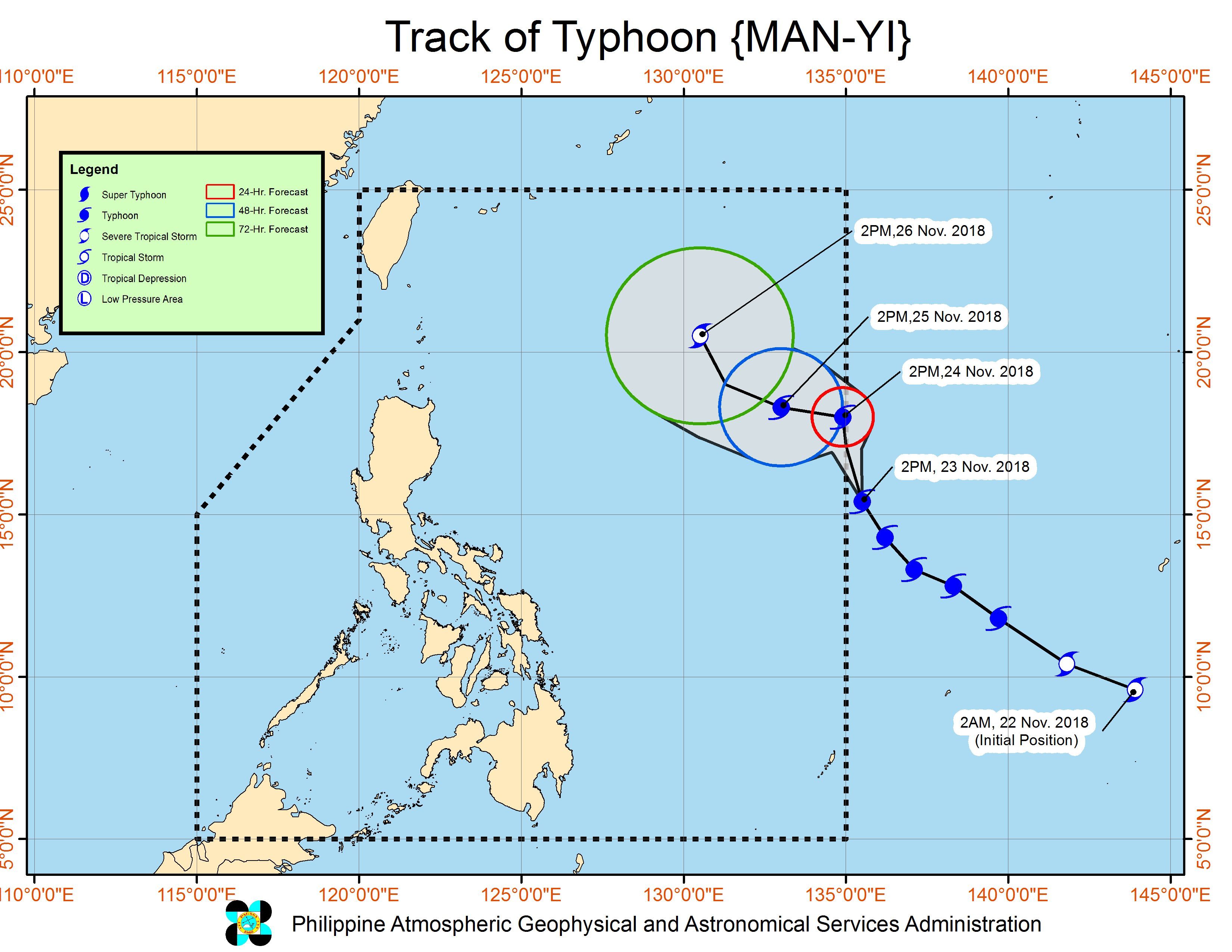
MANILA, Philippines – Typhoon Man-yi maintained its strength Friday afternoon, November 23, as it continued heading for the Philippine Area of Responsibility (PAR).
In a bulletin issued 4 pm on Friday, the Philippine Atmospheric, Geophysical, and Astronomical Services Administration (PAGASA) said Man-yi is already 1,495 kilometers east of Central Luzon.
It is still moving northwest at 25 kilometers per hour (km/h).
If it maintains its speed and direction, it would enter PAR either on Friday evening or on Saturday morning, November 24. When Man-yi enters, it will be given the local name Tomas. (READ: LIST: PAGASA’s names for tropical cyclones in 2018)
The typhoon continues to have maximum winds of 145 km/h and gustiness of up to 180 km/h.
At the moment, Man-yi remains unlikely to make landfall in the Philippines. But the public is advised to monitor updates in case this forecast changes. (READ: FAST FACTS: Tropical cyclones, rainfall advisories)
So far, the Philippines has had 19 tropical cyclones in 2018, and Man-yi would be the 20th. The country usually gets an average of 20 tropical cyclones per year.
Meanwhile, the northeast monsoon or hanging amihan will affect Northern Luzon.
Isolated light rains are again expected in Cagayan Valley, the Ilocos Region, and the Cordillera Administrative Region on Saturday. PAGASA said there will be “no significant impact.”
A gale warning, however, was issued at 5 pm on Friday for Batanes, Babuyan, Calayan, Cagayan, Ilocos Norte, and Ilocos Sur, due to the northeast monsoon.
Seas off those areas are rough to very rough, with wave heights reaching 2.8 meters to 4.5 meters.
PAGASA advised fishermen and others with small vessels not to set sail in areas covered by the gale warning. Larger vessels should watch out for big waves.
The rest of the country, not affected by the northeast monsoon, will only have localized thunderstorms on Saturday. But flash floods and landslides are possible if the thunderstorms become severe.
PAGASA declared the start of the rainy season last June 8. – Rappler.com
Add a comment
How does this make you feel?
There are no comments yet. Add your comment to start the conversation.