SUMMARY
This is AI generated summarization, which may have errors. For context, always refer to the full article.
What’s the weather like in your area? Report the situation through Rappler’s Agos or tweet us at @rapplerdotcom.
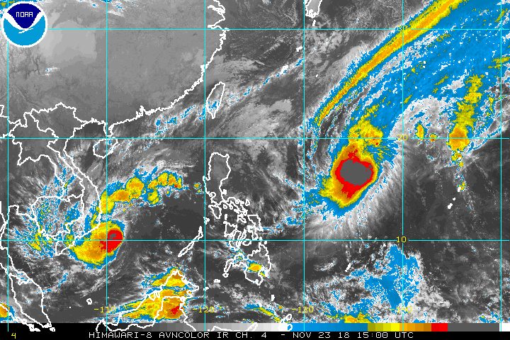
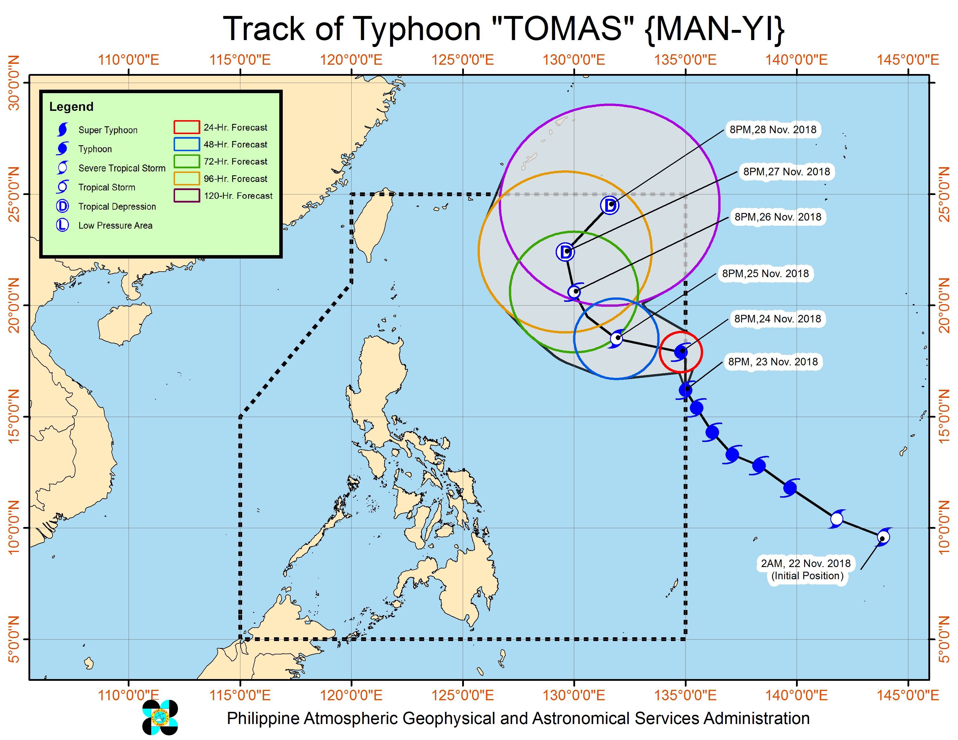
MANILA, Philippines – The typhoon with the international name Man-yi entered the Philippine Area of Responsibility (PAR) at 8 pm on Friday, November 23, becoming the country’s 20th tropical cyclone for 2018. It has been given the local name Tomas.
In a bulletin issued 11:30 pm on Friday, the Philippine Atmospheric, Geophysical, and Astronomical Services Administration (PAGASA) said Typhoon Tomas is already 1,365 kilometers east of Casiguran, Aurora.
It is now moving north northwest at a slower 15 kilometers per hour (km/h) from the previous 25 km/h.
But the typhoon maintained its strength as it entered PAR, with maximum winds of 145 km/h and gustiness of up to 180 km/h.
So far, PAGASA maintains that Tomas is not expected to make landfall in the Philippines.
The typhoon also has no direct effect on any part of the country at the moment, so there are no areas under tropical cyclone warning signals. (READ: FAST FACTS: Tropical cyclones, rainfall advisories)
Based on Tomas’ latest forecast track, it will leave PAR on Wednesday, November 28.
The Philippines usually gets an average of 20 tropical cyclones per year. Following Tomas’ entry, the country has already hit the average number, with over a month still remaining in 2018. (READ: LIST: PAGASA’s names for tropical cyclones in 2018)
Meanwhile, the northeast monsoon or hanging amihan is affecting Northern Luzon.
Isolated light rains are again expected in Cagayan Valley, the Ilocos Region, and the Cordillera Administrative Region on Saturday, November 24. PAGASA said there will be “no significant impact.”
A gale warning, however, was issued at 5 pm on Friday for Batanes, Babuyan, Calayan, Cagayan, Ilocos Norte, and Ilocos Sur, due to the northeast monsoon.
Seas off those areas are rough to very rough, with wave heights reaching 2.8 meters to 4.5 meters.
PAGASA advised fishermen and others with small vessels not to set sail in areas covered by the gale warning. Larger vessels should watch out for big waves.
The rest of the country, not affected by the northeast monsoon, will only have localized thunderstorms on Saturday. But flash floods and landslides are possible if the thunderstorms become severe.
PAGASA declared the start of the rainy season last June 8. – Rappler.com
Add a comment
How does this make you feel?
There are no comments yet. Add your comment to start the conversation.