SUMMARY
This is AI generated summarization, which may have errors. For context, always refer to the full article.
What’s the weather like in your area? Report the situation through Rappler’s Agos or tweet us at @rapplerdotcom.
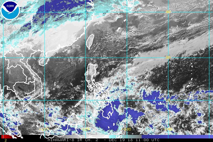
MANILA, Philippines – The trough or extension of a low pressure area (LPA) still located outside the Philippine Area of Responsibility (PAR) is already affecting Mindanao.
In a Facebook Live video past 5 pm on Wednesday, December 19, the Philippine Atmospheric, Geophysical, and Astronomical Services Administration (PAGASA) said the LPA is now 1,032 kilometers east of Mindanao.
It is expected to enter PAR either on Wednesday evening or early Thursday morning, December 20.
PAGASA said the LPA only has a slim chance of developing into a tropical cyclone.
But the LPA’s trough is bringing scattered rainshowers and thunderstorms to Mindanao. Flash floods and landslides are possible during severe thunderstorms. (READ: FAST FACTS: Tropical cyclones, rainfall advisories)
PAGASA earlier said that one to two tropical cyclones could enter or develop within PAR in December.
So far, the Philippines has had 20 tropical cyclones in 2018 – the average number it gets per year. (READ: LIST: PAGASA’s names for tropical cyclones in 2018)
Meanwhile, the northeast monsoon or hanging amihan will affect Luzon and the Visayas on Thursday.
Light rain is expected in those areas, but PAGASA said there will be “no significant impact.”
Due to the northeast monsoon, however, a gale warning was issued at 5 pm on Wednesday for the eastern coast of Cagayan, Isabela, Aurora, the eastern coast of Quezon including Polillo Island, Camarines Norte, the eastern coast of Camarines Sur, Catanduanes, the eastern coast of Albay, the eastern coast of Sorsogon, Northern Samar, Eastern Samar, the eastern coast of Surigao del Norte, Surigao del Sur, Siargao, and the Dinagat Islands.
Seas off those areas are rough to very rough, with wave heights reaching 2.8 meters to 4.5 meters.
PAGASA advised fishermen and others with small vessels not to set sail in areas covered by the gale warning. Larger vessels should watch out for big waves.
PAGASA declared the start of the rainy season last June 8. – Rappler.com
Add a comment
How does this make you feel?
There are no comments yet. Add your comment to start the conversation.