SUMMARY
This is AI generated summarization, which may have errors. For context, always refer to the full article.
What’s the weather like in your area? Report the situation through Rappler’s Agos or tweet us at @rapplerdotcom.
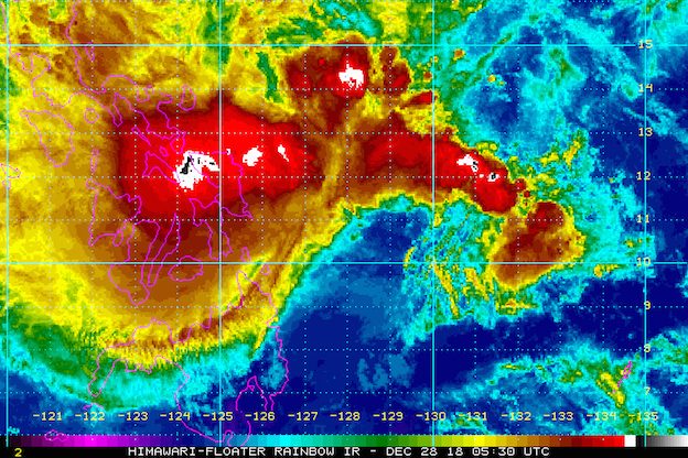
MANILA, Philippines – Moderate to heavy rain began as Tropical Depression Usman slowed down even further and became almost stationary early Friday afternoon, December 28.
In a bulletin issued 2 pm on Friday, the Philippine Atmospheric, Geophysical, and Astronomical Services Administration (PAGASA) said Usman is located 250 kilometers east of Guiuan, Eastern Samar, barely moving.
The tropical depression continues to have maximum winds of 55 km/h and gustiness of up to 65 km/h. It is now expected to just maintain its category as a tropical depression, after initially being projected to eventually intensify into a tropical storm. (READ: FAST FACTS: Tropical cyclones, rainfall advisories)
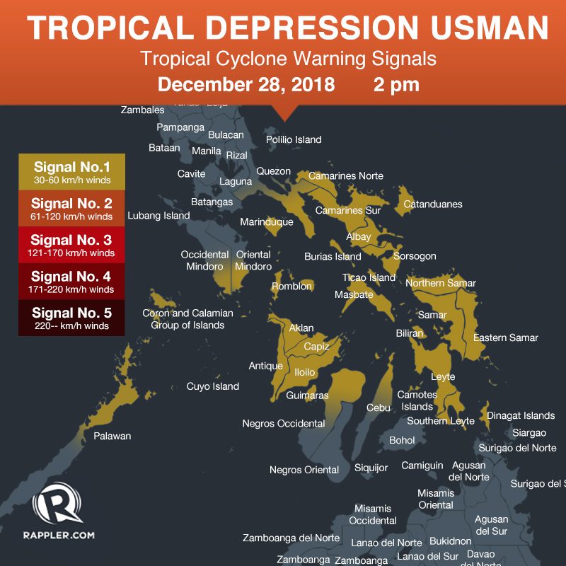
Signal No. 1 is raised in:
- northern part of Palawan including Calamian Group of Islands and Cuyo Group of Islands
- southern part of Quezon
- Marinduque
- Romblon
- Catanduanes
- Camarines Norte
- Camarines Sur
- Albay
- Sorsogon
- Masbate including Ticao Island and Burias Island
- southern part of Occidental Mindoro
- southern part of Oriental Mindoro
- Eastern Samar
- Northern Samar
- Samar
- Biliran
- Leyte
- Southern Leyte
- northern part of Cebu including Camotes Islands
- Aklan
- Capiz
- Iloilo
- Guimaras
- Antique
- northern part of Negros Occidental
- Dinagat Islands
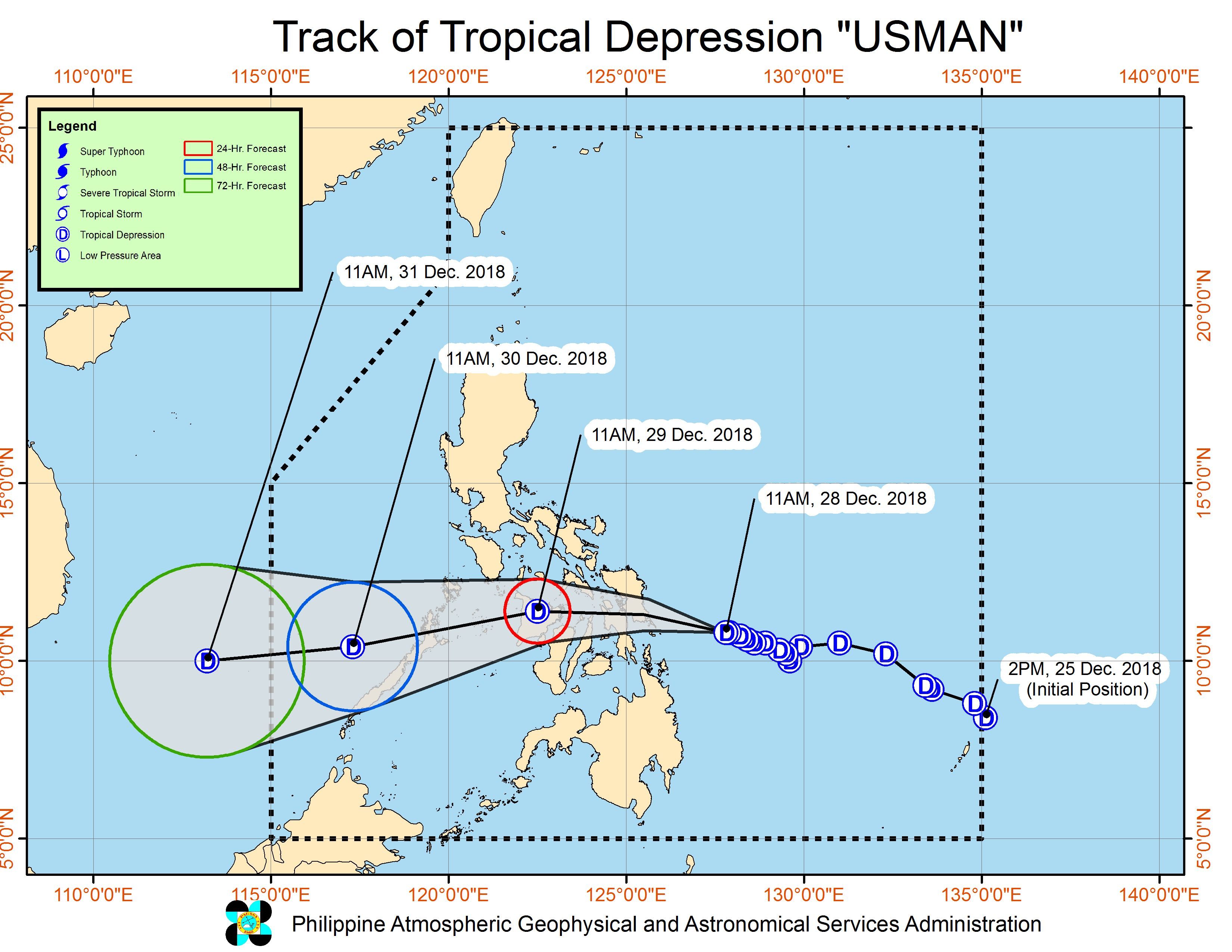
Usman is likely to make landfall in Eastern Samar on Friday evening. After hitting land, it will cross Leyte, Panay Island, Sulu Sea, Palawan, and the West Philippine Sea.
Moderate to heavy rain is also expected in the Visayas, Bicol, Oriental Mindoro, Occidental Mindoro, Marinduque, Romblon, and Quezon on Friday.
Metro Manila, meanwhile, will have light to heavy rain from Friday afternoon until Saturday, December 29.
Moderate to heavy rain will also hit Calabarzon, Aurora, Mimaropa, Bicol, Western Visayas, and Central Visayas on Saturday.
Areas in Usman’s path should be on alert for possible flash floods and landslides.
PAGASA also warned that sea travel is risky in areas under Signal No. 1, as well as in the seaboards of Northern Luzon, the eastern seaboards of Central Luzon and Southern Luzon, and the eastern seaboard of the Surigao provinces. This is due to both Usman and the surge of the northeast monsoon or hanging amihan. (READ: Tropical Depression Usman: Areas where sea travel is suspended)
Based on its latest forecast track, Usman is expected to leave the Philippine Area of Responsibility either on Sunday evening, December 30, or on Monday morning, December 31.
Usman is the Philippines’ 21st tropical cyclone for 2018. The country’s average number of tropical cyclones per year is only 20. (READ: LIST: PAGASA’s names for tropical cyclones in 2018)
Northeast monsoon
Meanwhile, the northeast monsoon is affecting Northern Luzon on Friday.
Cagayan Valley, the Ilocos Region, and the Cordillera Administrative Region have light rain, but PAGASA said there will be “no significant impact.”
The rest of Mindanao, not affected by either Usman or the northeast monsoon, only have isolated rainshowers or thunderstorms on Friday.
PAGASA declared the start of the rainy season last June 8. – Rappler.com
Add a comment
How does this make you feel?
There are no comments yet. Add your comment to start the conversation.