SUMMARY
This is AI generated summarization, which may have errors. For context, always refer to the full article.

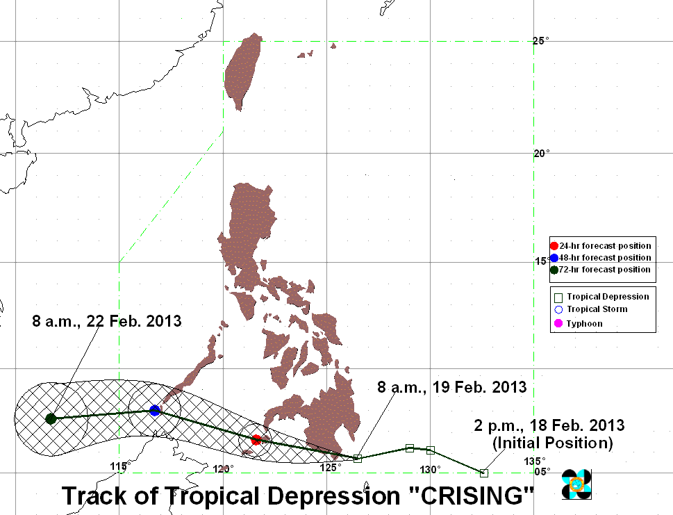
MANILA, Philippines (UPDATED) – Tropical depression Crising continues to move closer to land Tuesday, February 19, bringing rain to large parts of Mindanao and raising public storm warning signals over most of the island.
As of 10 am, Crising, which accelerated overnight, was located 100 km southeast of General Santos City, or closer to the southern tip of Davao del Sur, with maximum sustained winds of 45 km/h near the center.
Public storm warning signal number 1 are still in effect over the following areas:
- Davao del Norte
- Davao del Sur
- Samal Island
- Davao Oriental
- Compostela Valley
- southern part of Surigao del Sur
- Agusan del Sur
- Bukidnon
- Lanao del Norte
- Lanao del Sur
- North Cotabato
- Maguindanao
- Sultan Kudarat
- South Cotabato
- Sarangani
- Misamis Occidental
- Zamboanga del Norte
- Zamboanga del Sur
- Zamboanga Sibugay
These areas might experience possible landslides and flashfloods, with Crising forecast to bring moderate to heavy rain (5-15 mm/h) within its 300 km diameter.
The weather disturbance is currently moving west northwest at 22 km/h, crossing Mindanao. It will be 60 km southwest of Zamboanga City by Wednesday, and 270 km southwest of Puerto Princesa City by Thursday.
These areas might experience possible landslides and flashfloods, with Crising forecast to bring moderate to heavy rain (5-15 mm/h) within its 300 km diameter.
The weather disturbance is currently moving west northwest at 22 km/h, crossing Mindanao. It will be 30 km northwest of Cotabato City by Wednesday, and 380 km northwest of Zamboanga City by Thursday.
As Mindanao braces for more rain and gusty winds, Eastern and Central Visayas will have cloudy skies with moderate to heavy rain and thunderstorms, also possibly triggering flashfloods and landslides.
Bicol and the rest of the Visayas will have cloudy skies with light to moderate rainfall, while Cagayan Valley and the provinces of Aurora and Quezon will be cloudy with light rain.
The rest of the archipelago will have partly cloudy skies with isolated rain or thunderstorms.
PAGASA 24-Hour Public Weather Forecast, 19 February 2013, 5am
– With reports from KD Suarez/Rappler.com
Add a comment
How does this make you feel?
There are no comments yet. Add your comment to start the conversation.