SUMMARY
This is AI generated summarization, which may have errors. For context, always refer to the full article.
What’s the weather like in your area? Report the situation through Rappler’s Agos or tweet us at @rapplerdotcom.
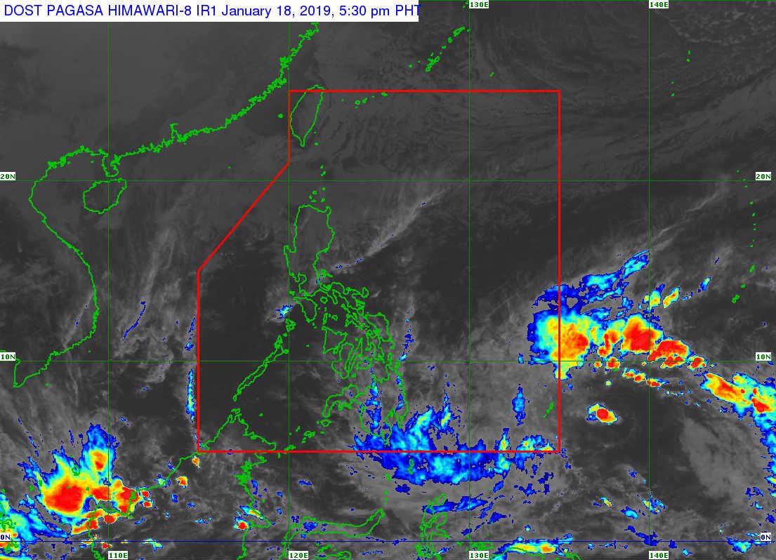
MANILA, Philippines – The low pressure area (LPA) being monitored by the Philippine Atmospheric, Geophysical, and Astronomical Services Administration (PAGASA) may enter the Philippine Area of Responsibility (PAR) on early Saturday morning, January 19.
In a briefing past 5 pm on Friday, January 18, PAGASA said that as of 3 pm, the LPA is still outside PAR or 1,315 kilometers east of Hinatuan, Surigao del Sur.
PAGASA said it may develop into a tropical depression inside PAR. If the LPA develops into a tropical depression, it would become the Philippines’ first tropical cyclone for 2019 and would be given the local name Amang.
Signal No. 1 could also be raised over provinces in the Eastern Samar-Caraga area by Saturday. PAGASA said a possible disruption in maritime travel may be experienced.
The LPA or potential Amang’s possible landfall would be in Caraga on Sunday, January 20. It may then weaken into an LPA while crossing land.
Here’s what to expect in terms of rainfall for the next 3 days:
- Saturday evening, January 19 – moderate to heavy rains over Eastern Visayas, Caraga, Compostela Valley, Davao Oriental
- Sunday, January 20 – moderate to heavy rains over Bicol, Eastern Visayas, Caraga, Central Visayas, Compostela Valley, Davao Oriental, southern part of Quezon, Mindoro provinces, Romblon, and Marinduque
- Monday, January 21 – moderate to heavy rains over Bicol, Eastern Visayas, southern part of Quezon, Mindoro provinces, Romblon, and Marinduque
PAGASA said residents in these areas should be alert, especially those living in areas at high risk of flooding and landslides.
Earlier on Friday morning, PAGASA warned the public to brace for the LPA.
“Hindi po puwede mag-kumpiyansa dahil kapag low pressure area ay puwede pong magbigay ng malalakas na ulan…. Kahit na hindi ito malakas na bagyo, puwedeng magbigay ng malalakas na pag-ulan,” PAGASA Administrator Vicente Malano earlier said.
(We can’t be complacent because even a low pressure area can bring heavy rain…. Even if the tropical cyclone isn’t of the strongest classification, it can still bring heavy rain.)
The Philippines gets an average of 20 tropical cyclones per year. The forecast for January is zero to one tropical cyclone.(READ: FAST FACTS: Tropical cyclones, rainfall advisories) – Rappler.com
Add a comment
How does this make you feel?
There are no comments yet. Add your comment to start the conversation.