SUMMARY
This is AI generated summarization, which may have errors. For context, always refer to the full article.
What’s the weather like in your area? Report the situation through Rappler’s Agos or tweet us at @rapplerdotcom.
MANILA, Philippines – Tropical Depression Amang accelerated early Sunday morning, January 20, hours ahead of its expected landfall in Surigao del Norte.
In a bulletin issued 8 am on Sunday, the Philippine Atmospheric, Geophysical, and Astronomical Services Administration (PAGASA) said Amang is now 360 kilometers east of Hinatuan, Surigao del Sur.
It is now moving west northwest at a faster 25 kilometers per hour (km/h) from the previous 15 km/h.
The tropical depression continues to have maximum winds of 45 km/h and gustiness of up to 60 km/h. Amang had developed on Saturday evening, January 19, from a low pressure area.
Signal No. 1 is now raised in:
- Eastern Samar
- Samar
- Biliran
- Leyte
- Southern Leyte
- eastern part of Bohol
- northern part of Cebu
- Agusan del Sur
- Agusan del Norte
- Surigao del Sur
- Surigao del Norte
- Dinagat Islands
- Camiguin
Amang is expected to make landfall in the Surigao del Norte-Siargao Island area on Sunday afternoon or evening.
Beginning Sunday, according to PAGASA, moderate to heavy rain will prevail over Caraga, Northern Mindanao, Compostela Valley, Davao Oriental, Eastern Visayas, Central Visayas, Bicol, the southern part of Quezon, Marinduque, and Romblon.
On Monday, January 21, moderate to heavy rain will hit the Visayas, Bicol, the southern part of Quezon, Marinduque, and Romblon.
Then on Tuesday, January 22, there will also be moderate to heavy rain in Albay, Sorsogon, Catanduanes, Masbate, Eastern Visayas, and Central Visayas.
Residents of those regions and provinces should be on alert for possible flash floods and landslides, especially if they live in low-lying communities, near rivers, or in mountainous areas. (READ: FAST FACTS: Tropical cyclones, rainfall advisories)
Sea travel is also risky in the seaboards of areas under Signal No. 1, the northern seaboard of Northern Luzon, and the eastern seaboards of Luzon, the Visayas, and Mindanao. This is due to the combined effects of Amang and the surge of the northeast monsoon or hanging amihan.
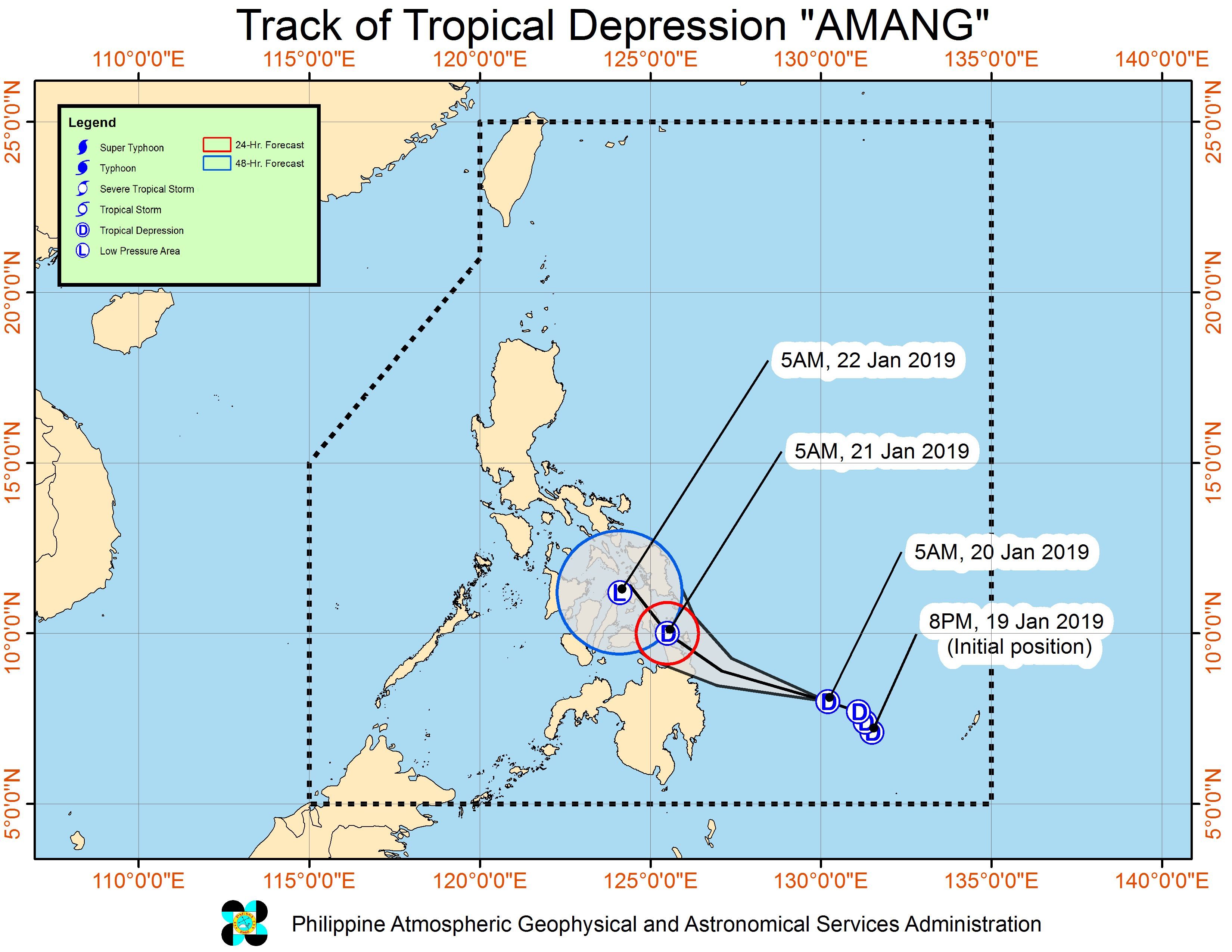
After hitting land, Amang might return to being an LPA by early Monday morning, but would still bring hazards.
PAGASA earlier emphasized that weather disturbances such as LPAs and tropical depressions can still trigger heavy rain, so officials and residents should watch out for flash floods and landslides.
Amang is the Philippines’ first tropical cyclone for 2019. The Philippines gets an average of 20 tropical cyclones per year.
The forecast for January is zero to one tropical cyclone. (READ: LIST: PAGASA’s names for tropical cyclones in 2019) – Rappler.com
Add a comment
How does this make you feel?


There are no comments yet. Add your comment to start the conversation.