SUMMARY
This is AI generated summarization, which may have errors. For context, always refer to the full article.
What’s the weather like in your area? Report the situation through Rappler’s Agos or tweet us at @rapplerdotcom.
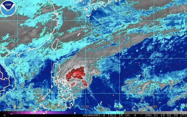
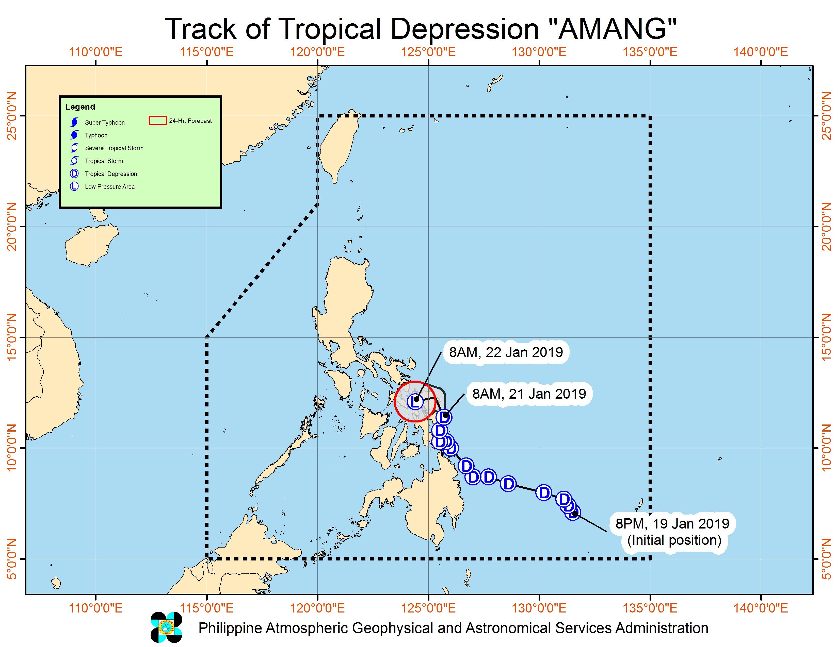
MANILA, Philippines – Tropical Depression Amang maintained its strength while over the eastern seaboard of Eastern Samar late Monday morning, January 21, with more rain expected in parts of the Visayas and Luzon.
In a bulletin issued 11 am on Monday, the Philippine Atmospheric, Geophysical, and Astronomical Services Administration (PAGASA) said Amang is 40 kilometers north northeast of Guiuan, Eastern Samar, or 45 kilometers east southeast of Borongan City, Eastern Samar.
It is now moving north – from the previous northwest – at the same slow pace of 10 kilometers per hour (km/h).
The tropical depression had made landfall in Siargao Island at 8 pm on Sunday, January 20.
At the moment, it still has maximum winds of 45 km/h and gustiness of up to 60 km/h.
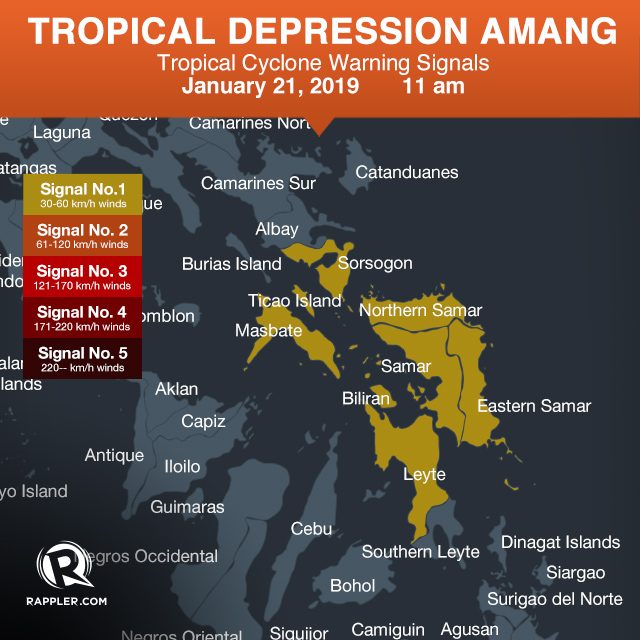
Signal No. 1 is now raised in a couple of areas in Luzon, while there are no more areas under Signal No. 1 in Mindanao. Several areas in the Visayas also remain under Signal No. 1.
- Sorsogon
- Masbate including Ticao Island
- Northern Samar
- Eastern Samar
- Samar
- Biliran
- Leyte
PAGASA warned that moderate to heavy rain will continue in Eastern Visayas and Bicol on Monday. Classes have been suspended in some areas. (READ: #WalangPasok: Class suspensions, Monday, January 21)
Then on Tuesday, January 22, moderate to heavy rain could be experienced in Eastern Visayas, Catanduanes, Albay, Sorsogon, and Masbate.
Residents of those regions and provinces should stay on alert for possible flash floods and landslides, especially if they live in low-lying communities, near rivers, or in mountainous areas. (READ: FAST FACTS: Tropical cyclones, rainfall advisories)
Sea travel also remains risky in the seaboards of Northern Luzon, and in the eastern seaboards of Central Luzon, Southern Luzon, the Visayas, Dinagat Islands, and Surigao del Norte, including all seaboards of areas under Signal No. 1. This is due to the combined effects of Amang and the surge of the northeast monsoon or hanging amihan.
Amang might also return to being a low pressure area (LPA) within the next 24 hours, though it would still pose threats.
PAGASA stressed that weather disturbances such as LPAs and tropical depressions do trigger heavy rain, which could cause flash floods and landslides.
Amang is the Philippines’ first tropical cyclone for 2019. The country gets an average of 20 tropical cyclones per year.
The forecast for January is zero to one tropical cyclone. (READ: LIST: PAGASA’s names for tropical cyclones in 2019) – Rappler.com
Add a comment
How does this make you feel?
There are no comments yet. Add your comment to start the conversation.